Download

1 / 12
120 likes | 221 Views
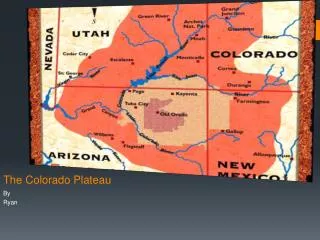
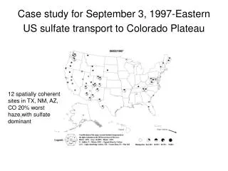
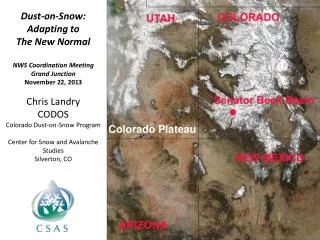
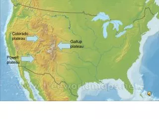
Colorado Plateau Sulfate Episode. Worst 20% at 5 sites: INGA, BRCA, MEVE, WEMI & SAPE. Clean NW & CA. Best 20% at GICL, SACR, CHIR, SIAN, GUMO, TONT, and most California sites. 1. Extinction Rankings for that day. Sites experiencing the worst 20% within the Colorado Plateau.

E N D
Colorado Plateau Sulfate Episode Worst 20% at 5 sites: INGA, BRCA, MEVE, WEMI & SAPE Clean NW & CA Best 20% at GICL, SACR, CHIR, SIAN, GUMO, TONT, and most California sites 1
Extinction Rankings for that day Sites experiencing the worst 20% within the Colorado Plateau Sites experiencing the best 20% in the Colorado Plateau and west Precipitation at these sites Clear skies at these sites 2
Synoptic Conditions in the morning This upper low caused high winds and blowing dust over the area yesterday Location of weak ridge over the area yields a southwest flow aloft around the Colorado Plateau. Surface winds from the S-SW in the Four Corners in PM, variable in the AM. This upper low still two days back 3
Surface Conditions in the morning Haze, & moist airmass Light snow in the Four Corners midnight 4
Cloud cover in the morning and continuing to the afternoon at northern sites BRCA WEMI MEVE SAPE TONT GICL SACR CHIR GUMO 6
7 Day Backtrajectories from April 7, 21z Sites that had the WORST 20 percent extinction on that day Mesa Verde (MEVE) Weminuche (WEMI) Grand Canyon (INGA) Red=10m, Blue=500m, Green=1500m 7
SO2 emission sources Ship lane SO2 emissions offshore Backtrajectory path 8
7 Day Backtrajectories from April 7, 21z Sites that were in the BEST 20 percent extinction category Tonto (TONT) Guadalupe (GUMO) Gila (GICL) Red=10m, Blue=500m, Green=1500m 9
Backtrajectories from Mesa Verde NP Trajectories every 3 hours over the whole day… 15z 21z 09z Early morning trajectories brought parcels from a more westerly region than the afternoon. Basically, the trajectories still follow the California coast out to 7 days. 10
Trajectory Observations • Sites with worst 20% extinction traveled over NE Arizona/NW New Mexico while those with 20% best didn’t. • All worst case Colorado Plateau trajectories traveled over southern Arizona, Phoenix and Tucson region within the past 12 hours. • All but one 20% worst case area trajectory passed over several large SO2 sources in the Four Corners and eastern AZ. The Indian Gardens air mass came from areas directly south 12 hours before arriving at the monitor. 11
Haze Episode Assessment Episode Name: Colorado Plateau sulfate transport from regional SO2 sources? Aerosol Composition at affected sites: Colorado Plateau sites with 20% worst hazy days, with sulfate dominating the aerosol light extinction (contribution > 40%) Spatial scale, regionality and seasonality: Several sites in UT, NM, AZ, COare influenced during the episode. Based on quick looks, most of these episodes are during the cool months. Frequency and duration: Several sites lasted two sampling days with other only on that day Dates of other similar examples: 4/7/2001, possibly 1/19/00, 8/25/00, 2/9/01, 3/8/01 Relationship to Meteorological Conditions: Cool, moist airmass, flow from the south Source Attribution Evidence: Large SO2 sources to the south in Arizona as well as ocean vessel and Southern California emissions are possible contributors.