Download
1 / 11
110 likes | 198 Views
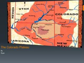
This case study examines the transport of sulfate from Eastern US to the Colorado Plateau in 1997, leading to significant haze at 12 sites. The study analyzes movement patterns and potential source areas.

E N D
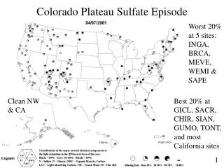
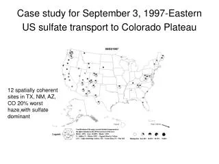
Case study for September 3, 1997-Eastern US sulfate transport to Colorado Plateau 12 spatially coherent sites in TX, NM, AZ, CO 20% worst haze,with sulfate dominant
Highest S for all 1997 at Arizona, New Mexico sites and Mesa Verde, 94-99 percentile other sites
2 days prior to event, flow was light from the east to southeast upwind of sites. Haze reported at many eastern US NWS stations
Weak cold front passes- stronger flow accelerates westward movement of hazy airmass? Flow in response to high pressure system along Canadian border
BIBE BAND Bandalier, Big Bend 315 hour backtrajectories from noon local time Sep 3
TONT Tonto, Grand Canyon 315 hour backtrajectories from noon local time Sep 3
MOZI GRSA Mt. Zirkel, Great Sand Dunes, 315 hour backtrajectories from noon local time Sep 3
Conceptual model of event • Highest S day for 1998 for Arizona and New Mexico sites long-range transport from eastern US • Specific source areas in eastern US, unknown, could be large hazy blob and many source areas included from southeast to possibly Ohio River Valley • Initial inspection of aerosol maps indicates rare to get this far west- but not unusual to reach Big Bend (from BRAVO study analyses) • Movement of large early autumn high pressure west to east along Canadian border associated with this pattern and other cases of eastern US transport to Big Bend • Additional analysis could look at airport visibility data, other aerosol data, additional cases (if found)