Download
1 / 30
300 likes | 336 Views
Learn about the typology and categorization of surface water bodies in the UK, including rivers, lakes, and coastal waters. Understand the ecological status and mapping of these water bodies based on specific criteria and characteristics. Explore the division of water bodies to reflect changes in status and ecological health.

E N D
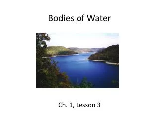
Identifying surface water bodies Experiences from the UK By Peter Pollard Coordinator UK Technical Advisory Group
Estuary limits defined for UWWT Directive 3 nautical mile limit from territorial baseline Identifying the categories
Type boundaries Coastal cells
Near-shore verses off-shore Further divisions added to delineate likely changes in status – based on the interim results of the pressures and impacts analysis
River length captured from 1:50,000 scale mapping: 127,517 km
River base-line network: 24,977 km
Minor tributaries included in water body but which, for presentational clarity, may not be shown on water body maps River water body at high ecological status River water body at good ecological status
1 2 3 4 5 6 Lakes strung along rivers Breaks in river water bodies occur at junctions with lakes
1 2 Base river water bodies on a contiguous river network 1 River water body at high ecological status 2 River water body at good ecological status Standing water
Divisions based on our existing water quality classification And information on likely differences in status based on initial results of pressures and impacts analysis for hydromorphological alterations Average river water body length = 10.5 km
1 2 < 50 ha > 50 ha < 50 ha < 50 ha 1 River water body at high ecological status < 50 ha River water body at good ecological status 2 Lake
Identified as a lake water body because a problem has developed Identified as a lake water body because of its importance to the objectives of a Protected Area > 50 ha < 50 ha < 50 ha < 50 ha Lake water body < 50 ha Standing water not meeting the size or significance criteria for identification as a lake water body
Approach to small elements of surface water Do not have the necessary information to fully implement the approach before the end of 2004 Standing water less than 50 hectares • Included in river water body to avoid gaps in the status maps • Some may later be identified as separate lake water bodies
2 1 3 5 4 Grouping or merging?
Identify a selection as waterbodies Coastal Water Up to 1 or 3 nm limit Surface water not included in a water body Coastal water body at good ecological status Coastal water body at high ecological status Land
2390 river water bodies (including 30 canal water bodies) 350 lakes 50 transitional water bodies 450 coastal water bodies (including about 100 small lagoons)
River water body at moderate ecological status Actual river length degraded to “moderate” by impact River water bodies at high ecological status Actual condition “good” until moderate stretch incorporated
Keep as large as can – but still highlight the problems Minimum size rule - 1 Km
Shellfish Water Protected Area Bathing Water Protected Area Natura 2000 Protected Area Coastal Water Coastal water body at high ecological status Coastal water body at good ecological status Land
Stream with catchment area less than 10 km2 not identified as a water body Water body with catchment area less than 10 km2 identified as a drinking water Protected Area Coastal Water Up to 1 or 3 nm limit Surface water not included in a water body Transitional water body at poor ecological status Coastal water body at good ecological status River water body at poor ecological status Coastal water body at high ecological status Land