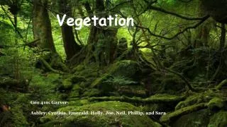
Enhancing Vegetation Analysis Through Feature Space Transformations
160 likes | 284 Views
This document delves into feature space and its role in enhancing vegetation analysis. It explains the construction of feature spaces, where plants and soils are situated within them, and how these spaces can be manipulated to extract meaningful information. We explore methods such as Principal Components Analysis (PCA) and Kauth’s Tasseled Cap, which allow for the visualization and mathematical manipulation of n-dimensional data. Practical examples and customization of spectral indices to highlight vegetation differences and minimize atmospheric effects are also discussed, providing valuable insights for remote sensing applications.

Enhancing Vegetation Analysis Through Feature Space Transformations
E N D
Presentation Transcript
Vegetation Enhancements (continued) Statistical and Feature Space Transformations
Learning objectives • What is a feature space and how are they constructed? • Where are plants and soils found in feature space? • How can we use feature space to enhance vegetation? • What is Principal Components Analysis (PCA) and how does it differ from Kauth’s Tasseled Cap?
Feature Space Transformations • Also called “band space” • Difficult to visualize because feature space is n-dimensional (where n is the number of bands) • Can mathematically manipulate feature space to enhance spectral information • Examples are Principal Components Analysis (PCA), Kauth’s Tasseled Cap, Perpendicular Vegetation Index (PVI), and many more
What is a feature space?? NIR Band Green Band Red Band Blue Band
Why is feature space useful? • A way to visualize pixel data – a different way to see information • Can transform or analyze a feature space mathematically to isolate groups of pixels that may be related
Creating Feature Space Graphs • Each axis represents DNs from one satellite band; Multiple axes = multiple bands • Can plot each pixel in the feature space from an image using its DNs by hand or using image analysis or statistical software.
Interpreting Feature Space Where is vegetation? Where is soil? NIR Red
Principal Components Analysis (PCA) • Transforms the original satellite bands into new “bands” that isolate important parts of the data (e.g., vegetation). • Principal component axes (PCs) must be perpendicular to one another • First 3 PCs usually contain the most useful info • Other PCs are sometimes useful for highlighting features • PC2 is usually a good vegetation index
Erdas Demo • Principal Components for Laramie Area
Kauth’s Tasseled Cap • Like PCA but axes don’t have to be perpendicular to each other • 1st axis oriented towards overall scene brightness (brightness) • 2nd axis oriented towards vegetation greeness (greeness) • 3rd and 4th axes often called “wetness” and “yellowness” – less useful than first two.
Tasseled Cap (cont.) • Fits all the criteria for a good vegetation index • Almost as widely used as the NDVI • Excellent index
Creating Your Own Spectral Indices • Can create custom indices to highlight anything that makes spectra unique • Can use temporal data just like you use spectral data • Can build indices for any material, not just vegetation
Summary • Vegetation Indices should highlight the amount of vegetation, the difference between vegetation and soil, and they should reduce atmospheric effects • Minimize soil background effects if possible • Indices can be customized for particular applications