Download
1 / 18
180 likes | 350 Views
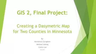
GIS 2, Final Project: Creating a Dasymetric Map for Two Counties in Minnesota . By: Hamidreza Zoraghein Melissa Cushing Caitlin Lee Fall 2013. General Outline. Study area Delineating residential areas Rural residential areas Urban residential areas

E N D
GIS 2, Final Project:Creating a Dasymetric Map for Two Counties in Minnesota By: HamidrezaZoraghein Melissa Cushing Caitlin Lee Fall 2013
General Outline • Study area • Delineating residential areas • Rural residential areas • Urban residential areas • Redistributing population density variation • Another approach: Area Modified Weighting • Limitations and outlooks
Study Area • Two counties in Minnesota • Criteria: • Diversity in population density • Having both urban and rural areas • Residential Area Delineation • Rural Area Study Area Another Approach Urban Area Population Density Redistribution Limitations & Outlook
Delineating Residential Areas • Different approaches for rural and urban areas • Rural Areas • NLCD • Block boundary density • Urban Areas • NLCD • Residential Area Delineation • Rural Area Study Area Another Approach Urban Area Population Density Redistribution Limitations & Outlook
Rural Areas Polygon to Line To Raster Focal Stats. Raster Calc. Focal Output Block Areas Block Boundaries Raster Boundaries Dense Cells Mosaic Rural Mask Rural Landcover NLCD 21, 22 First Refinement Second Refinement Clear Boundary Shrink Extraction • Residential Area Delineation • Rural Area Study Area Another Approach Urban Area Population Density Redistribution Limitations & Outlook
Rural Areas • Some patterns which don’t pass the threshold (33) • Some patterns which pass the threshold Pics fro Uhl (2011) • Residential Area Delineation • Rural Area Study Area Another Approach Urban Area Population Density Redistribution Limitations & Outlook
Urban Areas • Three different approaches were tested: • Extraction of classes 21, 22 • Extraction of classes 21, 22, 23 • Extraction of classes 21, 22, 23, 24 • Further Refinement • Applying NHD layers • Residential Area Delineation • Rural Area Study Area Another Approach Urban Area Population Density Redistribution Limitations & Outlook
Urban Areas Extraction Initial Urban Mask Urban Landcover Final Urban Mask Times Water Areas Rasterized Water To Raster • Residential Area Delineation • Rural Area Study Area Another Approach Urban Area Population Density Redistribution Limitations & Outlook
Urban Areas • Residential Area Delineation • Rural Area Study Area Another Approach Urban Area Population Density Redistribution Limitations & Outlook
Redistributing Population Density Variation • Urban Areas • DEM • Slope • Road Density • Distance to Flow Lines • Distance to Rivers • Rural Areas • DEM • Slope • Road Density • Distance to Flow Lines • Residential Area Delineation • Rural Area Study Area Another Approach Urban Area Population Density Redistribution Limitations & Outlook
Modified Pop Density Calculation Tool(s): Zonal Statistics as Table Creating Random Points Tool(s): Raster to Polygon, Create Random Points Attributing Points by Mod Pop Density Tool(s): Spatial Join Tool(s): Extract Values to Points Extracting Rasters to Points Summarizing by Tracts Tool(s): Summary Statistics Correlation Coefficients Calculation Tool(s): Excel Reclassifying and Masking Tool(s): Reclassify, Times Applying The Weights Tool(s):Weighted Sum • Residential Area Delineation • Rural Area Study Area Another Approach Urban Area Population Density Redistribution Limitations & Outlook
Redistributing Population Density Variation • Residential Area Delineation • Rural Area Study Area Another Approach Urban Area Population Density Redistribution Limitations & Outlook
Another Approach • Based on: • Polygon three class method (Eicher and Brewer 2001) • Sampling along with Area refinement on the above (Mennis 2003) • Applied on: • Urban part of the study area • Type of the method here: • Vector based • Residential Area Delineation • Rural Area Study Area Another Approach Urban Area Population Density Redistribution Limitations & Outlook
Removing Unlikely Classes Tool(s): Extraction Another Approach , , Vectorizing Land Cover Tool(s): Raster to Polygon Consolidating Classes Tool(s): Dissolve Tool(s): Select by Location Sampling Pop Density for Classes Overlaying Tracts on Land Cover Tool(s): Union Calculating Elements per Tract Tool(s): Summary Stats, Join, Calculate Field Pop Density per Class per Tract Tool(s): Join, Calculate Field Sampling Method: Centroid Class i Fraction= • Residential Area Delineation • Rural Area Study Area Another Approach Urban Area Population Density Redistribution Limitations & Outlook
Another Approach • Residential Area Delineation • Rural Area Study Area Another Approach Urban Area Population Density Redistribution Limitations & Outlook
Limitations and Outlooks • Limitations • Lack of statistical analysis and validation • Not utilizing parcel data • Not very good for rural areas • Outlooks • Using smaller areas for establishing the correlations (e.g. block groups or blocks) • Simulation • Create random points based on the area of the tracts • Using parcel data • Exploring other potential related variables • Exploring other sampling strategies and making comparisons • Residential Area Delineation • Rural Area Study Area Another Approach Urban Area Population Density Redistribution Limitations & Outlook
Resources • Eicher, C. L., & Brewer, C. A. (2001). Dasymetric Mapping and Areal Interpolation: Implementation and Evaluation. Cartography and Geographic Information Science, 28(2), 125–138. doi:10.1559/152304001782173727 • Mennis, J. (2003). Generating Surface Models of Population Using Dasymetric Mapping∗. The Professional Geographer, 55(1), 31–42. • Uhl, J. H. (2011). Master ’ s Thesis : “ Limiting and Related Variables for Dasymetric Analysis of U . S . Census Demography .” University of Colorado Boulder.
Thank you for your patience! Questions?