Download
1 / 15
150 likes | 313 Views
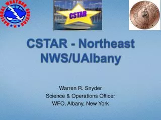
CSTAR - Recent CSTAR Activities and Looking Forward. Jonathan Blaes October, 2010 CSTAR Kickoff Workshop. Why are we here today and tomorrow?. Why are we here today and tomorrow?

E N D
CSTAR - Recent CSTAR Activities and Looking Forward Jonathan Blaes October, 2010 CSTAR Kickoff Workshop
Why are we here today and tomorrow? • The goal is to build relationships between PIs, students & WFOs and to develop more formal plans with dates, deliverables and actions items for the new CSTAR project. • In short, ensure that we engage in the best possible collaboration
What the next couple of days will cover • CSTAR background and recent activities • Recent science success stories at WFOs • Updates on recent NCSU-NWS collaborative research projects • Evening collaborations • Current CSTAR project – introduction and discussion
What is CSTAR? • The CSTAR Program represents an NOAA/NWS effort to create a cost-effective transition from basic and applied research to operations and services through collaborative research between operational forecasters and academic institutions which have expertise in the environmental sciences. These activities engage researchers and students in applied research of interest to the operational meteorological community and improve the accuracy of forecasts and warnings of environmental hazards by applying scientific knowledge and information to operational products and services • http://www.nws.noaa.gov/ost/cstar.htm
What is CSTAR? • The CSTAR Program represents an NOAA/NWS effort to create a cost-effective transition from basic and applied research to operations and services through collaborative research between operational forecasters and academic institutions which have expertise in the environmental sciences. These activities engage researchers and students in applied research of interest to the operational meteorological community and improve the accuracy of forecasts and warnings of environmental hazards by applying scientific knowledge and information to operational products and services • http://www.nws.noaa.gov/ost/cstar.htm
What is CSTAR? • The CSTAR Program represents an NOAA/NWS effort to create a cost-effective transition from basic and applied research to operations and services throughcollaborative research between operational forecasters and academic institutions which have expertise in the environmental sciences. These activities engage researchers and students in applied research of interest to the operational meteorological communityand improve the accuracy of forecasts and warnings of environmental hazards by applying scientific knowledge and information to operational products and services • http://www.nws.noaa.gov/ost/cstar.htm
How did we get here? • CSTAR grant announced on July 20, 2009 • Input was solicited from regional WFOs in August 2009 • During solicitations, 52 gaps, or needs were identified
Gaps Identified • Inland impact of tropical cyclone wind (RAH/AKQ/CHS/GSP/ILM/RNK) • Inland impact of tropical cyclone precipitation (RAH/AKQ/CHS/GSP/ILM) • Tropical cyclone tornadoes (GSP/RAH) • Improve quality and access to precipitation estimates including QPE (RAH/CAE/GSP/ILM/RNK) • Mesoscale ensemble and high resolution models primarily for QPF needs (AKQ/CAE/ILM/RNK) • Coastal fronts/decaying wedge fronts/boundaries and severe weather (RAH/RNK) • Severe weather in non-tropical high shear/low CAPE wnvironments (GSP/CHS) • Probabilistic forecasts (GSP/AKQ/ILM) • Examination of regional features which modulate convective initiation and evolution including coastal fronts, sea breeze (RNK/AKQ) • Decision support (GSP/MHX) • Heavy rain induced landslides (GSP/RNK) • Cold air damming (GSP/RNK) • Appalachian lee trough and cold frontal passage studies • Effective methods of "hot-starting" models to improve QPF/simulated reflectivity output. • Tidal impacts on rainfall runoff and associated flooding near the coast - especially in urban areas. Charleston and Savannah are very vulnerable to this. • Use of Analogs
How did we get here? • CSTAR grant announced on July 20, 2009 • Input was solicited from regional WFOs in August 2009 • During solicitations, 52 gaps, or needs were identified • Themes emerged – tropical cyclones, precipitation, and HSLC convection • Proposal submitted on October 16, 2009 • Proposal funding officially announced in spring 2010 • Kickoff call on August 4, 2010 • Kickoff workshop on October 28 and 29, 2010 • Support received from the NOAA Hydrometeorology Testbed
Result Improving Understanding and Prediction of Hazardous Weather in the Southeastern United States: Landfalling Tropical Cyclones and Convective Storms Three year project comprised of two 2 year project periods Participants from NCSU, RENCI, 10 WFOs, SERFC, 3 NCEP centers, GSD, HRD
What has been accomplished so far? • Graduate students identified • Kickoff call • Research outline proposed (updated tomorrow) • Collaborative Investigators (CIs) recruited • CIMMSE blog launched • Web site team starting up
CIMMSE Blog http://cimmse.wordpress.com/
Collaboration Web Page Revisions http://www.meas.ncsu.edu/nws/