Download
1 / 25
250 likes | 376 Views
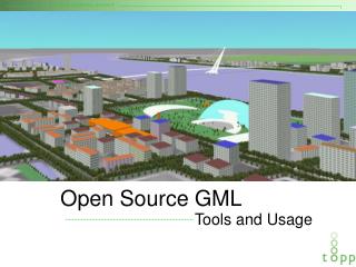
Pioneering GML Deployment for the NSDI. 2004 NSDI Cooperative Agreement Program Grant Project Category 5: Establishing Framework Data Services using the OGC Web Feature Service Specification. September 22, 2005 Jeff Harrison, President, The Carbon Project jharrison@thecarbonproject.com

E N D
Pioneering GML Deployment for the NSDI 2004 NSDI Cooperative Agreement Program Grant ProjectCategory 5: Establishing Framework Data Services using the OGC Web Feature Service Specification September 22, 2005 Jeff Harrison, President, The Carbon Project jharrison@thecarbonproject.com Tel: 703-628-8655 Barry Cross, geoLeaders bcross@geoleaders.com Tel: 585-243-2418 Nuke Goldstein, Founder & CTO, The Carbon Project ngoldstein@thecarbonproject.com Tel: 617-584-5077 Panagiotis A. Vretanos, Senior Developer pvretano@cubewerx.com Tel: 416-701-1985
Agenda • Quick Introduction • Demonstration-An Environmental Assessment • Project Overview • Demonstration-”Interactive NSDI” • Next Steps • Q&A
Team Introduction • Barry Cross, Project Manager, geoLeaders • Peter Vretanos, Senior Developer, CubeWerx • Nuke Goldstein, Founder & CTO, The Carbon Project • Jeff Harrison, Co-Founder & CEO, The Carbon Project
Purpose of Today’s Demo • Demonstrate the potential of accessing a new reference implementation of the National Hydrography Dataset (NHD) through a powerful Web Feature Service (WFS) and a new profile of Geography Markup Language (GML). • Highlight multi-vendor interoperability using open-geospatial web services from CubeWerx, CarbonArc (a new extension for ESRI’s ArcGIS developed with CarbonTools) and Gaia, a free Open-Geospatial .NET viewer from The Carbon Project. • Illustrate how this approach can enable the NSDI.
The “So What” Factor • With this service, users can access up-to-date hydrographic content and download it directly to their application through an open standards-based service. • Significant milestone in realizing a services oriented architecture (SOA) as part of the FEA • This means users can download data from many different sources, freely exchanging maps and content and rapidly integrating information to support business and personal decision-making. • This type of multi-source integration capability is essential to respond to dynamic events like floods, security situations as well as supporting a wide variety of environmental assessment and planning applications. • Authorized users can also update NHD data using WFS-T, ushering in a new age of the “Interactive NSDI”
Overview of NHD • National Hydrography Dataset (NHD) is one of the Framework Data Themes of the National Map. • Along with Roads is one of the most complex themes • Comprehensive set of digital spatial data that contains information about surface water features such as lakes, ponds, streams, rivers, reservoirs, springs and wells and other features such as dams. NHD accessed from CubeSERV Web Feature Server (WFS)
NHD/WFS Demonstration – Environmental Assessment • A user is conducting an environmental site assessment in Washington, DC near the Potomac River • Must pull access NSDI content, including Hydrography Data, to support assessment • Step 1 - NHD Feature Access • Step 2 – Save GML and Share GSF Photo Courtesy of USNPS
Steps 1 & 2 – NHD Feature Access, Save GML (NHD/WMS/WFS and Gaia) • Access Web Feature Server • User reviews NHD/WFS content • Review GML Feature Attributes • Adds additional NSDI information (metro lines, stations) • Review GML • Save off as GSF Photo Courtesy of USNPS
Content and Tools • NHD in CubeSTOR (Oracle DB) • CubeSERV Web Feature Server • GMLSF • Web Map Servers • Carbon Project’s Gaia Geospatial Web Browser and GMLAnalyzer • Geospatial Session File (GSF) • Jeff’s iPod
Project Overview Objectives • Develop and deploy an online operational WFS capability for the Hydrography Framework Data layer (NHD/WFS). • ‘Lower the bar’ for implementing WFS for Framework Data Theme(s) by employing GML Simple Features Profile (GMLSF). • Coordinate with ongoing efforts to define GML Application Schemas for the Framework Data Themes. • Generate feedback on the proposed OGC GMLSF standard, provide comment and reference on the draft ANSI Framework Standards, and develop input to refine the OGC Web Feature Service (WFS) specification.
NSDI Content and ToolsDefined GMLSF Schemas for Hydro and Transportation(XML for the NSDI)Developed CubeWerx GMLSF ValidatorDeployed NHD content using CubeWerx WFSTested access via Gaia Geospatial Web Browser Integrated with ESRI ArcGIS through CarbonArc ArcGIS Desktop Application Geospatial Web Browser CarbonWMS CarbonWFS CarbonGML Other… CarbonGeometries CarbonProjection Tools Open-Geospatial Operations (Capabilities, Map, Feature, …) Web Service Content OGC Services (WMS, WFS, GML) XML Descriptions NHD Data Services Other Resources
Project Architecture • Technologies we used – • Web Feature Service • Geography Markup Language - GMLSF • Web Map Service • Goal – Establish a “NHD/WFS” will serve as an operational reference implementation that can be reused by other organizations at all levels of government. ESRI CubeWerx IONIC …
Key Points on GMLSF • GMLSF defines a simplified profile of GML for encoding geographic features • Similar to the way WMS uses JPEG, GIF, PNG to be successful (message format is well-understood) • GMLSF supports simple geometric types (Points, Lines, Polygons) • NSDI content providers can now publish using GMLSF • Provides a simple, consistent platform for NSDI content • GMLSF makes it easy to use GML and WFS in multiple applications
How it was done – from UML Models to GML Schemas Abstract Model… GMLSF Implementation
Why GMLSF? • Greatly simplifies development of NSDI applications, simple ‘façade’ in front of multiple data sources. • Since GMLSF is just XML, it can also be integrated into new applications on network-connected mobile, desktop and multi-media platforms. • Some potential applications for hydrography content in GMLSF include • water quality assessments • natural resource management • environmental site assessments and impact statements • delineating watershed boundaries • many others.
NHD/WFS Demonstration – “Interactive Framework” • A government user is interactively updating NSDI content for Washington, DC near the Potomac River • Another user is searching for NSDI content • Step 3 – NHD/WFS Access (CarbonArc) • Step 4 – NHD/WFS Bulk Transactions (CarbonArc) • Step 5 – User Access (Gaia) • Step 6 - Discovery (CubeWerx Registry Client)
Step 3, 4 & 5 – NHD/WFS Access (NHD/WFS, CarbonArc) • Picks up where we left off • Quick look at CarbonArc tools • Add “Hydro” Elements • Delete and add data to NHD/WFS • Commit transactions • Quick look at Transaction XML • Review updates in Gaia
Next Steps • Near-Term Project Activities • Finalize schemas on NHD/WFS • Deploy NHD/WFS to Denver • Register NHD/WFS with Geospatial One-Stop at www.geodata.gov – Initial Test • Potential Future Work • NHD/WFS ArcMap Toolkit • Binary XML Support • Transaction “Agreement” for NHD (in XML) • NHD Line and Polygon Transactions • NHD Event Modeling w/WFS • GMLSF Profiling for other datasets • Others
NHD/WFS ArcMap Toolkit Tools and Functions • Potential to handle hydrographic functions in ArcMap, using GMLSF and CarbonArc • Tools for easy navigation, access and use • Integrated with ArcMap Platform, using content from many sources
Binary XML Support • Provides greatly increased performance, much more compact • Reduces ‘conversion’ overhead (from binary to text) • Integrate available Open Source Library • Java and .NET Libraries that do Binary XML encoding • Can be integrated into NHD/WFS ArcMap Toolkit and handle the binary XML stream Content OGC Services (WFS, GML) XML Descriptions NHD Data Services Other Resources
NHD Line and Polygon Transactions • Add capability to update more complex geometries via GMLSF and NHD/WFS (lines and polygons) in “Interactive” NSDI
Transaction “Agreement” for NHD (in XML) • Provides schema for transactions • Based on WFS • Examples available in CarbonArc </Transaction>
Event Modeling w/WFS • Let’s say something happens on River • Enhanced WFS for Notifications • Database updates • Changes can trigger WFS transactions that can be automatically distributed across the “Interactive” NSDI • Usher in • Like a Levee break…
GMLSF Profiling for other Datasets • Geodetic Control • Cadastral (Parcels) • Roads and Rails • Governmental Units • Boundary and Annex Survey Data • … • Provides well-known packaging against which application can be developed – Smart Clients, mobile applications, etc.
2004 NSDI Cooperative Agreement Program Grant ProjectCategory 5: Establishing Framework Data Services using the OGC Web Feature Service Specification September 22, 2005 Jeff Harrison, President, The Carbon Project jharrison@thecarbonproject.com Tel: 703-628-8655 Barry Cross, geoLeaders bcross@geoleaders.com Tel: 585-243-2418 Nuke Goldstein, Founder & CTO, The Carbon Project ngoldstein@thecarbonproject.com Tel: 781-229-6619 Panagiotis A. Vretanos pvretano@cubewerx.com (416) 701-1985