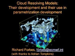
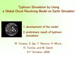
Global cloud-resolving model development
Global cloud-resolving model development. Masaki Satoh & NICAM developing team Atmosphere and Ocean Research Institute, Univ. of Tokyo Research Institute for Global Change, JAMSTEC. 26th SESSION OF THE CAS/JSC WORKING GROUP ON NUMERICAL EXPERIMENTATION (WGNE-26)

Global cloud-resolving model development
E N D
Presentation Transcript
Global cloud-resolving model development Masaki Satoh & NICAM developing team Atmosphere and Ocean Research Institute, Univ. of Tokyo Research Institute for Global Change, JAMSTEC 26th SESSION OF THE CAS/JSC WORKING GROUP ON NUMERICAL EXPERIMENTATION (WGNE-26) (Tokyo, Japan, 18-22 October 2010) Group web page http://nicam.jp
Cyclone Nargis made landfall in southern Myanmar on 2 May 2008 with winds in excess of 65 ms-1, with 600 mm total rainfall, plays havoc with Irrawaddy delta http://www.nasa.gov/mission_pages/hurricanes/archives/2008/h2008_nargis.html) Planned Newsletter (No. 92) Section A---Cyclone Nargis and its simulation. ” Because, the special issue of JMSJ has been published, and also many related papers appeared in GRL, I feel a need of discussion with you what will be the best way to proceed. I still feel Taniguchi et al. should be the lead article. But some adjustment may be desired. I welcome your counter proposals. “ by Prof. Yanai,4th Oct. , 2010 Journal of the Meteorological Society of Japan Special Edition on the Myanmar Cyclone, Vol. 88, No. 3, 2010 http://www.jstage.jst.go.jp/browse/jmsj/88/3/_contents
Contents • Myanmar cyclone & Boreal summer ISV (2008) • NICAM quasi real time forecast • Contribution to the field observation: PALAU2010 • Athena analysis
NICAM • Nonhydrostatic Icosahedarl Atmospheric Model Development since 2000 Tomita and Satoh(2005, Fluid Dyn. Res.), Satoh et al.(2008, J. Comp. Phys.) First global dx=3.5km run in 2004: Tomita et al.(2005, Geophys. Res. Lett.) • Icosahedral grid Spring dynamics smoothing, Second order accuracy Tomita et al.(2001, J. Comp. Phys.), Tomita et al.(2002, J. Comp. Phys.) • Flux-form conservative nonhydrostatic scheme Split-explicit time integration, Mass, total energy & momentum conserving Satoh (2002, Mon. Wea. Rev.), Satoh (2003, Mon. Wea. Rev.)
TC Nargis ensemble simulation Taniguchi et al. (2010), JMSJ special edition on the Myanmar Cyclone Horizontal mesh size: 14 km Vertical mesh size: 0 m ~ 38,000 m (40 layer, stretching grid ) Integration: 30-days Initial condition: linear interpolation from JMA GPV/GSM data (every 6hr, 0.5x0.5grid) initial time: 1200UTC,10, 23, 24, 25, 26, 27, 28, Apr 2008 (7 control run without any perturbation: Lagged Average Forecasting (LAF) method, Hoffman and Kalnay, 1993) without any nudging process (Nargis formed on 27 Apr2008) Boundary condition: weekly Reynolds-SST , Sea ICE ETOPO-5 topography, Matthews vegetation UGAMP ozone climatology (AMIP2) http://www.nasa.gov/mission_pages/hurricanes/archives/2008/h2008_nargis.html)
Taniguchi et al. (2010), J. Meteor. Soc. Japan Incipient disturbances for cyclone Nargis: U10m & OLR (IR) Obs. NICAM : 4/23 • WWB • Cyclonic eddy in SIO • Wind from the South China Sea • A weak cyclonic circulation • Northward migration of WWB • Cyclonic eddy in NIO • Wind from the South China Sea
Taniguchi et al. (2010), J. Meteor. Soc. Japan Incipient disturbances for cyclone Nargis Obs. NICAM : 4/23 • Northward migration of Cyclonic eddy in NIO • Wind from the South China Sea • Northward migration of Cyclonic eddy in NIO • northward movement of northern vortex and its cyclonic circulation development
Taniguchi et al. (2010), J. Meteor. Soc. Japan Init. Apr 23 Init. Apr 24 Obs. Init. Apr 26 Init. Apr 27 Init. Apr 25 Loc. of TC genesis (Sim.) Loc. of TC genesis (Obs.) U850 (Averaged: 80E-100E) • Cyclone Nargis formed during the northward propagation of low-level zonal wind in the Bay of Bengal. • Simulated cyclones also formed during the northward propagation
Taniguchi et al. (2010), J. Meteor. Soc. Japan MJO phase: (a) observed, (b-h) simulated TC genesis CHI200 composite on each MJO phase Apr.27 4/10 Obs. Apr.27 4/23 6 5 Ph1 1 4 Ph2 2 3 Ph3 Apr.27 4/24 4/25 4/26 Apr.27 Ph4 Apr.27 Ph5 Ph6 Ph7 Apr.27 Ph8 4/27 4/28 Apr.27 EOF2 • TC genesis occurs when active convective region associated with the MJO resides over the maritime continent region. • No TC genesis occurs for the member of which phase propagation of the MJO is not reproduced. EOF1
Nargis ensemble exp. Cyclone Tracks(global view) Halong (TY05) 5/23-5/20 init: 4/10 Nargis 4/28-5/3 Matmo (TY04) 5/13-5/16 Rammasun (TY03) 5/6-5/13 No TCs in Eastern Pacific & Atlantic Durga 4/22-4/24 Neoguri (TY02) 4/12-4/19 Rosie 4/21-4/24 init: 4/24 init: 4/25 init: 4/23 init: 4/28 init: 4/27 init: 4/26
PALAU Field Campaign in June—Aug. 2010 ISV Wang and Rui (1990) SST Sensitive to MJO / ISV? Ocean Temp • Purposes: • Mechanisms of N-propagation of a summertime ISV (w/ TC genesis) over the monsoon trough • Role of a thin ocean mixed layer South North
Outline of 1-week prediction system by NICAM initial data (ATM, LND, OCN)at 00UTC NCEP/FNL (http://dss.ucar.edu/datasets/ds083.2/) wget at 19:00 on the day After 2days data available • make initial state (ATM, LND, OCN) for NICAM grids system • make ocean data for nudging • make configuration file for the run with above initial state • start run (7-days integ., MAT+Mix-Ocn+MY2Moist, 14km, 136E-8N) • multi-level: every 3hr (snapshot) • u, v, w, t, p, rho, qv, dh • single-level: every 1hr (average) • cldi, cldw, evap, olr, q2m, qr, slp, t2m, • t_sfc, tppn, u10m, v10m vap_atm calc. time:1.7 days
http://iprc.soest.hawaii.edu/users/ykaji/monsoon/definition.htmlhttp://iprc.soest.hawaii.edu/users/ykaji/monsoon/definition.html
The Athena Project Collaborating Groups • COLA - Center for Ocean-Land-Atmosphere Studies, USA • ECMWF - European Center for Medium-range Weather Forecasts, UK • JAMSTEC - Japan Agency for Marine-Earth Science and Technology, Research Institute for Global Change, Japan • University of Tokyo, Japan • NICS - National Institute for Computational Sciences, USA • Cray Inc. Codes • NICAM: Nonhydrostatic Icosahedral Atmospheric Model • IFS: ECMWF Integrated Forecast System Supercomputers • Athena: Cray XT4 - 4512 quad-core Opteron nodes (18048) • #30 on Top500 list (November 2009) • Kraken: Cray XT5 - 8256 dual hex-core Opteron nodes (99072) • #3 on Top500 list (November 2009)
Precipitation and bias Dirmeyer et al.(2010,JCLI submitted)
Athena analisys • T. Nasuno • Intraseasonal variability in the Indian ocean region • “1 month predictability” • H. Taniguchi • MJO statistics • MJO vs TC genesis • K. Oouchi & Y. Yamada • TC statistics
Indian Monsoon Index ERA inrerm, NICAM, IFS 2001 2002 (El Nino) 2004 2005 6/1 7/1 8/1 6/1 7/1 8/1 6/1 7/1 8/1 6/1 7/1 8/1 2006 2007 (La Nina) 2008 2009 (El Nino) 6/1 7/1 8/1 6/1 7/1 8/1 6/1 7/1 8/1 6/1 7/1 8/1 Time series of Indian Monsoon Index (Wang et al. 2004) for NICAM and IFS simulations and ERA Interim data.
Time-latitude sections of 60-90E average zonal wind (850 hPa) in initial 40 days of NICAM and IFS simulations and ERA Interim data. NICAM IFS ERA
Time-latitude sections of 60-90E average zonal wind (850 hPa) in initial 40 days of NICAM and IFS simulations and ERA Interim data. NICAM IFS ERA
Time-latitude sections of 60-90E average zonal wind (850 hPa) in initial 40 days of NICAM and IFS simulations and ERA Interim data. NICAM IFS ERA
Fig. 2. Time-latitude sections of 60-90E average zonal wind (850 hPa) in initial 40 days of NICAM and IFS simulations and ERA Interim data. NICAM IFS ERA
Jun-Jul. 2006 Indian Ocean ISV Zonal wind (850 hPa) Precipitation Precipitation & U850 Time-latitude sections of 60-90E average precipitation and zonal wind (850 hPa) in the period of 21 May to 10 July 2006 for NICAM and IFS simulations and ERA Interim data. NICAM IFS GPCP 6/15-7/1にかけて北進。15-20Nで降水強まる
Pentad-mean precipitation in the period of 21 May to 10 July 2006 for NICAM and IFS simulations and TRMM data. 2006/5/21- 2006/5/26- 2006/5/31- NICAM IFS TRMM
Fig. 6. Pentad-mean precipitation in the period of 21 May to 10 July 2006 for NICAM and IFS simulations and TRMM data. 2006/6/5- 2006/6/10- 2006/6/15- NICAM IFS TRMM
Fig. 6. Pentad-mean precipitation in the period of 21 May to 10 July 2006 for NICAM and IFS simulations and TRMM data. 2006/6/20- 2006/6/25- 2006/6/30- NICAM IFS TRMM
Fig. 6. Pentad-mean precipitation in the period of 21 May to 10 July 2006 for NICAM and IFS simulations and TRMM data. 2006/7/5- 2006/7/10- 2006/7/15- NICAM IFS TRMM
Total data JRA25 7/31 8/31 4/21 5/20 5/21 Analysis period MJO reproducibility -Phase structure & propagation- 30-day lowpass filtered data (21 May – 31 Aug.) with additional 30days JRA data before 20 May.
2006 30-day lowpass filtered VP200 EOF1/2 (NICAM / IFS / JRA25) NICAM (IFS) good year
2004 30-day lowpass filtered VP200 EOF1/2 (NICAM / IFS / JRA25) IFS good year
MJO reproducibility • -Power spectrum of VP200- • Symmetric component of raw-clim • Normalized spectrum by each maximum
2001-2009 Power spectrum of VP200 10N-10S 2004 2001 2001 2005 2005 2008 2008 2002 2001 2009 2009 2009 2006 2006 2002 2002 2005 2006 2007 2008 2004 2007 2007 2004 NICAM JRA IFS
2001-2009 30-day lowpass filtered VP200 MJO phase vs. TC genesis NICAM IFS JRA25 TC threshold: NICAM 17.0 m/s; IFS 15.4 m/s
Black line: BEST TRACK from IBTrACs Red line: NICAM simulation Blue line: IFS simulation Solid line: Wind speed ≥ 17.5 [m s-1] Dotted line: Wind speed < 17.5 [m s-1] Tracking result for JJA 2006 2001 2002 2007 2008 2004 2009 2005 OBS: 25/y; NICAM 27/y; IFS 7/y(WS=17m/s) or 25 (WS=10m/s)
PDFs of TC intensity -global Surface winds IBTrACs NICAM IFS Sea Level Pressure IBTrACs NICAM IFS
Summary • Cyclone Nargis simulation Nargis formed during the northward propagating of zonal wind, associated OLR and precipitation in the BOB when the active convective region associated with the MJO passed though the Bay of Bengal and resided over the Maritime continent • An ensemble simulation by NICAM • Northward migration of zonal wind, OLR, and precipitation • Each simulated TC genesis also occurs • Athena analysis • First statistical analysis of MJO and TCs of NICAM simulations • Precipitation bias in climatology • Good reproducibility of ISV for first 1month • NICAM 7km vs IFS TL2047 • TC intensity better for NICAM • MJO, almost comparable • NICAM quasi-realtime forecasting system • Tested for PALAU2010 • Will be operationally for CYNDY/DYNAMO2011
On going research • YOTC simulations • Jule,15-25, 2010; 3.5km-global • Other MJO active cases (Nov.-Dec. 2009) • Cloud improvements and evaluations • Cloud microphysics scheme development (NDW6; Seiki 2010) • PBL scheme development (MYNN3; Noda et al. 2010 AR) • Satellite data evaluations (J-simulator; Masunaga et al. 2010 BAMS) • Future projections • TC change (Yamada et al. 2010,GRL) • Cloud change and sensitivity (Tsushima; Iga; Satoh, in prep.) • Numerics and computer performance • Vertical coordinates and advection scheme • Stretched Grid Regional modeling for downscaling • Preparations for the K computer; Jul. 2012- • 3.5km for 10 years; 1.8km, 900m & 450m-global
GCRM development • “GCRM” • explicit cloud process without deep cumulus parameterization • Subgrid schemes used for PBL and shallow/congestus clouds • Does not mean convergence of individual clouds • LES shows 10m required for moist process, not a target of GCRM • Large scale organizations of ISV and cloud clusters • 7, 14km-run looks very similar to 3.5km-run • At least less than 5km required for nonhydrostatic models • Many evidences show 2km is good for meso-scale simulations. • We plan to run NICAM with 1.8km, 900m & 450m using the K-computer.
Convective momentum transport (CMT) in MJO • Moncrieff (2004), Grabowski and Moncrieff (2001), • Houze et al. (2000), Oouchi and Yamasaki (2001), Tung and Yanai (2002) calculation of CMT in a NICAM simulation of an MJO event 2006 TRMM PR Miura et al. (2007) NICAM dx=7 km Squall -type cluster (10S-5N) Eastward 10-15 m/s Nasuno et al. (2009) Miyakawa(poster) 1˚mean wind Subgridwind Turbulence etc. “Convective momentum transport”
composite of U and CMT(10S-5N) contour: total condensate Base point: U(z=1.5km,10S-5N)= 0 U z=1.5 km U NICAM 7-km mesh Height average contour:U onset region of low-level westerly CMT strong Westerly region red:cloudy columns purple:cloudy column w> 0.5m/s broken lines: vertical component Westerly acceleration Height Easterly acceleration reduce Easterly shear increase Easterly shear Westerly acceleration
A letter from Prof. Yanai Dear Drs. Oouchi, Satoh, and Taniguchi, After a very long delay, I am now ready to discuss the Nargis issue for UCLA Tropical Meteorology and Climate Newsletter. Let me briefly review the history of this issue. (1) Immediately after Cyclone Nargis hit Myanmar in May 2008, I planned to make this cyclone as a topic of my Newsletter. Takio Murakami sent me several "map discussion" type articles. I tried to invite three more experts in my plan, but I could not get their responses in timely manner, although Peter Webster later mentioned his Nature article: "Myanmar's deadly daffodil.". (2) The second motivation came in November 2009 when I visited JAMSTEC and learned your successful numerical simulation of the formation of Nargis by a global cloud-system resolving Model. Early this year I proposed to make the essence of "Taniguchi, Yanase, and Satoh paper " (JMSJ special issue) a lead artcle with additional notes on the numerical model. Then, I had unexpected problems (mainly my health problems) that caused delay of my Newsletter activity. Lately, I am reorganizing my efforts to restart my Newsletter Section A in two steps. Newsletter (No.91) Section A -- history of UCLA AOS--- I am collecting esssays from many former and present members of UCLA AOS. So far I have collected 15 interesting essays (recollections) related to the history of UCLA AOS since its foundation by J. Bjerknes in 1940. I plan to issue Part 1 by October 10.. Newsletter (No. 92) Section A---Cyclone Nargis and its simulation. Because, the special issue of JMSJ has been published, and also many related papers appeared in GRL, I feel a need of discussion with you what will be the best way to proceed. I still feel Taniguchi et al. should be the lead article. But some adjustment may be desired. I welcome your counter proposals. Sincerely, Michio Yanai
TC genesis associated with ISO (1) BSISO MJO Courtesy of Kikuchi (IPRC)
2001-2009 Power spectrum of VP200 10N-10S (JRA25-clim) 2004 2002 2001 2009 2005 2006 2007 2008
2001-2009 Power spectrum of VP200 10N-10S (NICAM-clim) 2001 2005 2008 2009 2006 2002 2007 2004

