Download
1 / 32
320 likes | 513 Views
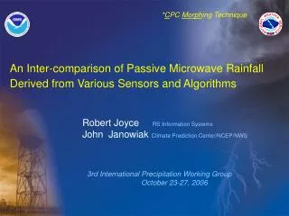
* C PC Morph ing Technique. An Inter-comparison of Passive Microwave Rainfall Derived from Various Sensors and Algorithms. Robert Joyce RS Information Systems John Janowiak Climate Prediction Center/NCEP/NWS. 3rd International Precipitation Working Group

E N D
*CPC Morphing Technique An Inter-comparison of Passive Microwave Rainfall Derived from Various Sensors and Algorithms Robert Joyce RS Information Systems John Janowiak Climate Prediction Center/NCEP/NWS 3rd International Precipitation Working Group October 23-27, 2006
Outline • 1. Passive Microwave Rainfall for CMORPH • 2. Oceanic PMW Rainfall Inter-comparison • 3. Land PMW Rainfall Inter-comparison • 4. Potential AMSU-B Improvements • 5. Conclusions
At present, precipitation estimates are used from various passive microwave sensor types on 8 platforms: • AMSU-B (NOAA 15,16,17,18) • SSM/I (DMSP 13,14,15) • TMI (TRMM – NASA/Japan) • AMSR-E (Aqua) • SSMIS? • WindSat? (ocean only) NOAA/NESDIS “CMORPH” is not a precipitation estimation technique but rather a method that creates spatially & temporally complete information using existingprecipitationproducts that are derived from passive microwave observations.
3-hr mosaic: good coverage but time of obs. varies by 3 hrs • PMW rainfall gridded to 8km resolution in 30 minute frames
The cumulative percentage of half hourly periods sampled for an eight day period, in 30 minute increments to nearest past/future scan, instantaneous (timestamp = 0, top) • cumulative % sampled within 30 minutes of half hourly frame (timestamp <= 1, middle) • cumulative % sampled within 60 minutes of half hourly frame (timestamp <= 2)
TMI rainfall estimates from NASA’s 2A12 algorithm (Kummerow et al., 1996) Goddard Profiling (GPROF) version 7 AMSR-E precipitation estimates from GPROF rainfall algorithm run at NOAA/NESDIS/ORA level 2 rainfall files version B08. SSMI precipitation estimates from NOAA/NESDIS/ORA GPROF V-6, V-6.5 transitioning to V-7 May 2006 SSMI rainfall algorithm. NRL algorithm (Ferraro et al. 1997) referred as EDRR. AMSU-B rainfall estimates from new NESDIS/ORA MSPPS AMSU-B rainfall algorithm (Weng et al., 2003, Ferraro et al., 2005, recent rainfall algorithm changes March 2005 and 1 August 2006 to improve coastal retrievals ). Half hourly, 0.0727 lat/lon (8 km at equator) resolution arrays (separate for each sensor type) are populated by the nearest rainfall estimate within swath regions. Averaging of retrieval estimates within same grid points (AMSR-E and TMI only) CPC IRRAIN half hourly, 8 km rainfall derived from frequency matching highest PMW rain-rates with GEO IR heaviest RRs with coldest BTs All 8km sensor/algorithm rainfall averaged into half hourly 0.25 degree lat/lon
CONCLUSIONS • PMW satellite/sensor/algorithm rainfall [and geo-derived rainfall] can and should be inter-compared with TRMM/GPM products at high temporal spatial resolution • AMSU-B illustrates more skill over land and ocean than geo-IR • SSMI GPROF algorithm has improved recently relative to TRMM TMI • AQUA AMSR-E and TRMM TMI by far best agreement
CMORPH Notes • A near real time version of CMORPH (Quick MORPH) is available on NCEP/CPC ftp server with a 3 hours lag. QMORPH is a forward in time propagation of PMW rainfall • ftp.cpc.ncep.noaa.gov • precip/qmorph/3-hourly_025deg • precip/qmorph/30min_8km • CMORPH is available • entire 3 hrly 0.25 deg lat/lon archive (Dec 2002-present): • precip/global_CMORPH/3-hourly_025deg • 8 km 30 minute (recent 5 days): • precip/global_CMORPH/precip/global_CMORPH/30min_8km • Retrospective CMORPH reprocessing begins early next year data set will build backward from Dec 2002