Download

1 / 16
170 likes | 331 Views
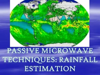
Evaluation of Passive Microwave Rainfall Estimates Using TRMM PR and Ground Measurements as References. Xin Lin and Arthur Y. Hou NASA Goddard Space Flight Center.

E N D
Evaluation of Passive Microwave Rainfall Estimates Using TRMM PR and Ground Measurements as References Xin Lin and Arthur Y. Hou NASA Goddard Space Flight Center Accumulated 5-day surface rainfall (mm) from satellite retrievals, and from single forecasts by the ECMWF IFS and the NASA GEOS-5 high-resolution global models. The official NOAA observed “best track” (black line) and the forecast tracks (blue line) for Katrina are superimposed. The ECMWF and NASA forecasts are initialized at 12z and 06z, 25 August 2005, respectively. (Lin et al. 2006)
The Global Precipitation Measurement Mission is trying to create a multi-member satellite constellation to measure precipitation over the globe at a 3-hourly interval or shorter. • It is expected that GPM will consist of a PR for calibration purpose, and a number of passive microwave sensors to enhance temporal and spatial sampling. • Assess the quality of rainfall estimations from cross-track microwave sounders relative to those from conically-scanning microwave radiometers • There are no “truth” rainfall observations.
Limitations by using ground measurements alone: • Evaluations are only performed over a few sites over open oceans and some well-instrumented land areas. The error statistics maybe highly rain-regime-dependent, and may not be applied to other parts of the globe. • A careful calibration of gauges and operational radars at different locations onto a unified reference framework is very expensive. • Satellite rainfall retrieval algorithms have different sensitivities on the rain/no rain detection, and rain estimations at different rain intensities.
Why using TRMM PR as a reference? • One of the TRMM science objectives: TRMM PR serves as a “flying rain gauge” to calibrate other rainfall retrieval algorithms • Active microwave sensor • Theoretical superiority to overland PMW technique • A number of validation studies have shown the high quality of PR data (e.g., Schumacher and Houze 2000, Liao et al. 2002)
Objectives • Using both TRMM PR data and ground measurements as references to evaluate coincident PMW rain retrievals • Better understand the rainfall error statistics of PMW radiometer and sounder data over land and ocean • Better understand the error statistics of convective, stratiform, and warm rain estimations
Active microwave sensor: TRMM Precipitation Radar (PR) Passive microwave radiometers: TRMM TMI, SSM/I from DMSP F13, F14, and F15, AMSR-E on AQUA, GPROF Version 6. Passive microwave sounders: AMSU-B from NOAA-15, -16 and -17 satellites. All the rainfall data (January 2005-August 2006) are grided onto a 0.25º x 0.25º grid at 10-minute intervals. Sensors and Rainfall Retrievals
Over TRMM ocean For instantaneous rain rates below 5 mm/h, the GPROF6 algorithm tends to do a better job than AMSU-B.
Over TRMM land Rain estimates from PMW sounders are comparable in quality to those from PMW radiometers.
Using Ground Measurements as A Reference to Evaluate Passive Microwave Rainfall Retrievals • NCEP National Hourly Precipitation Analysis: • Hourly radar rainfall estimates from about 140 WSR-88D radars • About 3,000 gauge reports • 4-km resolution • Data are preliminarily quality controlled.
Warm Rain Detection Warm rain: precipitation that is not associated with ice during its formation Lau and Wu (2003) suggested that warm rain could account for 31% of the total rain amount and 72% of the total rain area in the Tropics
Summary • For instantaneous rain rates between 1 and 10 mm/h, AMSU-B rainfall estimates are comparable in quality to those derived from conically-scanning radiometers over land, even though they are some what worse over oceans. • Cross-track microwave sounders with high-frequency channels on operational satellites can play a significant role in augmenting conically-scanning microwave radiometers to achieve better sampling and coverage over land.
Current and Future Work • The variation of rainfall error statistics at different temporal and spatial resolutions • The variation of rainfall error statistics over different raining regimes • Simulating GPM satellites in global high-resolution model forecasts and global cloud model output