Download
1 / 105
1.05k likes | 1.32k Views
Understand remote sensing, data collection, analysis, and applications without direct contact. Discover sensor types, platforms, and information flow complexities in this insightful guide.

E N D
Defining Remote Sensing Remote sensing = collection of data about features or phenomena of the earth surface (and near surface) without being in direct contact • Lack of contact with features or phenomena • Sensors utilize electromagnetic radiation (EMR) • Collection of data • Analysis of data collected
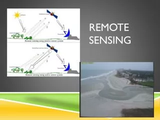
Sensing • Data are collected by sensor • Passive – collection of reflected or emitted electromagnetic radiation • Active – Generates signal and collects backscatter from interaction with terrain • Imaging & Non-Imaging • Photographic vs. Non-Photographic
Distance – How remote is remote? • Platforms for sensors operate at multiple levels • Cranes • Balloons • Aircraft • Satellite • Permit near-surface to global scale data collection
Remote sensing: the collection of information about an object without being in direct physical contact with the object.
Remote Sensing vs. Aerial Photography • Remote sensing is performed using a variety of sensors and platforms that may operate in multiple parts of the EMR spectrum • Aerial photography is performed using film-based cameras that sense only in UV, visible, and NIR spectrum and are operated on aircraft • Aerial photography is a subset of remote sensing
Image vs. Air Photo Interpretation • Images can be produced by most remote sensing systems • Air photos are produced by aerial photographic camera systems • Air photo interpretation is a subset of image interpretation
Science vs. Art • Science • RS is a tool for scientific analyses • Draws on multiple scientific disciplines • Probabilistic • Art • Interpretation combines scientific knowledge with experience and knowledge of the world • Interpretation skill is primarily learned through practice
Simplified Information Flow • Passive systems – detect naturally upwelling radiation • Flow: Source Surface Sensor • Source, the sun, illuminates surface • Surface reflects/emits radiation • Sensor detects reflected radiation within its field of view (FOV). • Photographic systems – detected radiation exposes film • Non-photographic – detected radiation generates electrical signal • Interpretation – manual or machine
Complexities in Information Flow • Variation in illumination • Sun angle • Clouds • Aerosol concentrations, other scattering • Variation in surface properties/coverage • Soil moisture, vegetation growth/conditions, surface roughness affect reflectance properties • Reflectance properties are dependent on solar angles, ratio of diffuse and direct, viewing angle
Complexities of Information Flow (cont.) • Sensor/platform variation • Attitude • Altitude • Orbit • Film/wavelength sensitivities • Calibration or Optics • Processing/interpretation variation • Film or digital processing • Repeatability of interpretation results
In situ vs. Remote Sensing • Both attempt to observe/measure phenomena • In situ • Physical contact • Instruments for direct measure • May be source of error • Interaction with phenomena • Sampling method • Ground reference vs. “ground truth”
In situ or remote sensing? GroundMeasurement In Support of Remote Sensing Measurement Ground spectroradiometer measurement of soybeans Ground ceptometer leaf-area-index (LAI) measurement
Advantages of Remote Sensing • Different perspective • Obtain data for large areas • In single acquisition – efficient • Synoptic • Systematic • Obtain data for inaccessible areas • No effect/interaction with phenomena of interest
Disadvantages of Remote Sensing • Accuracy and Consistency • Artifacts • Noise • Generalization • Processing • Scale-related effects • High initial outlays for equipment and training
Data Collection - Sensors • Cameras (film based) • Metric, Strip, Panoramic, Multi-spectral • Video Systems • Video cameras, Return Beam Vidicon • Imaging Radiometers • Digital frame, Scanners, Pushbroom, Hyperspectral • Passive Microwave • Radar • Operational vs. State-of-the-art
Data Collection - Imagery • Panchromatic (monochrome or B&W) – sensitive across broad visible wavelengths • Color – may provide added discrimination • Color film • Color composites • Thermal – in region 3 microns to 1 mm, sensitive to temperature • Microwave – all weather capability
Three-way Interaction Model Between the Mapping Sciences as Used in the Physical, Biological, and Social Sciences Jensen, 2000
Art vs. Science • Image interpretation is not exact science • Interpretations tend to be probabilistic not exact • Successful interpretation depends on • Training and experience • Systematic and disciplined approach using knowledge of remote sensing, application area and location • Inherent talents
Image Interpretation - Defined Act of examining images for the purpose of identifying and measuring objects and phenomena, and judging their significance
Image Interpretation (II) Tasks • In order of increasing sophistication... • Detection • Identification • Measurement • Problem-Solving • Not necessarily performed sequentially or in all cases
II Tasks - Detection • Lowest order • Presence/absence of object or phenomena • Examples: buildings, water, roads and vegetation
II Tasks - Identification • More advanced than detection • Labeling or typing of the object/phenomena • Tends to occur simultaneously with detection • Examples: houses, pond, highway, grass/trees
II Tasks - Measurement • Quantification of objects / phenomena • Direct physical measurement from the imagery • Examples • Inventories (count) • Length, area and height of objects
II Tasks – Problem Solving • Most complex task • Uses information acquired in first three tasks to put objects in assemblages or associations needed for higher-level identification • With experience, recognition becomes more automatic and tasks become less distinct • Example: residential housing density
Interpreter Requirements - Cognition • Concerned with how interpreter derives information from the image data • Varies from individual to individual • Reasons for differences/inconsistencies among interpreters • Cognitive processes are concerned with perceptual evaluation of elements of interpretation and how they are used in interpretation process
Resolution & Discrimination Germane to Task • Resolution • The ability of a remote sensing system to distinguish between signals that are radiometricall/spectrally/spatially near or similar • Discrimination • The ability to distinguish an object from its background • Function of spatial, spectral, and radiometric resolution • Germane to task • What is required for the particular assessment/task
Resolution • Four components of resolution • Spatial • Spectral • Radiometric • Temporal
Spatial Resolution • Indication of how well a sensor records spatial detail • Refers to the size of the smallest possible feature that can be detected as distinct from its surroundings • Aerial Camera: function of of platform altitude and film and optical characteristics • Non-film sensor: function of platform altitude and instantaneous field of view (IFOV)
Lower (coarser) spatial resolution Higher (finer) spatial resolution
Spatial Resolution Jensen, 2000
The width of the specific EMR wavelength band(s) to which sensor is sensitive Broadband Few, relatively broad bands Hyper-spectral Many, relatively narrow bands Spectral Resolution
Spectral Resolution Jensen, 2000
Airborne Visible Infrared Imaging Spectrometer (AVIRIS) Datacube of Sullivan’s Island Obtained on October 26, 1998 Color-infrared color composite on top of the datacube was created using three of the 224 bands at 10 nm nominal bandwidth. Jensen, 2000
Radiometric Resolution • Ability of a sensor to distinguish between objects of similar reflectance • Measured in terms of the number of energy levels discriminated • 2n, where n = number of ‘bits’ (precision level) • Example: 8 bit data = 28 = 256 levels of grey • 256 levels = 0-255 range • 0 = black, 255 = white • Affects ability to measure surface properties
1 - bit 2 - bit 8 - bit
Temporal Resolution • The ability to obtain repeat coverage for an area • Timing is critical for some applications • Crop cycles (planting, maximum greenness, harvest) • Catastrophic events • Aircraft • Potentially high • Actually (in practice) lower than satellites • Satellite • Fixed orbit • Systematic collection • Pointable sensors
TemporalResolution Landsat Data Acquisition June 1, 2001 June 17, 2002 July 3, 2003 16 days Jensen, 2000
Discrimination • Ability to distinguish object from its background and involves basic tasks of image interpretation: • Detection, identification, measurement, and analysis • As complexity of task increases, so do resolution requirements • Key: target to background contrast • Function of all 4 resolution elements • Example: vegetation type, soil/rock type, building type
Electromagnetic Radiation (EMR): Properties, Sources and Atmospheric Interactions
Sun Sensor Surface EMR as Information Link • Link between surface and sensor
Energy Transfer (cont) • Radiation • Energy transferred between objects in the form of electromagnetic waves/particles (light) • Can occur in a vacuum (w/o a medium)
EMR Properties • Wave Theory • EMR => continuous wave • Energy transfer through media (vacuum, air, water, etc.) • Properties • Quantum (Particle) Theory • EMR => packets of energy • Photons or quanta • Interaction of energy with matter
Wave Theory • Explains energy transfer as a wave • Energy radiates in accordance with basic wave theory • Travels through space at speed of light at 3 x 10⁸ ms-1(meters per second)
Electromagnetic Wave Two components or fields E = electrical wave M = magnetic wave http://www.colorado.edu/physics/2000/waves_particles/
Quantum Theory • Wave theory doesn’t account for all properties of EMR • Interaction of EMR with matter (atoms) • Absorption • Emission • EMR is transferred in discrete packets (particles) • Photons (quanta)
Wavelength & Frequency Near Infrared Green Microwave