
Remote Sensing
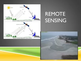
Remote Sensing. How can I study the way the mouth changes?. Remote Sensing. There are 1071 satellites in orbit around earth 50% of them have been launched by the US. REAl Time kinematic GPS. Use GPS and satellites to collect latitude and longitude plus elevation.

Remote Sensing
E N D
Presentation Transcript
Remote Sensing There are 1071 satellites in orbit around earth 50% of them have been launched by the US
REAl Time kinematic GPS Use GPS and satellites to collect latitude and longitude plus elevation.
EsriArcGis • Program that allows you to manipulate remote sensing data and analyze it in the form of basemaps and data layers. • Open up ESRI application on iPad. • Open up Feature Groups and Click on Esri Maps and Data • Click on More Results and then click on USA Soil Survey • Zoom into the Carolina Bays • I dentify the type of soils that are associated with the Carolina Bays • Use USA Topo Maps to make conclusions aboug elevation in the Myrtle Beach Ara


