
REMOTE SENSING
REMOTE SENSING. Presented by: Anniken Lydon. What is Remote Sensing?. Remote sensing refers to different methods used for the collection of information via detection devices that are not in physical contact with the object under investigation

REMOTE SENSING
E N D
Presentation Transcript
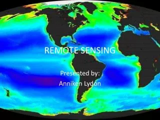
REMOTE SENSING Presented by: Anniken Lydon
What is Remote Sensing? • Remote sensing refers to different methods used for the collection of information via detection devices that are not in physical contact with the object under investigation • Remote sensing is often performed by aircraft, spacecraft, satellite, buoy and ship • Remote sensing can be performed through both active and passive methods
Remote Sensing Uses • Can be used to measure the total biomass of phytoplankton (presence of chlorophyll a) (Falkowski, 1998) • Hyperspectral detection methods can be used to identify specific phytoplankton species based on the type of pigments characteristics of different species • Many algal species posses characteristic light harvesting pigments that can also be used for photoprotection as they dissipate light energy that as longer wavelengths • Pigment analysis can be used as a rapid means for assessing algal composition (Richardson, 1996) • Observing chlorophyll biomass changes over time (http://oceancolor.gsfc.nasa.gov/SeaWiFS/)
Algal Pigments • Algal pigments absorb different wavelengths of the electromagnetic spectrum. • Pigments include chlorophylls, carotenoids, and phycobilins • All carotenoids absorb in the same region of the electromagnetic spectrum, but the shape of the electromagnetic spectra appear different for the various carotenoids • Phycobilins absorb in the part of the electromagnetic spectrum that is between the carotenoids and the chlorophylls (500-650nm)
Pigments and Remote Sensing • The absorption spectra for a particular algal species is a combination the absorption spectra for all the different pigments contained within that species • These distinct spectrum are referred to as optical “signatures”-measured with spectrophotometers • Reflectance and transmittance of different wavelengths of light can be measured at a given surface by remote sensing via spectroradiometers • Reflectance signatures for pigments are the opposite of the absorption spectrum
Problems for Remote Sensing • Phytoplankton communities are not always monospecific populations, they often contain many species with different optical signatures, making community detection difficult. • Particle load in the water can also interfere with spectral measurements: these particles include suspended sediments, dissolved organic matter, and humic acids (Carder and Steward, 1985; Siegel and Michaels, 1996) • Atmospheric conditions can affect the radiation spectra as well.
Effect of Overlying Water on Spectral Signature • Population of a mixed blue-green algae and diatom benthic mats • Spectral intensity decreases, but the signature remains relatively the same Richardson, 1996
Depth effects on Remote Sensing • Water also absorbs light • The “red edge” peak of absorbance can be used for the remote sensing to estimate depth from the surface – this is caused by the emission of light from chlorophyll a. • The depth of the algal species in the water column can affect their contribution to the measured reflectance • Algal blooms can often be identified by the presence of strong spectral signatures
Benefits of Remote Sensing • Algal communities can be assessed on a regional basis, via satellite remote sensing, providing a more comprehensive picture of the phytoplankton community in a given area. • Provides a snapshot of the overall phytoplankton community at a single moment in time • Allows for estimation of global primary productivity and how climate change influences distribution and abundance (Richardson, 1996; Falkowski, 1998) • Can aid in the detection of Harmful Algal bloom species
Systems Using Remote Sensing • Satellite and Aircraft-borne sensors: • Coastal Zone Color Scanner- NASA’s Nimbus 7 satellite • Measure phytoplankton biomass based on chlorophyll a • Airborne Ocean Color Imager (AOCI) • SeaWiFS- Sea-viewing Wide Field-of-View Sensor • Mainly used to detect ocean color • MODIS- Moderate Resolution Imaging Spectroradiometer • Monitors chlorophyll fluorescence, atmospheric marine aerosols, • Thematic Mapper • Used mainly for land surveys, but has a spatial resolution of 30m and is useful for lake and coastal surveys • AVIRIS- Airborne Visible/Infrared Imaging Spectrometer • Flown in an airplane at 65,000 feet • Each pixel has 224 individual spectra; Images contain some 300,000 individual spectra
References • Richardson, L. 1996. Remote Sensing of Algal Bloom Dynamics. BioScience. 46 (7): 492-501 • Carder, K.L. and R.G. Steward. 1985. A Remote-Sensing Reflectance Model of a Red-tide dinoflagellate off west Florida. Limnology and Oceanography. 30(2): 286-298 • Siegel, D.A. and A.F. Michaels. 1996. Quantification of non-algal light attenuation in the Sargasso Sea: Implications for biogeochemistry and remote sensing. Deep-Sea Research II. 43(2-3): 321-345 • Graham, L., J. Graham and L. Wilcox. 2009. Algae. Pearson Benjamin Cummings. San Francisco, CA • Falkowski, P. 1998. Biogeochemical Controls and Feedbacks on Ocean Primary Production. Science. 281: 200-206 • SeaWiFS Project Homepage. http://oceancolor.gsfc.nasa.gov/SeaWiFS/


