Download
1 / 43
440 likes | 622 Views
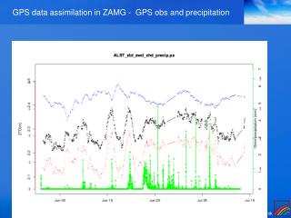
Assimilation of GPS Data for Short-Range Precipitation Forecast C. Rocken, Y.H. Kuo, J. Braun, T. Iwabuchi, S.Y. Ha. Purpose: Discuss the use of GPS networks for meteorology (and earthquake research). Precipitable Water vapor (PWV) and Slant Water Vapor.

E N D
Assimilation of GPS Data for Short-Range Precipitation Forecast C. Rocken, Y.H. Kuo, J. Braun, T. Iwabuchi, S.Y. Ha
Purpose: Discuss the use of GPS networks for meteorology (and earthquake research)
Precipitable Water vapor (PWV) and Slant Water Vapor • SW is the integrated water vapor along single GPS ray paths • PWV is “the average of all SW observations in a cone scaled to zenith” • Simultaneous observations along 8-12 GPS ray paths • GPS and WVR sensed SW and PWV agree to ~1.5 mm rms
Outline • Beijing GPS Analysis • Assimilation of PWV leads to improved forecast • US Studies • PWV during Hurricane Katrina • BAMEX (3DVAR WRF Assimilation) • IHOP (4DVAR MM5 Assimilation of Slant Water Vapor) • Japan’s GEONET • GPS Meteorology • Typhoon 20 • Observations from the Ocean • Geodetic/Seismic Application of GEONET • Summary
一、灾情 20040710北京遭遇突发性强雷雨袭击。其范围小、突发性强、发展快、常规气象要素难以捕捉。
Model Domain and Terrain 12km Model Configuration • Two domain, run in two-nested mode • Domain 1: 12 km; domain 2: 4 km • Physics used in domain 1: • KF CU, YSU PBL, 5-layer soil model (not LSM), RRTM lw, Dudhia sw • Physics used in domain 2: • Same as in domain 1, except no KF • Two different micropysics options: Lin et al. (1983) and WSM-6 4km
Data Used • GFS final analysis at 1 degree resolution • Radiosonde, surface and AWS observations obtained from BMB • GPS PW from Fang Shan obtained from BMB
The GPS network in FangShan Beijing area of China . 8 GPS Stations with mean distance less than 10km . A Vaisala AWS(P,T,RH) built on each GPS station . YSDD->54511 ~ 30 km . YCSS->RAIN_GAUGE ~ 5km 54511(Brown Square): The Radiosonde Station RAIN_GAUGE(Green Diamond): The FangShan AWS Black triangle: Four Single Frequency GPS Stations of BMB Black circle: Four Dual Frequency GPS Stations of BMB
Experiments • Control: or experiment A • GFS data only, used for both IC and BC • 3DVAR 1: or experiment B • GFS + radiosonde, sfc + AWS • 3DVAR 2: or experiment C • GFS + radiosonde, sfc + AWS + GPS PW All experiments start at 1200 UTC 7/9/04 and run for 36 hours
30km 0709 0710 0711
Difference in PW due to Assimilation Of GPS PW 12 UTC 9 July
BMB+PW 4-km WRF Radar ref. Wind at 1km WSM-6 microphysics
Beijing Case Preliminary Conclusions • WRF 4-km model initialized with the NCEP GFS analysis did not produce any precipitation over Beijing. GFS is quite good on the larger scale, but it fails to capture the mesoscale details. • WRF 3D-Var assimilation of local data set makes a big difference in the stability of the local convective environment. • Simulation of convective evolution is sensitive to quality of mesoscale analysis and precipitation microphysics (WSM-6 microphysics resulted in better forecast than Lin microphysics)
0709 0710 0711
Katrina Time Series GPS PW (red) Pressure (blue)
BAMEX Data Assimilation Control Cycling GPS+WP Obs.
MM5 4DVAR of GPS SWD - So-Young Ha GPS SWV Radar+
Ground-based GPS Network in Japan Short-term repeatabilities in radial component of the coordinate in 2002 (left) and 2004 (right). GEONET site distribution in 2002 - 1223 sites with relatively even spacing of 17 km (only on the islands) - Most of the antenna was replaced to choke-ring antenna in 2003 - Improvement of coordinate RMS repeatabilities ( => improve ZTD estimates )
WRF Forecast with GPS PWV in Japan Cycling GPS Observation Control 8~9 hr 2~3 hr Difficult to forecast False forecast prevent false forecast Weaker rainfall Intensified rainfall IC: AVN 06Z, July 3, 2003 1 hr integrated rainfall (mm). 8~9 hr after IC of forecast (control), 2~3 hr after free forecast (cycling) - GPS PWV cycling data assimilation shows positive impact on rainfall - Several hours forecast is beneficial in the Japanese Islands
Rapid analysis of GEONET ZTD Typhoon 14th hit western Japan It is important to install pressure gauges at GPS stations because a decrease in pressure can cancel the increase in PWV in the GPS delay signal
Summary • Case studies in the US, China, Japan have show positive impact of GPS water vapor in forecasting • Results are sensitive to cloud microphysics, surface processes, radiation, time integration schemes, finite differencing, …etc • Results over US show positive impact out to 18 hours • Slant water has shown better impact than PW (only short term) • Forecast impact in Japan is generally short-term (lack of data over oceans) • Taiwan GPS network can potentially be used for • Now-casting using real-time PWV time series • Short term precipitation forecast possible • Required development • Network must be real-time • Pressure data must be available because sharp topography + typhoon pressure drop will make assimilation of tropospheric delay difficult • No conflict between geodetic/seismic and meteorological applications
Forecast: WRF/3DVAR System 3. Forecasts of Rainfall Minimization of cost function: J(x) Covariance matrices B: Background error E: Observation error F: Representativity H: Observation operator Observation operator - Background error statistics come from NMC methods in global model run - Tuning of scale length is required for each domain Control variable of specific humidity: 0.35 for the U.S. domain, 0.09 for the Japanese domain
Cycling 3DVAR and WRF Forecast 3. Forecasts of Rainfall Same parameter setting with real-time WRF forecast (see http://www.mmm.ucar.edu/wrf/REAL_TIME/real_time.html) - Lin's microphysics, no cumulus parameterization
MM5 4DVAR experiments CTRL (No_4DVAR) 12:00 UTC 06/12/2002 18:00 UTC 06/12/2002 21:00 UTC 06/12/2002 4DVAR Optimal Run (from 4DVAR) 2h • Data assimilation • SWD (32 sites, every 10 min) • PW (32 sites, every 30 min) • Wind_profiler (12 sites, hourly mean) • Surface dewpoint temperature (255 sites, every 5 min)
RMS ERROR (U-Wind) SWD assimilation is superior to PW assimilation in improving the retrieval of horizontal wind fields.
RMSE_PW PW at 06-12-18:00Z Verification area • PW rms error verified against 32 GPS sites • The rms errors are increased very quickly after 7-hr forecast time. • The value in () is a time-averaged rms error for 7 forecast hours. • => (SWD+Wprf) assimilation has the smallest rms error. • The assimilation of SWD has largest impact on the moisture retrieval.
BMB+PW 4-km WRF Radar ref. Wind at 1km Lin et al. microphysics
Nowcasting - Official homepage of JMA (Japan Meteorological Agency)
JMA rainfall nowcasting - up to 60 minute rainfall forecast every 10 minutes - 1km grid
Summary • GEONET PWV Data Assimilation • Development and validation(OSE,OSSE) of ZTD, ZWD data assimilation • Rapid GEONET data analysis • GEONET ZTD using IGU products with 3 hr latency • 10 year GEONET Analysis for Meteorology/Climatology • 5 minute products of ZTD (PWV), gradient, slant delay, and coordinate • Nowcasting with real-time GPS analysis • Get maximum benefit of the dense GPS network in small nations • Buoy GPS observation would be beneficial for island nations • Hope for Hurricane / typhoon simulation (OSSE) • Collaboration with other nations • Data exchange, observation in the ocean