Download
1 / 21
210 likes | 321 Views
Explore the capabilities of GIS on the GEONgrid portal, learn about behind-the-scenes services, and see demos of useful mapping services. Discover how GEON enables interdisciplinary geoscience research using grid computing. Experience ontology registration, dataset association, and more.

E N D
GIS in GEON Cyberinfrastructure Presented by Ashraf Memon
Summary • Demo of GIS capability on GEONgrid portal • Zoom in to nuts and bolts of “behind the camera” services • Demo of useful services (on the fly mapping) • Map Assembly Overview (assembling heterogeneous spatial data type on the fly) • Use of GIS in grid computing
GEON Project: • NSF Large ITR project – collaborative effort • GEON is creating an IT infrastructure to “enable” interdisciplinary geoscience research -- not a group of researchers, but the entire community will benefit • Project started in October 1, 2002 and will continue until September 30, 2007 • GEON is one of the first cyberinfrastructure projects funded by NSF!
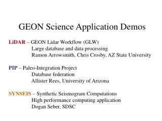
Demonstration Preview NOTE: A technology demonstration, not a content demonstration (vocabulary, ontology, maps, …) Ontology Registration (geologicAge.owl) • Dataset Registration (myShapeFiles.zip) • Item-Level Association (12) • GEONsearch • metadata, spatial, temporal, concept-based • GEONworkbench • use of workspace e.g. composing new maps from existing one
Other distributed apps Kepler, DLESE, … Client Access (via web services) myOntology.owl myDataset.foo Search condition(s) spatialtemporalconcept User actions add delete manipulate metadata metadata ResourceRegistration GEONsearch GEONworkbench GEON Workspace (user) GEON Catalog SRB Log GEONmiddleware external services Gazetteer, DLESE, … Geologic Age, Chronos, … Demonstration Preview User Access (via Portal)
Domain Knowledge Ontologies Arizona Dataset to Ontology Registration (Item-level)
Lets play with it • Sandbox information • http://www.geongrid.org/ • Select Portal Login • Get an portal test account • Login using this account • Upload one the shape file existing on your local machine
Disks Internet User-friendly messages XML, ZIP, ASCII, SRB ID SOAP Server Exception Handler URL User Friendly Messages Map Server SRB ID SRB Shape ToMap Logger ArcIMS ASCII ToMap XML ToMap Resource Allocator log Create Service/ Image Cleanup Service MapEngine Shape Files log Analyzer Mapping Resources Services Infrastructure
MapEngine Map Engine Web Services
Demo • ShapeToMap • Have the dataset in shape file format, don’t have expertise/technology to create maps. • ASCIIToMap • Have tab delimited file, don’t have expertise/technology to create maps. • XMLToMap • Have XML dataset in database want create map. • ESRI Grid Ascii to Map (GeoTiff) • Have a GRID ASCII file, want to create map.
ShapeToMap • Zip the file associated with a zip file • Upload the shape file and create map • View and analyze the results • URL:
ASCIIToMap • Tab delimited file with spatial information • Example from the SCEC website (lat, lon, magnitude) • Only point dataset supported at this points • Upload the ASCII file and create map • View and analyze the results • URL:http://data01.geongrid.org:8080/ASCIIToMap/
XMLToMap • Query database for data • Only point dataset support at this point • Convert to XML (defined by us) • Spatial information • Attribute data • Upload the XML file and create map • View and analyze the results • URL:http://data01.geongrid.org:8080/XMLToMap/
GridAsciiToMap • ESRI Grid Ascii format • Upload the Grid Ascii file and create map • View and analyze the results • URL:http://data01.geongrid.org:8080/GridAsciiToMap/
More Formats To Map • Opportunity to develop your own data converter. • Publish your conversion tool on GEON and make it available to the world.
Querying multiple map services In GEON (www.geongrid.org) Mediator Ontology Legend Generator Map Assembler … GRID SERVICES FOR MAP INTEGRATION ArcIMS and WMS Services wrapped in WSDL/SOAP
Map Engine XML ToMap Some Advanced Mapping Service GEONgridnodes • GridMonitor (Grid Systems Monitor) Other XML Grid Instances Services Ping GS Ping GS Grid Monitor Config Nodes Repositories Ping GS Ping GS Disk OGSI Ping GS Ping GS Map Server ArcIMS DEMO