Download
1 / 20
200 likes | 327 Views
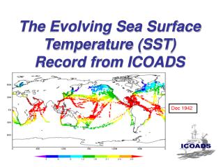
This work focuses on the advancement of the Sea Surface Temperature (SST) climate data record via the Advanced Very High Resolution Radiometer (AVHRR) as part of the Pathfinder Program. This comprehensive dataset, covering global SSTs from 1985 to present, offers improved spatial resolution of approximately 4 km, enabling better monitoring of oceanic and coastal environments. With enhancements over previous versions, such as refined land masks and ancillary data inclusion, the new dataset supports various climate, coastal, and ecosystem applications, fulfilling IOOS DMAC requirements.

E N D
Toward the SST Climate Data Record from Space Kenneth S. Casey - NOAA National Oceanographic Data Center Richard W. Reynolds - NOAA National Climatic Data Center Edward J. Kearns - University of Miami Andrew D. Barton - NOAA National Oceanographic Data Center
The AVHRR Pathfinder Program • Advanced Very High Resolution Radiometer (AVHRR) on NOAA Polar Orbiters • Heritage: NOAA/NASA AVHRR Oceans Pathfinder Program of the 1990’s (V4) • Collaboration: NODC, NCDC, RSMAS, NASA PO.DAAC To develop the SST climate data record for AVHRR in a sustained environment
AVHRR Pathfinder Version 5 • Coverage: Global, 1985-near present • Spatial resolution: ~ 4 km • Averaging periods: Daily, 5-day, 7-day, 8-day, Monthly, and Yearly (day and night) • Corresponding climatologies • FGDC and Rich Inventory Metadata • Satisfies most IOOS DMAC requirements http://pathfinder.nodc.noaa.gov
Improvements over Pathfinder V4 • Finer global resolution - now 4 km was 9 km • Significantly improved land mask • Inland waters and lake observations • More ancillary and statistical data • Longer time series… now in our 21st year! Climate, coastal,and ecosystemapplications now possible!
Improved Coastal Coverage • ReefBase reef location database ~ 8000 sites • 9 km Pathfinder coverage only 61% • 4 km Pathfinder coverage: > 98%
Operational NESDIS 50 km Latitude Longitude
AVHRR Pathfinder 9 km Latitude Longitude
AVHRR Pathfinder 4 km Latitude Longitude
Nighttime Pathfinder - HadSST2 NOAA9 NOAA11 NOAA14 NOAA16 Operational - HadSST2 NOAA7 NOAA9 NOAA11 NOAA14 NOAA16
Daytime Pathfinder - HadSST2 NOAA9 NOAA11 NOAA14 NOAA16 Operational - HadSST2 NOAA7 NOAA9 NOAA11 NOAA14 NOAA16
Nighttime Pathfinder - OISSTv2 NOAA9 NOAA11 NOAA14 NOAA16 Operational - OISSTv2 NOAA7 NOAA9 NOAA11 NOAA14 NOAA16
Daytime Pathfinder - OISSTv2 NOAA9 NOAA11 NOAA14 NOAA16 Operational - OISSTv2 NOAA7 NOAA9 NOAA11 NOAA14 NOAA16
Satellite Biases Nighttime Operational Pathfinder +/- 1 C 1982 2004 Daytime +/- 1 C Weekly Satellite-OISSTv2
Maximum Satellite - OISSTv2 Operational Pathfinder Weekly Nighttime 1982 2004 Weekly Daytime
Minimum Satellite - OISSTv2 Operational Pathfinder Weekly Nighttime 1982 2004 Weekly Daytime
Improvements Coming in PFV 6 • Wind and aerosol ancillary data • Improved QC including aerosol flagging and better use of sea ice • Improved data management (HDF5 with CF and ACDD metadata?) • 1985-2005 (maybe back to 1981?) • Implement “18-line problem” correction with new global gridding scheme
Connections to GHRSST • GODAE High Resolution SST (GHRSST) • GHRSST is both real time and retrospective • Optimizing the retrospective connection… • Level 2 • Times of Observation • All AVHRRs? • Error estimates
Acknowledgements Thanks to John Kennedy and Nick Rayner, Hadley Centre, UK Met Office, for providing the HadSST2 data set !!