Global Land Research for Sustainability
Explore human-environment changes, vulnerabilities, and resilience at local to global scales with integrated research approaches and focusing on terrestrial systems. Investigate land use dynamics, ecosystem services, and vulnerability to global changes.

Global Land Research for Sustainability
E N D
Presentation Transcript
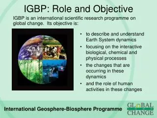
IGBP-II LAND Research Program K S Rajan Institute of Industrial Science, University of Tokyo LAND SC-TT Member Scientific Officer, LUCC Focus 2 Office
GCTE LUCC New Structure of IGBP (2003~ )
New Joint Projects START
Objective of the LAND Project: • To identify changes in the human-environment system and critical thresholds of vulnerability at local, regional and global scales of the system.
Fundamental Principles for LAND research • First, integrating for Transition to sustainability • ‘functionalities’ or characteristics of the Earth System • feedbacks (processes which amplify or dampen aspects of the dynamics of the planetary life-support system), • teleconnections (linkages between processes across space), • switch and choke points on the earth’s surface (control points). • Second, Integrative with other sciences, as possible • Third, a fruitful platform of investigations - exploration of pathways (or trajectories) of land change
Major Concepts to consider • Ecosystems as life-support systems • Pathways of change (trajectory analysis) • People and ecosystems at risk (vulnerability ) Methodological issues • Coupled (socio-economic and biophysical) models • Linked, geo-referenced and long-term databases of socio-economic and biophysical variables • Comparative regional assessments:
THE LAND Project • Land-Centric integrative research programme • Guiding Questions of the Research Agenda are: • What are the dynamics and drivers of variability and change in human-environment systems? • How is the provision of environmental goods and services affected by changes in human-environment systems? • What are the characteristics and dynamics of vulnerability in human-environment systems?
Focal Research Themes • Agents, Drivers And Processes Of Terrestrial Human Environmental Change • Ecosystem Goods And Services • Vulnerability Of Terrestrial Human Environment Systems To Global Change
Research Questions (1) • How do economic growth, globalization, governance, and other socio-economic processes interact to drive changes in land use and the functioning of the land system? • How does the changing spatial distribution of land use, urbanization, changing populations, and settlement patterns to drive changes in the land system, and in land-atmosphere, land-ocean exchanges? • How do management of land systems and disturbances drive changes in the land system, and its interaction with the atmosphere and oceans?
Research Questions (2) • How does the legacy of historical management and disturbance, drive changes in the land system, and its interactions with the atmosphere and oceans now and in the future? • How do environmental changes and human activities drive changes in biodiversity and how do these effects feed forward to cause changes in ecosystem functioning and properties? • How does the changing physical and chemical atmosphere interact with the land to drive changes in land systems, land-atmosphere and land ocean exchanges?
Focus on Integrated Research Activities: • Agriculture impacts and feedbacks • An integrative systems analysis • Land scarcity and degradation • Impacts of the inputs and flow • MEGA-BASINS: How do biophysical and human-decision interactions control vulnerability of mega-basins? • Water Resources – Availability, Development and Management • Water-Food-Economic Production System Interactions • Upstream-Downstream Links (Material Flows)
Radiation Precipitation Temperature Evapotransipration Tillage Wind Layered Soil Pedon Runoff Sediment Chemicals -Dissolved -Adsorbed Percolation Spatial-EPIC Overall Framework Physical Components of the Model
GIS IE Maps(Climate,Soil, Terrain) and socio-economic data (Population, income, …) Combination for Main Crops Land use pattern and irrigation water use Logit Model Creating of spatial database Data handling (Interpolating, analysis) Estimate of planting and harvest date Sample data of Land use and choices Export of grid data EPIC International market/trade model RS, GPS and other Investigated data EPIC Model Simulation EPIC Parameters Modelling for Crop Growth Flowchart of GIS-EPIC Using Crop Models and GIS to Study the Global Irrigation Water Requirements
Rice Yields (T/HA) (T/HA) Maize Yields Estimation of Land Productivity Using Crop Models and GIS to Study the Global Irrigation Water Requirements
Estimation of Land Productivity T/HA T/HA T/HA Comparing the rice crop yields simulated by EPIC with FAO statistic data Comparing the wheat crop yields simulated by EPIC with FAO statistic data T/HA T/HA T/HA Comparing the maize crop yields simulated by EPIC with FAO statistic data Comparing the soybean crop yields simulated by EPIC with FAO statistic data Using Crop Models and GIS to Study the Global Irrigation Water Requirements
Spatial-EPIC Results for India - Rice Fig. RICE Validation Fig. State Wise Comaprision of Rice Crop Yiled (t/ha) 3.5 3.0 3.0 3.0 2.5 2 R = 0.2123 2.5 2.0 Actu_Rice95 2.0 2.0 1.5 Average Simulated Yield (t/ha) 1990 Average Reported Yield (t/ha) Sim_Rice95 1.5 Simulated District Average 1.0 Linear (1990) 1.0 1.0 0.5 0.5 0.0 0.0 0.0 Bihar Gujrat Kerala Punjab Orissa Assam Haryana Karnataka Tamil Nadu Maharastra West Bengal Uttar Pradesh 0.0 1.0 2.0 3.0 4.0 Andhra Pradesh Madhya Pradesh Jammu & Kashmir Reported District Average
An Example of the INTERACTIONS at the LOCAL Scale Source: Fukui, 1993
Micro-sphere of Decision Making Agricultural Land Use (Crop Choice) Urban Land Use Pastures/Grassland Other Land uses Farmer Earth (Environment ) Resource System (Land/ Water, Ecosystem) Land Owner Long Term Short term Macro-sphere of Decision Making Policy Directions Water Supply Migrations Market Dynamics Cumulative Changes in Environment Changes in Life Style
International Market National Scenario MACRO Sub-Model Crop Demand Estimation Regulations Price Supply Population Agent Decision Sub-Model Migration Land User Land Use Conversion - within Agriculture Behavioral Models AGRO-ECONOMIC Sub-Model SPATIAL URBAN EXPANSION MODEL MICRO Sub-Models BIO-PHYSICAL CROP MODEL Environment / Resource System Model Structure of AGENT-LUC
Income Map of Nan Province Legend Examples of the Micro-Simulation Model Results [1]
Examples of the Micro-Simulation Model Results [2] Urban Centre No. of Households in Each Grid : 60 LU: Paddy(4); Maize(1,6,7,8); Paddy+Maize(rest)
Examples of the Micro-Simulation Model Results [3] No. of Households in Each Grid : 83(1,2); 117(rest) LU: Paddy(all grid points)
Fixed Cost Variable Cost - Land Based - Yield Based
Web-DSS Project USGS Land cover map
Web-DSS Project Define discharge observation point
Web-DSS Project Scenario2 All agricultural lands change to irrigated lands. @irri.raw 0:other, 1:unirrigated 2: irrigated 3 outside Scenario-1 (no change) Scenario3 All lands change to irrigated lands.
Web-DSS Project x 10.000 m3 Scenario1 Scenario2 Scenario3 Month Monthly discharge at point C
Web-DSS Project x 10.000 m3 Scenario1 Scenario2 Scenario3 Month Monthly discharge at point A
MAIRS - Monsoon Asia Integrated Regional Studies • Sponsored by START • Will cover 3 Sub-regions • South Asia • South East Asia • East Asia
Monsoon Asia Integrated Regional Studies • Emissions/Energy/industrial transformations – • Climate-related Disasters and Hazards – floods, droughts, storms, fires, GLOFs • Water (fresh and salt), catchments and coasts • Food, Fiber • Human health • Biodiversity and ecosystem change + Ecosystem services Cross-Cutting Themes : Land Use; Monsoon climate system Resilience; Adaptive capacity; Ecosystem services
Water-Food Theme • How will changes in land-use and cover, atmospheric emissions, and ocean productivity in the Asian Monsoon region interact with the global hydrological cycle? • What will be the consequences of changes in land-use, and modification of rivers for ground water, riverine, coastal and marine environments? • Will these changes amplify vulnerability to (the natural and man-made disasters like) floods and droughts –Food Production Systems
Vulnerability Theme How will changes in the AM, especially the frequency and intensity of extreme event challenges human responses? How do rapid economic and social changes influence vulnerability to hazards? How many changes in frequency/severity of biological invasions, pests, weeds and diseases affect human well-being? How can human-decision making be improved to reduce disasters under both current and future environmental conditions?