Download
1 / 23
230 likes | 439 Views
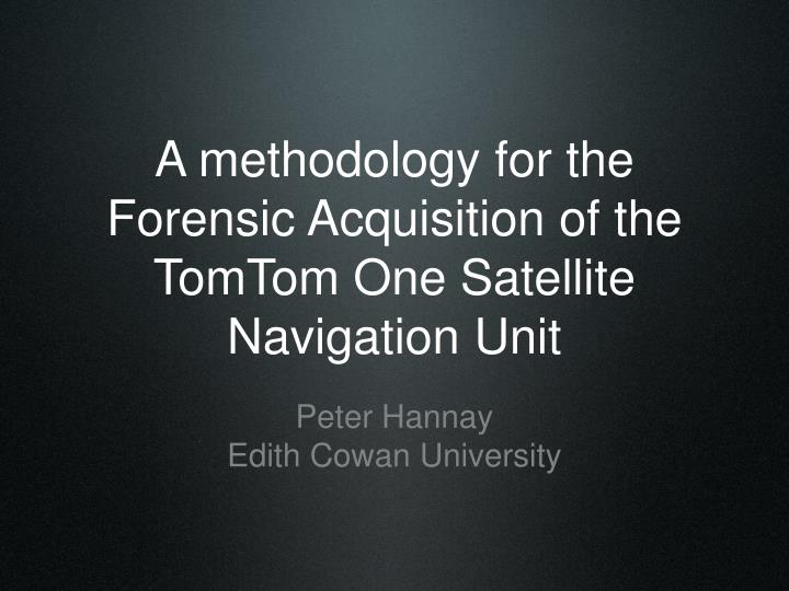
A methodology for the Forensic Acquisition of the TomTom One Satellite Navigation Unit. Peter Hannay Edith Cowan University. Contents. Details of TomTom One History of Satellite Navigation Forensic Requirements Use of SatNav evidence Methodology and notes

E N D
A methodology for the Forensic Acquisition of the TomTom One Satellite Navigation Unit • Peter Hannay • Edith Cowan University
Contents • Details of TomTom One • History of Satellite Navigation • Forensic Requirements • Use of SatNav evidence • Methodology and notes • Limitations and Problems with SatNav evidence • Ongoing research
Selected Device • TomTom One • SirfStarIII based GPS receiver module • Uses SD media • Boot sector • Operating System - NavCore 6/7 • Map data • Supporting files
Background • Satellite navigation devices determine their current position and provide navigational aid • These devices are becoming increasingly common • Satellite navigation devices may provide historical locational information to forensic investigators
History • 1960 - 1991 : TRANSIT • 1974 - CURRENT : NAVSTAR • 1995 - CURRENT : GLONASS
TRANSIT • NAVY NAVIGATION SATELLITE SYSTEM
1960 - 1991 : TRANSIT • A project of the United States Navy • Designed to assist Polaris Submarines with navigation (Parkinson & Gilbert, 1983, p. 1117). • Determined location based on Doppler effect • Corrections had to be made for velocity
NAVSTAR • UNITED STATES DOD SATELLITE NAVIGATION SYSTEM
1974 - : NAVSTAR • A project of the United States DoD Joint Projects Office (Braunschvig, Garwin, & Marwell, 2003). • Managed by United States Airforce 50th Space Wing • Utilizes triangulation based on time differentials • Dual use system - civilian and military (Parkinson & Spilker, 1996, p. 601).
GLONASS • A Soviet Response to the NAVSTAR GSNS
1995 - : GLONASS • Project incepted during the cold war as a response to the NAVSTAR system. • A project of the Soviet Union’s defense ministry (Polischuk & Kozlov, 2002, p. 154). • Utilizes triangulation based on time differentials.
Digital Forensics • Aims • Examine evidence in such a way that it is admissible in a courtroom setting (ACPO, p. 6). • Ensure that original evidence is not changed as part of the investigation(HB171, 2003, pp. 17-18).
SatNav as Evidence • It is important to examine previous cases in which SatNav evidence has been used in a legal context • Two significant incidents in Australia in which evidence from commercial automotive SatNav units was used • GPS tracking units for monitoring persons of interest are widely used by law enforcement and other agencies (Keith, 2007, p. 25).
Brett Pownceby • A Victorian farmer who was issued a speeding fine for exceeding the speed limit by 21km/h (Watt & Crase, 2007). • Supposedly a Garmin GPS receiver was turned on and active at the time the alleged infringement occurred. • Mr Pownceby retrieved records from the GPS device which showed his speed as being within an acceptable range at the specified time. • Records were presented to an unknown member of law enforcement and charges were subsequently dropped. • In relation to this incident a representative of the Traffic Camera Office has stated that "The production of a GPS report alone to avoid any speeding infringement is insufficient” (Whinnett, 2007).
Michael Simotas • Charged for exceeding the speed limit by 25km/h • Mr Simotas chose to contest the charges in court (Wainwright, 2007). • Made use of expert witness and GPS evidence acquired from the satellite navigation unit in his car • Initially the court ruled against Mr Simotas. • Charges were dismissed by district court on appeal. • It is not known if the GPS evidence presented contributed to the outcome. • the police operating the radar unit at the time of the incident admitted to not using it correctly and instead making a visual estimation of Mr Simtoas’ speed (Wainwright, 2007). • Mr Simotas is a distributor of the GPS device from whcih evidence was acquired and uses the case as an advertising point("EziTrak NSW Distributors," 2007; Pye, 2007).
Limitations • Not all sources of potential evidence are examined • Accuracy of testing may be limited if open sky testing is used
Ongoing Research • Analysis of acquired evidence • Methodology for analysis • Documented results from analysis • Automated tool for analysis ?
References ACPO. Good Pracice Guide for Computer based Electronic Evidence. 3.0. Retrieved 16 Oct, 2007, from ACPO. Good Pracice Guide for Computer based Electronic Evidence. 3.0. Retrieved 16 Oct, 2007, from http://www.acpo.police.uk/asp/policies/Data/gpg_computer_based_evidence_v3.pdf. Braunschvig, D., Garwin, R. L., & Marwell, J. C. (2003). Space Diplomacy. Foreign Affairs, 82(4), 156. EziTrak News. (2007). EziTrak Retrieved 16 Oct, 2007, from http://www.ezitrak.com.au/aa-News.htm EziTrak NSW Distributors. (2007). EziTrak Retrieved 16 Oct, 2007, from http://www.ezitrak.com.au/aa-NSWDistributors.htm
References HB171. (2003). HB171: Guidelines for the management of IT evidence : handbook. Sydney: Standards Australia. Keith, H. (2007). Tracking "Bad Guys": Legal Considerations in Using GPS. FBI Law Enforcement Bulletin, 76(7), 25. Parkinson, B. W. (1997). Origins, evolution, and future of satellite navigation. Journal of Guidance, Control, and Dynamics, 20(1), 11-25. Parkinson, B. W., & Gilbert, S. W. (1983). NAVSTAR: Global positioning system—Ten years later. Proceedings of the IEEE, 71(10), 1177-1186. Parkinson, B. W., & Spilker, J. J. (1996). Global Positioning System: theory and applications: Aiaa.
References Polischuk, G. M., & Kozlov, V. I. (2002). THE GLOBAL NAVIGATION SATELLITE SYSTEM GLONASS: DEVELOPMENT AND USAGE IN THE 21ST CENTURY. 34th Annual Precise Time and Time Interval Meeting, 151-160. Pye, G. (2007, March 14). A Knight With Shining GPS. Rock Paper Dynamite Retrieved 16 Oct, 2007, from http://rockpaperdynamite.wordpress.com/2007/03/14/a-knight-with-shining-gps/ Wainwright, R. (2007). Father and son stick to guns to prove radar wrong. The Sydney Morning Herald Retrieved 16 Oct, 2007, from http://www.smh.com.au/news/national/father-and-son-stick-to-guns-to-prove-radar-wrong/2007/03/11/1173548023012.html Walter, B. (1996). Satellite navigation systems. Sensor Review, 16(1), 4. Watt, J., & Crase, S. (2007, July 2, 2007). How I used my GPS to beat my speeding fine. Retrieved 16th August, 2007, from http://www.abc.net.au/southwestvic/stories/s1967739.htm Whinnett, E. (2007, 16 Oct 2007). GPS beats radar gun. Retrieved 16 Oct, 2007, from http://www.news.com.au/heraldsun/story/0,21985,21999706-661,00.html