Download
1 / 30
300 likes | 323 Views
This presentation provides an update on a fish study focusing on potential impacts of a flood storage facility on the Upper Mainstem Chehalis River's anadromous salmon populations. Components analyzed include hydrology, water quality, geomorphology, fish habitat modeling (PHABSIM), and fish population modeling (SHIRAZ). Changes to geomorphic reaches, fish habitat simulations, and population modeling using SHIRAZ are discussed. The next steps and recommended actions include data collection, incorporating climate change projections, and conducting aerial photo interpretation. This study aims to inform decision-making regarding the river's ecosystem health.

E N D
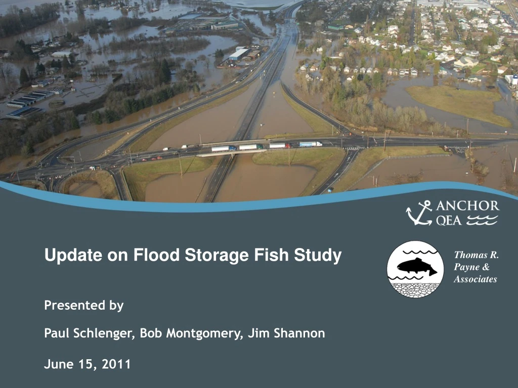
Update on Flood Storage Fish Study Presented by Paul Schlenger, Bob Montgomery, Jim Shannon June 15, 2011
Overview of Presentation • Introduction • Update on Fish Study Analysis Components • Hydrology • Water Quality • Geomorphology • Fish Habitat Modeling (PHABSIM) • Fish Population Modeling (SHIRAZ) • Next Steps • Recommended Steps
Purpose of Fish Study To characterize the magnitude of potential impacts that a flood storage facility on the upper mainstem Chehalis River could have on anadromous salmon populations
Study Approach • To use applicable existing and new data to characterize habitat conditions in the basin that contribute to salmon viability and would potentially be impacted by a dam • Hydrology and Hydraulics (water flow) • Water Quality (temperature) • Geomorphology (sediment transport)
Fish Study Status • Fish Study Elements • Hydrology • Water Quality • Geomorphology • Fish Habitat Modeling (PHABSIM) in prep. • Fish Population Modeling (SHIRAZ) in prep.
Geomorphology Geomorphic Reaches Changes to Geomorphic Reaches from proposed flood storage facility
Changes to Geomorphology Reduced peak flow Channel migration Bedload transport Reduced sediment and wood input
Estimated Changes to Geomorphology • Reach 1 (upstream-most reach) • Inundated • Reach 2 • Transport capacity 4 percent of existing. • Bedload transport 4 of 20 years vs. 12 of 20. • Sediment input 29 percent of existing. • Change? Aggradation and percent fines up. • Reach 3 • Similar to Reach 2 but also channel migration patterns may change. Peak flow vs. aggradation?
Estimated Changes to Geomorphology • Reach 4 and 5 • Transport capacity 65 percent of existing. • Sediment input 75 percent of existing. • Change? Aggradation and percent fines change relatively small. • Reach 6 (downstream-most reach) • Changes muted because downstream of bedrock control grade.
Fish Habitat Modeling Using PHABSIM • PHABSIM = Physical Habitat Simulation • PHABSIM is a subcomponent of IFIM (Instream Flow Incremental Methodology) • PHABSIM and IFIM were developed as aids to instream flow decision-making • PHABSIM predicts changes in habitat availability with changes in flow
PHABSIM Mesohabitat survey Six reaches Ten study sites 71 transects Reviewed and agreed upon with WDFW and Ecology Measured depth, velocity, substrate, and cover along transects
PHABSIM Used results in SHIRAZ to determine spawning and rearing areas. Results must be put into context. Other variables (i.e. water quality) Looking at peaks oversimplifies results (i.e. maximum flow may not exist in a reach) Usable habitat can be the same at two flows.
Fish Population Modeling Using SHIRAZ • Microsoft Excel-based model to relate habitat conditions to salmon production • Capacity • Productivity • User-defined inputs to build the model, i.e., a transparent model • Allows for year-to-year changes in habitat conditions (as well as marine survival, harvest, and hatcheries, if desired)
SHIRAZ Inputs • Species data • Define assessment reaches • Populate model with data to characterize habitat conditions in each reach • Establish relationships, i.e., functional linkages, between habitat conditions and salmon survival • Future condition scenarios
Species Data • Species presence and distribution • Coho, spring Chinook, winter steelhead • Life history • Freshwater lifestages • Age of outmigration • Age of return migration • Species periodicity • Population numbers in the mainstem
Habitat Conditions • Capacity • Spawning area (flow dependent) • Rearing area (flow dependent) • Productivity • Flow • Water temperature • Fine sediment in redds
Future Condition Scenarios • Flood Storage Facility • Natural flows past dam when in non-flood conditions • Following flood, downstream flows increased by reservoir draining • Multi-Purpose Facility • Controlled flows when in non-flood conditions, including potential to augment low flows • Use studies to inform habitat condition changes
SHIRAZ Outputs • Number of population alive by lifestage & area • Life-cycle productivity
Next Steps Complete PHABSIM data collection and analysis Continue to build SHIRAZ models Reporting Data Transfer Workshop
Recommended Steps Collect more data on habitat conditions in proposed inundation area and representative portions of tributaries that would not be inundated Incorporate projected changes in basin hydrology associated with climate change Aerial photo interpretation of the growth of gravel bars Cross-section surveys at the same location as previous surveys, such as the FEMA surveys from the early 1980s – dual purpose to help in the sediment budget analysis and support updating the HEC-RAS model
Recommended Steps (continued) • Investigate fish passage options for a dam • Investigate sediment transport and/or large woody debris transport options for passing material past a dam • Comprehensively identify opportunities to enhance habitat to improve fish population resilience in basin whether dam constructed or major floods encountered