Download
1 / 32
340 likes | 390 Views
Explore the vast potential of Senegal's petroleum resources in the Mesozoic-Cenozoic basin. Discover reservoirs, seals, source rocks, and production occurrences in this rich geological region.

E N D
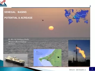
SENEGAL BASINS POTENTIAL & ACREAGE By Mrs Nd. Rokhaya.Diallo Manager Basin Geology Petrosen
LOCATION AREA : 196 192 Km2 POPULATION : ~12 000 000 hbts DENSITY: 51 h / Km2 GNP : 1110 $ Dakar
REGIONAL SETTING NW African coastal basin the MSGBC Mesozoic-Cenozoic passive margin basin overlying a Paleozoic basin no wells in deep water
RESERVOIRS & SEALS • Upper Devonian shales • Devonian sandstones :fine to coarse grained, often oolithic with porosities ~ 15% - 20%. • Upper Tertiary shaly sequences • Lower Tertiary clastics and carbonates • Upper Cretaceous sands and shale sequences • Jurassic - lower Cretaceous • carbonate section • Ordovician sandstones : no primary porosity, but intensely fractured, good secondary porosity having excellent deliverabilty
SOURCE ROCKS & MATURATIONc Best source rocks Cenomanian-Turonian and Albian • in CM-7 • Cenomanian level at 2608m with • TOC = 8.72 % • HI = 660 mg/g • in CM-10 • Turonian level at 2554 m with • TOC = 5.25 % • HI = 638 mg/g
SOURCE ROCKS & MATURATION Silurian shales : best regional source rocks TOC ~ 1% - 3% Ro ~ 0.95 - 1.3
SOURCE TESTED RESERVOIR FIELD (or Reference Well) 3D SEISMIC PICKING Ref. Well P F G VG PLIO-RECENT Dakar Canyon MIOCENE Upper Miocene unc. T 020 SLOPE DEPOSITS AND CONFINED TURBIDITES CHINGUETTI, THIOF, BANDA T 030 Lower Miocene unc. OLIGOCENE Oligocene unc. TERTIARY T 040 DOME FLORE, DOME GEA T 060 T 080 EOCENE OPEN MARINE CARBONATES T 090 PALEOCENE PELICAN SLOPE DEPOSITS AND CONFINED TURBIDITES K 070 MAASTRICHT. DIAM NADIO K 090 CAMPANIAN GADIAGA K 100 DELTAIC AND SHALLOW MARINE CLASTICS RF 3 - (CVM 1) SANTONIAN K 110 CRETACEOUS Turonian transgression Senonian unc. TURONIAN CM 10 FAUCON ? - (CVM 1) K 110 a PROGR. CARB. PLATFORM K 120 CENOMANIAN K 130 FAUC. MIXED SYSTEMS DELTAIC VS CARBONATE PLATFORM JAMMAH 1 - (CVM 1, FAUCON) ALBIAN DSDP 367 APTIAN Aptian transgression Top Neocomian Lmst DKM 2, RF 2 NEOCOMIAN SHALLOW TO OPEN MARINE CARBONATES DKM 2 ??? MALM Gas JURA Condensate Oil DOGGER HYDROCARBON OCCURRENCES & PRODUCTIONc
HYDROCARBON OCCURRENCES & PRODUCTION • Diam Niadio field • Gadiaga field • Dome Flore & Gea fields
HYDROCARBON OCCURRENCES & PRODUCTION Gadiaga field • ~ 95 000 000 Nm3 ( 3.325 BCF ) • producing since Oct 2002 Diamniadio field • 217 393 033 Nm3 (7.6 Bcf) • from 1987 to 2000 • 62 642 bbs light oil 34° API • 35 692 bbls condensate 2009 : 17 114 983 Nm3 (~600 mmscft) 759 bbls condensate
DOME FLORE & GEA Heavy Oil in Oligocene limestones ( 10 – 13 ° API ~ 1Bbls ) Light Oil Maestrichtian ( 33° API ) Oil shows in Miocene & Albian sands Flore & Gea fields
Gadiaga field • 34 km • - 10 km • - 9 km Kabor storage and epuration station Gas Turbine at Cap des Biches GAS TRANSPORT NETWORK Cement plant 11
CONTRACT AREAS Licenses • 3 PSC offshore • 3 PSC onshore • 5 Companies • 5 blocks under negotiation • 5 open blocks offshore • 3 open blocks onshore
SEBIKHOTANE Avril 2003 DN-15B in 2006 commitment : 2 exploration wells Konkorong-1 Baobab-1
TAMNA • 6 wells drilled the last two years • Gas in Lower Senonian sands connected to transport system ~64 000 Nm3 to SOCOCIM cement plant presently ~ 300 000 Nm3 / day possible delivery to SENELEC power plant October 2006
SAINT LOUIS offshore 60 % 30 % 10 % • Structural/Stratigraphic traps • west of the Cayar fault zone; • Structural traps within the • Cayar fault zone; • Turbidites/mas flow deposits west • the Cayar fault zone granted 2003 1200 km 2D Juillet 2004
Acquisition 620 km2 of 3D in March-April 2008 Ibis & Flamengo leads
SAINT LOUIS offshore profond • 1500 Km 2D • high frequency airmag survey • 4225 Km2 • 5695 line Kms • Satellite seep study • economic evaluation • (1.5 TCF)
CAYARS offshore blocks ~ 1690 km 2D on March 2006 Airmag survey March 2007
December 2008 CAYARS offshore blocks
RUFISQUE offshore profond 2088 Km 2D Nov/Dec 2004 1500 km2 3D Jan/ Feb 2007 Relinquished by Edison/Petrobras
SANGOMAR - RUFISQUE 90 % 10 % 2050 km2 3D ( Feb - Mar 2007 ) November 2004
plays & leads L Cretaceous Carbonate shelf Margin play Top Aptian Senonian Unconformity Depth 3D line 1541 Albian Buried hills 3D Line 9076 Santonian fans N S Slope fan play Albian S N 3d Line 9076 Depth Prospective dip closed Interval Top Aptian High amplitude Upper slope Fan complexes Neocomian Senonian Unconformity 3d Line 1541 Depth Turonian
SENEGAL OFFSHORE SUD • About 10 000 km of 2D from 1973 et 2001 • 8 wells
Bassins intracratoniques PALEOZOIC BASIN • Prospective Area : East Meridian 16° • Surface : environ 60 000 km² • Two sub-basins East Meridian 15°
190 km Basin L3 H1 DiF-1 H2 KrF-1 Basin NiF-1 L1 Basin L4 H3 Ta-2 Basin L2 H5 L5 H4 Db-1 L6 SENEGAL EAST AREA 2 bassins L1 et L2 identified Landsat 7 ETM+ ERS SAR
PETROLEUM LEGISLATION LEGAL AND FISCAL TERMS
LAW N° 98-05 of January 08, 1998 (PETROLEUM CODE) • PRODUCTION SHARING CONTRACT (PSC) • EXPLORATION • Initial Period: 3-4 years • Renewal Periods: 2-3 years • EXPLOITATION PERIOD • Initial Period: 25 years • Extension Periods: 10+10 years
EXPLORATION WORK PROGRAM & EXPENDITURE OBLIGATIONS to be negotiated RETENTION PERIOD • If a discovery is certified non commercial, Contractor may be granted a Retention Period of maximum: • 3 years for crude oil • 8 years for natural gas
PETROSEN’S PARTICIPATION • Exploration phases: Carried Interest of 10 % • After Commercial discovery: Working Interest up to 20 % FISCAL REGIME Twenty five per cent (25%) Income Tax ( applied on net profit )
THANK YOU • Senegal Basin has generated oil and gas • Diamniadio, Gadiaga and Casamance Dôme Flore • Presence of world class source rocks in Turonian-Cenomanian • secondary good sources in Albo-Aptian and Jurassic • Petroleum system in Deep water • with various structural trends and traps • 60 000 km2 underexplored Paleozoic basin • with good reservoirs in Ordovician and Devonian • and good source in Silurian, and traps and plays • identified Law with flexible terms