Download
1 / 43
430 likes | 449 Views
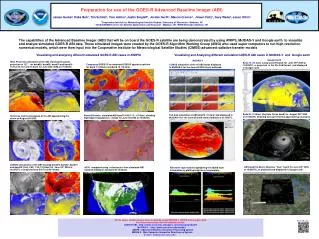
This article provides an overview of the Advanced Baseline Imager (ABI) on the GOES-R satellite, including its spectral coverage, bands, and spatial resolution. It also discusses the potential uses and applications of the ABI's visible and near-infrared channels and highlights the improvements and new capabilities compared to the current GOES Imager.

E N D
A Introduction of the ABI on GOES-R Timothy J. Schmit NOAA/NESDIS/STAR Advanced Satellite Products Branch (ASPB) and many others June 2005 UW-Madison
A few Subject Matter Experts... Achtor, Tom; Ackerman, Steve; Antonelli, Paolo; Aune, Bob; Bachmeier, Scott; Baggett, Kevin; Baum, Bryan; Flanagan, Dan; Ellrod, Gary; Feltz, Joleen; Feltz, Wayne; Frey, Rich; Griffin, Michael K.; Gumley, Liam; Gunshor, Mat; Gurka, James J.; Hillger, Don; Huang, Allen; Key, Jeff; Knuteson, Bob; Karnauskas, Kristopher; Li, Jun; Mecikalski, John; Menzel, Paul; Moeller, Chris; Mosher, Fred; Nelson, James; Nasiri, Shaima; Olander, Tim; Plokhenko, Youri; Prins, Elaine; Rabin, Bob; Revercomb, Hank; Schmidt, Chris; Schreiner, Tony; Seemann-Wetzel, Suzanne; Sieglaff, Justin; Strabala, Kathy; Sun, Fengying; Tobin, Dave; Uhlenbrock, Nate; Velden, Chris; Wade, Gary; Whittaker, Tom; and Woolf, Hal…
Roadmap • What is ABI? (Next generation Advanced Baseline Imager) • Summary of Bands • Visible/near infrared • Infrared • How might select bands be used? • Summary/More information
GOES-R • Advanced Baseline Imager (ABI) • Hyperspectral Environmental Suite (HES) • Disk Sounding • Severe Weather Mesoscale • Coastal Imager • Solar Instrument Suite (SIS) • Space Environment In Situ Suite (SEISS) • Auxiliary Services (AUX) • Geostationary Lightning Mapper (GLM) • Magnetometer (MAG)
GOES-R Program Schedule ABI currently slated for a launch in late 2012 As of: 22 Mar 05
ABI Current Spectral Coverage 16 bands 5 bands Spatial resolution 0.64 mm Visible 0.5 km Approx. 1 km Other Visible/nearIR 1.0 km n/a Bands (>2 mm) 2 km Approx. 4 km Spatial coverage Full disk 4 per hour Every 3 hours CONUS 12 per hour ~4 per hour Mesoscale Every 30 sec - Visible On-orbit calibrationYes No The Advanced Baseline Imager:
ABI spatial coverage rate versus the current GOES Imager ABI coverage in ~5 minutes Current GOES coverage in 5 minutes • There are two anticipated scan modes for the ABI: • full disk images every 15 minutes + CONUS images every 5 minutes + mesoscale. • Full disk every 5 minutes.
MODIS 0.25 km Lake Effect Snow Bands: Visible MODIS 0.5 km MODIS 1 km 19 January 2001, 1720 UTC GOES-8 1 km
AVIRIS spectra Snow, Phase Cirrus Part. size Veg. Haze Clouds Visible and near-IR channels on the ABI Radiance The current GOES has only one visible band.
Visible and near-IR channels on the ABI The ABI visible and near-IR bands have many uses.
While there are differences, there are also many similarities for the spectral bands on MET-8 and the Advanced Baseline Imager (ABI). Both the MET-8 and ABI have many more bands than the current operational imagers.
ABI Bands Recent Spectral Changes to be consistent with VIIRS
Weighting Functions for the IR channels on the ABI Weighting functions for the standard atmosphere at a local zenith angle of 40 degrees.
The large many of uses of the GOES Imager data will continue with the ABI data. This includes, in part…. clouds/fog aerosol products land/sea surface temperature clear sky mask snow ice detection cloud particle size rainfall volcanic ash hurricane intensity atmospheric motion smoke fires drylines cloud height/emissivity heat islands haze/visibility solar eclipses dust radiances severe weather signatures …
There will be many new/improved applications. This includes, in part…. clouds/fog aerosol products cloud phase land/sea surface temperature snow ice detection cloud particle size rainfall volcanic ash cloud classification SO2 severe weather signatures atmospheric motion turbulence fires ozone cloud height/emissivity radiances haze/visibility dust NDVI clear sky mask hurricane intensity insolation …
Three-color composite (0.64, 1.6 and 11 µm) shows the low cloud over the snow and the water versus ice clouds. Snow Low cloud
Volcanic Ash Plume: 11-12 and 8.5-11 μm images UW/CIMSS One day after the Mt. Cleveland eruption 20 February 2001, 0845 UTC Simulated ABI (11-12 μm) Simulated ABI (8.5-11 μm)
GOES-R ABI detects SO2 plumes Water Vapor Band Difference convolved from AIRS data sees SO2 plume from Montserrat Island, West Indies SO2 Plume Current GOES Imager No skill in monitoring Current GOES Imager can not detect SO2 ABI 7.34 μm – 13.3 μm
GOES-R and GOES-I/M Simulations of Southern California Fires GOES-12 Simulated 3.9 micron Data Padua/Grand Prix Fires Date: 27-Oct-03 Time: 09:50 UTC GOES-R Simulated 3.9 micron Data Padua/Grand Prix Fires Date: 27-Oct-03 Time: 09:50 UTC Brightness Temperature (K) 12
Mountain Waves in WV channel (6.7 µm) 7 April 2000, 1815 UTC Simulated ABI Actual GOES-8 Mountain waves over Colorado and New Mexico were induced by strong northwesterly flow associated with a pair of upper-tropospheric jet streaks moving across the elevated terrain of the southern and central Rocky Mountains. The mountain waves appear more well-defined over Colorado; in fact, several aircraft reported moderate to severe turbulence over that region. Both images are shown in GOES projection. UW/CIMSS
GOES-8 Enhanced “V”: IR window May 25, 2000
“ABI” (simulated from MODIS) concentric anvil-layer waves may be indicative of turbulence Enhanced “V”: IR window May 25, 2000
5 March 2001 - Nocturnal Fog/Stratus Over the Northern Plains “ABI” 4 minus 11 μm Difference ABI image (from MODIS) shows greater detail in structure of fog.
5 March 2001 - Nocturnal Fog/Stratus Over the Northern Plains GOES-10 4 minus 11 μm Difference ABI image (from MODIS) shows greater detail in structure of fog.
UW/CIMSS GOES Sounder Ozone and Turbulence
Skin T Skin T MODIS 5 km resolution GOES Sounder ~30 km resolution SST GOES Imager 4 km resolution
Using MODIS, MET-8 and AIRS to simulate the spectral bands on the Advanced Baseline Imager (ABI) “0.47m” (MODIS) “0.64m” (MODIS) “0.86m” (MODIS) “1.38m” (MODIS) “1.61m” (MET-8) “2.26m” (MODIS) “3.9m” (MODIS) “6.19m” (MET-8) “6.95m” (AIRS) “7.34m” (AIRS) “8.5m” (MODIS) “9.61m” (MODIS) “10.35m” (AIRS) “11.2m” (MODIS) “12.3m” (MODIS) “13.3m” (MODIS) (K) (reflectance)
“0.47m” “0.64m” “0.86m” “1.38m” “1.61m” “2.26m” “3.9m” “6.19m” “6.95m” “7.34m” “8.5m” “9.61m” “10.35m” “11.2m” “12.3m” “13.3m” Using MODIS, MET-8 and AIRS to simulate the spectral bands on the Advanced Baseline Imager (ABI)
“0.47m” “0.64m” “0.86m” “1.38m” “1.61m” “2.26m” “3.9m” “6.19m” “6.95m” “7.34m” “8.5m” “9.61m” “10.35m” “11.2m” “12.3m” “13.3m” Similar bands on the GOES-12 Imager
“0.47m” “0.64m” “0.86m” “1.38m” “1.61m” “2.26m” “3.9m” “6.19m” “6.95m” “7.34m” “8.5m” “9.61m” “10.35m” “11.2m” “12.3m” “13.3m” Using MODIS, MET-8 and AIRS to simulate the spectral bands on the Advanced Baseline Imager (ABI) Aerosols Vegetation Cirrus Clouds Particle size Snow Upper-level SO2 Cloud phase Total Ozone Water Vapor Low-level Moisture Surface features
Approximate spectral and spatial resolutions of US GOES Imagers Visible Box size represents detector size Near-IR 8 4 2 “MSI mode” Infrared
GOES-R The great amount of information from the GOES-R series will both offer a continuation of current product and services, but also allow for improved or new capabilities. These products, based on validated requirements, will cover a wide range of phenomena. This includes applications relating to: weather, ocean, coastal zones, land, hazards, solar and space. The Advanced Baseline Imager (ABI), the Hyperspectral Environmental Suite (HES), the Geostationary Lightning Mapper (GLM), the space and solar instrument suites (Solar Imaging Suite (SIS) and the Space Environment In-Situ Suite (SEISS) on GOES-R will enable much improved monitoring compared to current capabilities.
http://cimss.ssec.wisc.edu/goes/abi/ http://osd.goes.noaa.gov/ http://www.osd.noaa.gov/ http://goespoes.gsfc.nasa.gov/goesr_industry.htm
More information -- ABI • ABI Research Home page (with a link to all these links): • http://cimss.ssec.wisc.edu/goes/abi/ • http://cimss.ssec.wisc.edu/goes/abi/wf/ • NOAA GOES-R page: • http://osd.goes.noaa.gov/ • GOES and MODIS Galleries: • http://cimss.ssec.wisc.edu/goes/misc/interesting_images.html • http://www.ssec.wisc.edu/~gumley/modis_gallery/ • ABI Documentation from NASA: • http://goespoes.gsfc.nasa.gov/abihome.htm • ABI Simulated Spectral Response functions: • ftp://ftp.ssec.wisc.edu/ABI/SRF 2005 AMS BAMS article by Schmit et al.
Fourth GOES-R Users’ Conference: • May 1-3, 2006: • Location: Broomfield CO • Will focus on User Readiness For more info: • http://www.osd.noaa.gov/announcement/index.htm