Download
1 / 53
620 likes | 1.12k Views
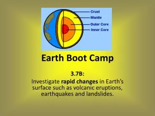
LESSONS LEARNED FROM PAST NOTABLE DISASTERS. THE PHILIPPINES. PART 3: VOLCANIC ERUPTIONS. Walter Hays, Global Alliance for Disaster Reduction, Vienna, Virginia, USA . NATURAL HAZARDS THAT PLACE THE PHILIPPINES’ COMMUNITIES AT RISK. EARTHQUAKES. GOAL: DISASTER RESILIENCE. TYPHOONS. FLOODS.

E N D
LESSONS LEARNED FROM PAST NOTABLE DISASTERS. THE PHILIPPINES.PART 3: VOLCANIC ERUPTIONS Walter Hays, Global Alliance for Disaster Reduction, Vienna, Virginia, USA
NATURAL HAZARDS THAT PLACE THE PHILIPPINES’ COMMUNITIES AT RISK EARTHQUAKES GOAL: DISASTER RESILIENCE TYPHOONS FLOODS ENACT AND IMPLEMENT POLICIES HAVING HIGH BENEFIT/COST FOR COMMUNITY RESILIENCE LANDSLIDES VOLCANIC ERUPTIONS GLOBAL CLIMATE CHANGE
VOLCANO HAZARDS • BLDG. INVENTORY • VULNERABILITY • LOCATION • PREPAREDNESS • PROTECTION • EARLY WARNING • EMERGENCY RESPONSE • RECOVERY and • RECONSTRUCTION VOLCANO RISK POLICY OPTIONS ACCEPTABLE RISK RISK UNACCEPTABLE RISK GOAL: EARTHQUAKE DISASTER RESILIENCE PHILIPPINES’ COMMUNITIES DATA BASES AND INFORMATION HAZARDS: GROUND SHAKING GROUND FAILURE SURFACE FAULTING TECTONIC DEFORMATION TSUNAMI RUN UP AFTERSHOCKS
THE KEYS TO RESILIENCE: 1) KNOW THE ERUPTIVE HISTORY OF YOUR REGION’S VOLCANOES,2) BE PREPARED3) HAVE A WARNING SYSTEM 4) EVACUATE5) LEARN FROM THE EXPERIENCE AND START OVER
CAUSES OF RISK LATERAL BLAST PYROCLASTIC FLOWS FLYING DEBRIS VOLCANIC ASH VOLCANIC ERUPTIONS LAVA FLOWS CASE HISTORIES LAHARS TOXIC GASES
VOLCANOES VOLCANOES HAVE ERUPTED VIOLENTLY IN THE PHILIPPINES AS A RESULT OF COMPLEX INTERACTIONS OF THE PHILIPPINE AND EURASIAN PLATES
LUZON VOLCANIC ARC Chain of subduction volcanoes on the west side of the Philippine island of Luzon, including Mount Pinatubo red triangles = volcanoes active in the last 10,000 years
Major Volcanoes in the Philippines http://vulcan.wr.usgs.gov/Volcanoes/Philippines/Maps/map_philippines_volcanoes.html
MOUNT PINATUBO FACTS • Pinatubo is a stratovolcano, a volcano comprised of layers of lava flows and pyroclastic material that gradually accumulated over time. http://volcano.und.nodak.edu/vwdocs/volc_images/southeast_asia/philippines/pinatubo.html
ANCIENT MOUNT PINATUBO • Ancestral Pinatubo was an andesite and dacite stratovolcano whose center was in roughly the same location as the modern Pinatubo. http://volcano.und.nodak.edu/vwdocs/volc_images/southeast_asia/philippines/pinatubo.html
MOUNT PINATUBO FACTS • Before April 2, 1991, volcanologists considered Mount Pinatubo to be an inconspicuous, currently inactive volcano that had once been active a millennium ago. http://volcano.und.nodak.edu/vwdocs/volc_images/southeast_asia/philippines/pinatubo.html
ERUPTION HISTORY • The largest prior eruption in the history of the modern Pinatubo occurred over 35,000 years ago. • That eruption distributed over 325 ft (100 m) of pyroclastic flow material on all sides of the volcano, signaling the geologic rebirth of the volcano. http://volcano.und.nodak.edu/vwdocs/volc_images/southeast_asia/philippines/pinatubo.html
ERUPTION HISTORY • Radiocarbon ages suggest that eruptions from the modern Pinatubo have been clustered in at least six and possibly as many as a dozen eruption episodes. . http://volcano.und.nodak.edu/vwdocs/volc_images/southeast_asia/philippines/pinatubo.html
MOUNT PINATUBO FACTS • Many people residing in the area, including those in nearby military bases, barely knew of Mount Pinatubo at allm a factor that hindered evacuation. http://volcano.und.nodak.edu/vwdocs/volc_images/southeast_asia/philippines/pinatubo.html
VOLCANO HAZARDS CAN HAVE FAR REACHING IMPACTS • VERTICAL PLUME (can affect jet aircraft) • ASH AND TEPHRA • LATERAL BLAST • PYROCLASTIC CLOUDS, BURSTS, AND FLOWS
VOLCANO HAZARDS CAN HAVE FAR REACHING IMPACTS • LAVA FLOWS • LAHARS (can bury villages) • EARTHQUAKES (related to movement of lava) • “VOLCANIC WINTER” (causing famine and mass extinctions)
THE PHILIPPINES’ MOST NOTABLE VOLCANIC ERUPTION MOUNT PINATUBO JUNE 7, 1991
TIME LINE 1 • On July 16, 1990, a 7.8 magnitude earthquake hit central Luzon. Its epicenter was 100 km NE of Mt. Pinatubo • On March 15, 1991, a series of earthquakes took place on the NW side of Mt. Pinatubo
TIME LINE 2 • The earthquakes continued to increase in intensity for 2 weeks • On April 2, 1991, small eruptions began. Hundreds of small earthquakes were recorded every day.
TIME LINE 3 • SO2 emission increased from 500 tons/day on May 13 to 5,000 tons/day on May 28 • The first magmatic eruptions occurred on June 3
TIME LINE 4 • The first explosion on June 7 generated a column of ash 7 km high • The Philippine Institute of Volcanology and Seismology (PHIVOLCS) issued a warning predicting an eruption within 2 weeks
The Eruption ofMount Pinatubo June 15, 1991 Luzon, Philippines
SNAPSHOTS IN TIME BEFORE, DURING, AND AFTER THE HISTORIC ERUPTION
MOUNT PINATUBO FACTS • Pinatubo had an elevation of 5725 ft (1745 m) above sea level before the June 1991 eruption, and an elevation of 5248 ft (1600 m) above sea level after the June 1991 eruption. http://volcano.und.nodak.edu/vwdocs/volc_images/southeast_asia/philippines/pinatubo.html
EARLY WARNINGS WERE SUCCESSFUL • Warnings issued by PVO (Pinatubo Volcano Observatory) before the eruption succeeded in saving many lives and protecting property. • Warning issued by Civil Defense and local officials saved lives. • Warnings issued by PHILVOCS and USGS led to total evacuation of Clark Air force Base (including aircraft).
EVACUATION • PHIVOLCS and USGSdeveloped three evacuation zones
EVACUATION • The 10 km and 10-20 km zones contained 40,000 people • The 20-40 km zone contained 331,000 people • A volcanic alert system was developed, with daily updates
EVACUATION • Evacuation began: • 10 km zone on April 7 • 10-20 km zone on June 7 • 20-40 km zone on June 14
The Climactic Eruption • Large tremors began at 13:42 on June 15 • By 14:30 all seismographs were inoperative • The most violent phase lasted 3 hours and generated a 34 km high eruption column • The ash cloud covered 50,000 sq. miles
EVACUATION HAPPENED BEFORE DAY TURNED TO NIGHT • : • Wednesday, 8:15 AM June 12, 1991
The Climactic Eruption • Typhoon Yunga hit Lazon on the same day, obscuring direct view • The eruption ended 9 hours later at 22:30
VIEW OF PINATUBO AFTER THE ERUPTION Mount Pinatubo, as seen from Clark Air Base runway
AFTER THE ERUPTION O’Donnell River
AFTER THE ERUPTION A house by the Sacobia-Bamban River, Bamban, Tarlac, July 23, 1991. Nearly 9 m of sediment were deposited during a single lahar event on August 15, 1991 A house by the Sacobia-Bamban River, Bamban, Tarlac, July 23, 1991.
AFTER THE ERUPTION Sacobia Bamban River
The Climactic Eruption • This was the second largesteruption on Earth in the 20th century; Volcanic Explosivity Index of 6 • Expelled: 10 billion tons of magma and 20 billion tons of sulfur dioxide (SO2)
LOCAL IMPACTS • In the first three months after the enormous eruption, >200 lahars occurred • About 300 people were killed, mostly by roofs collapsing under wet ash • 364 communities and 2.1 million people were impacted School buried by lahar, Church buried by lahar
LOCAL IMPACTS • >8,000 homes completely destroyed • Pyroclastic flows filled river valleys with hot volcanic rocks, which killed vegetation and rendered land infertile • The GDP fell by 3% in 1991 • Every rainy season, lahars return School buried by lahar Church buried by lahar
GLOBAL IMPACTS • This was the largest injection of aerosols into the stratosphere ever recorded by modern instruments SAGE II observations show that aerosols in the tropics increased by almost a factor of 100 immediately following the eruption, spread to the Earth’s mid-latitudes three months later, and slowly decreased over several years.
GLOBAL IMPACTS • Aerosols formed a stratospheric cloud which reduced sunlight reaching the Earth’s surface by up to 5% for 3 years • Northern hemisphere average temperatures decreased by 0.5-0.6 °C SAGE II observations show that aerosols in the tropics increased by almost a factor of 100 immediately following the eruption, spread to the Earth’s mid-latitudes three months later, and slowly decreased over several years.
SUMMARY • The evacuation effort organized by PHIVOLCS and USGS saved tens of thousands of lives • This was a great success for volcanology and the prediction of volcanic eruptions • The indigeneous Aeta people were hardest hit; many were relocated permanently • Mt. Pinatubo is now a popular eco-tourism destination Mt. Pinatubo, 2013