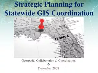
Statewide GIS Tax Units Database
220 likes | 376 Views
Statewide GIS Tax Units Database. A collaborative partnership between the State of Kansas Department of Revenue – Property Valuation Division, the Kansas GIS Policy Board’s Data Access & Support Center (DASC), and Kansas County Clerks. Data Access & Support Center – Quick Overview.

Statewide GIS Tax Units Database
E N D
Presentation Transcript
Statewide GIS Tax Units Database A collaborative partnership between the State of Kansas Department of Revenue – Property Valuation Division, the Kansas GIS Policy Board’s Data Access & Support Center (DASC), and Kansas County Clerks
Data Access & Support Center – Quick Overview • Established by the GIS Policy Board in 1991 • Located at the Kansas Geological Survey at the University of Kansas, funded through Kansas Division of Information Systems and Communications (DISC) • Web site – http://www.kansasgis.org • Central repository of GIS databases of statewide/regional importance • Receive, QA/QC, archive, and catalog public GIS data • Web Application & Hosting • State & Local Government coordination • Data Integration • Much more ….
Tax Unit Certification Review • WE DID IT !!! • Now that we have completed a Certification cycle – how did we do? • All 105 counties submitted a Certification through PVD, then DASC • Clerks now familiar with DASC web interface • No more paper maps mailed to PVD • Saving staff time, postage and paper
Tax Unit Certification Review After submitting Certification to PVD next step is to complete Certification of tax unit boundaries on DASC website Access the following web link: http://www.kansasgis.org/services/pvd/index.cfm Complete the fields of contact information Review your tax unit boundaries using the interactive map Choose if your county has changes or no changes Submit!
Tax Unit Certification Review • If your county has no changes … • You are done! • If your county has changes you have 3 choices … • Please have DASC send us a paper map for editing • We have our own paper maps and will mail a map with our edits to DASC. • We have changes and will submit our tax units through a GIS file.
Certify vs. Verify Certification All tax unit changes must be Certified! Each county will have at least one certification annually - changes or no changes; if your county has multiple changes throughout the year, then each submission must be a new Certification. Verification Must be done ONLY if your tax unit boundary certification included changes, the verification is done after we have edited the GIS file to ensure the boundaries are correct. Your opportunity to double check our work! Each new Certification will result in another verification. No changes = no verification.
Post-Certification & Verification Statewide GIS file available on DASC website around March 1
Next Steps … • Feedback – • Any comments/ideas for DASC web site Certification/Verification process? • How about non-GIS county needs? • GIS data available for download but no maps • Do non-GIS counties need plot size ( 36” x 24”) PDF file available for download? Or do you need KDOR/DASC to print county size plot for you and mail it to you?
Utilities, customers, etc. • DASC gave a presentation about the Kansas Tax Units GIS Boundary project to the Kansas Association of Tax Representatives (KATR) in April, 2011 • Several utility companies in attendance • Good feedback – all anxious to use GIS file • Added 2 fields to GIS file based on feedback – changes/no changes & Certification Date • Clerks – how has this effected your tax unit inquiries?
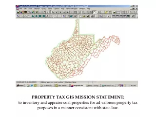
GIS example – select all tax units that intersect 1 m buffer
GIS example – List of counties & tax units intersected by 1 m pipeline buffer
Contact Information Eileen Battles GIS Analyst/Local Government Liaison 785-864-2289 battles@kgs.ku.edu Brent Miller GIS Specialist/Geodatabase Manager 785-864-2130 bmiller@kgs.ku.edu