Download
1 / 47
470 likes | 666 Views
Integration of Locator and GPS Technology. MAP AFRICA CONFERENCE CAPE TOWN October 29,2007 Ashok Wadwani AFDS, Houston, TX. Why do utilities need accurate records of their assets. Call before you dig Locate buried assets quickly especially in emergencies. Utility Marking.

E N D
Integration of Locator and GPS Technology MAP AFRICA CONFERENCE CAPE TOWN October 29,2007 Ashok Wadwani AFDS, Houston, TX
Why do utilities need accurate records of their assets • Call before you dig • Locate buried assets quickly especially in emergencies
Utility Marking • Why is there a need to mark utilities? • Minimize crew response time • Ease of location - both during daytime and nighttime, flooded streets, resurfaced streets etc. • Identify the type of utility (Water, Sewer, Electric, Gas, etc.) • Know where all utilities are located prior to digging
Fire Hydrant Not all fire hydrants are easily visible from roadway
Ease of Location • Utility problems happen around the clock, both in daytime and nighttime • The quicker the crew can locate the utility, the faster their work can begin • Unstopping sanitary sewers • Establishing a bypass pumping operation to pump around a failure • Reduces the potential for property damage • Isolating a section of water main for repair • Supports water conservation programs • Fighting a fire (may assist the water supply officer)
Minimize Response Time • Utility repair or service crews are generally responding because something is not working • Sewer stoppage • Water main break • Manholes or water valves need to be located quickly to gain control and address the problem at hand • Fire departments need to be able to easily identify fire hydrant locations
Identify the type of utility Water & Fire Sanitary Sewer
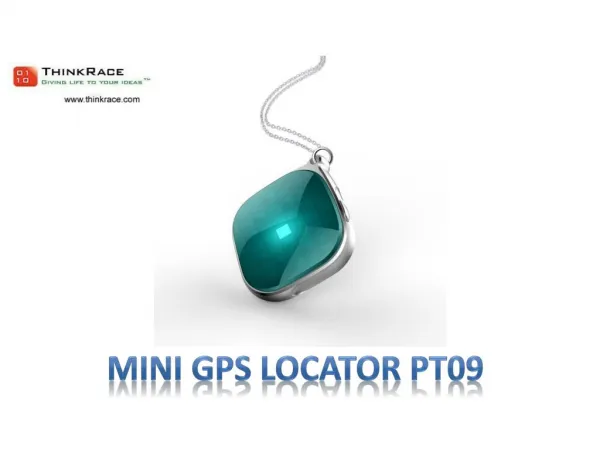
What assets need to be marked • Valves • Buried Splices • Buried pipelines • Service Tees • Fiber Optic path • Service drops
Electronic Locators/Markers • Established technology • Available for several years to locate underground and above ground assets • Used by various public works departments • Not a good solution unless operators are familiar with the overall areas • Do not provide any position data
Electronic locators/markers • Flattened disks 5-10 inch diameter • Color coded with APWA STANDARDS • Made out of HDPP OR HDPE • Include precisely tuned antenna. • Depth range up to10 ft. For deeper depths multiple markers can be used. • Buried next to buried asset
LOCATOR Single or multi frequency units. Battery operated Weight about 5 lbs
Electronic Markers • Typically operators take a locator and use it to find buried asset. • Very difficult if you don’t know the general area-or a new emergency crew shows up.
Integrate locator with GPS Better solution • Now with availability of economical GPS units you can achieve better results with 2 combined technologies.
GPS • Now very popular tool for mapping and locating assets. • Just about all municipalities use GPS in conjunction with GIS • New low cost and easy to use hand held GPS units are now available with better accuracy.
GPS Accuracy • 10-15 meter autonomous $100.00-$400.00 plus data collector and software • 2-5 meter (real time WAAS) $400.00-$700.00 plus data collector and software • Both the above units are economical, easy to use units but no data collection capability unless used with data collector and software. • Sub Meter (real time or post processing) $4000.00-$10,000.00 • Ideal for GIS mapping application. • Relatively easy to use • Decimeter (real time or post processing) $8000.00-$12,000.00 • Centimeter (post processing) over 30,000.00
GPS Accuracy Cont’d • Sub Meter (real time or post processing) $4000.00-$10,000.00 • Ideal for GIS mapping application. • Relatively easy to use • Decimeter (real time or post processing) $8000.00-$12,000.00 • Centimeter (post processing) over 30,000.00
GPS Accuracy Cont’d • Expensive units, difficult to learn, Heavy • High accuracy not required for mapping applications unless elevation is a issue
Starting an in-house program • Identify the asset to be to be located and marked. (Water, Sewer, Gas etc.) • Conduct physical inspection, collect attribute data, determine GPS position or use existing GIS information ( This creates a data base or validates existing GIS information) • Install under ground markers or above ground markers with or without on board memory.
Implementation Cont’d • When repair is requested or post disaster work is required, drawings and other data is generated from GIS. • Repair crew collects paper drawings or drawings are sent to hand held PDA. • With the help of low cost GPS , repair crew navigates to the site within 20-30 ft.(or better with WAAS)
Implementation Cont’d • Use electronic locator to locate underground asset within a inch or so. • Do necessary repairs and update information on Hand held PDA, drawings and get it to GIS dept for updates and further action.
What type of data? • Water • Hydrant and Valve locations with GPS coordinates • Physical address • Depth and size of carrier pipe • Valve type • Butterfly • Gate • Valve Rotation (Right or Left) • Number of turns
What type of data? Manholes • Manhole number and GPS coordinates • Manhole number for the Upstream and Downstream Manholes and the GPS coordinates for each respective manhole • Depth of manhole • Number and size of sewer entering and leaving the manhole • Physical street address
Benefits of Integration • Instead of wasting time to locate assets, low cost GPS allows you to get to within 20-30 ft quickly and then using locator, the buried assets are located much faster. • Data re the repair maintenance work is on the PC for updating your main data base or in case of memory markers, its on site for future review also.
Electronic Memory Markers • Relatively new to the market. • Used above ground • Have read and write memory • Allows you to leave all necessary data on the asset at site. This data can be accessed and new data can be posted on site and left on site.
Manholes Current Method Of Marking Manhole number painted on curb with arrow pointing to location.
Painted Manhole • Used to aid in the location of manholes • Paint has a limited life • Hard to see painted manhole at nighttime
Currently This Is The Most Common Method Of Marking Water Valves In time, this mark will fade away and will have to be remarked
Numbered Fire Hydrant This is a unique number ideal for a database.
In Search of “A Better Marking System” • Can a marking system be developed that last longer than paint? • Can a marker stay affixed to the spot originally marked? • Not be subject to easy removal such as the commonly used locator flags • Can a marker be made smart? • Can a marker assist a repair or construction crew to take caution in these areas when excavating? • Can a marker aid in locating and identifying the utility type?
What Is a Data-Flekt ™ Utility Marker • Retroreflective pavement marker • Contains either a 16 K or 64 K EPROM which utilizes one wire technology • Data can be stored: • In the marker or • In the marker and in conjunction with a database • Marker can be interrogated using a field reader and a laptop or a handheld device
Data-Flekt™A Smart Utility Marker Available in APWA’s Uniform Utility Code Colors
Data-Flekt Construction • Constructed of high strength ABS plastic • Reflective lenses are ultrasonically welded in place • External contacts are of non-corrosive stainless steel • The shell is completely filled with an inert thermosetting compound
Data-Flekt Color Makes it Easily Identifiable in Daylight
Data-Flekt Reflector Improves Visibility at Night
Data-FlektReading the Marker in the Field Getting Ready to Place the Field Reader on the Data-FlektMarker Interrogating the Data-FlektMarker
Data-FlektUtility Markers Can Provide Onsite Warnings for Other Utilities in the Area
Typical Installation . DATA FLEKT™ Reflective smart utility marker
Contact Information • Ashok Wadwani • APPLIED FIELD DATA SYSTEMS INC • HOUSTON, TX 77094 • 281 579 0492 • email afdsaw@aol.com