Download
1 / 1
10 likes | 92 Views
Explore the past, present, and future initiatives of collaborative weather efforts in the Saint John River Basin by WFO Caribou, NERFC, and partners, including shared forecasts, snow-water equivalent measuring, and joint research projects. Discover how improving technologies and ongoing research continue to shape lifesaving warnings in the region.

E N D
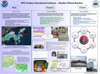
WFO Caribou International Initiatives – Weather Without Borders Future Past Present • Present Initiatives • Recent collaborations between WFO Caribou, NERFC, and the New Brunswick RFC resulted in accurate lifesaving warnings during the flood of record on the Saint John River. Present initiatives include: • Shared River forecasts – NERFC & New Brunswick RFC • Saint John river headwaters mesonet improvements including 2 • sites paid for by New Brunswick Dept. of Environment • Joint River Ice Jam Wave Research with Environment Canada • International Snow-Water equivalent measuring • Severe Weather Coordination and shared radar data • International NWS Chat • NERFC Probabilistic ensemble QPF Forecast • Future Initiatives • Through advancements in technologies and research we continue to look for opportunities to work together on new initiatives. Some that have already been identified include: • Inundation mapping • Bilingual weather coder – French & English • With help from NERFC – Canadian implementation • of NWS CHIPS • Forecaster exchanges between WFO Caribou and the Atlantic • Forecast Center in Halifax, Nova Scotia • Possible collaboration on a St John Valley summer severe • weather study • Past Initiatives • WFO Caribou came into existence in 1999, since then it has had many interactions with our Canadian partners. Three provinces surround the Caribou County Warning Area: Quebec, New Brunswick, and Nova Scotia. The Saint John River is the International border between the US and Canada along much of the Northern Main border. Past WFO Caribou initiatives include: • Lead US office participating in annual Saint John River Basin • Hydrology Committee Meeting – WMO sanctioned • Joint WFO CAR-ERH-Environment Canada collaboration on US- • Canadian Radar Mosaic • Hosting and attending joint workshops • Sharing of data for research e.g. severe weather climatology Our Partners Weather input are provided by Environment Canada, US National Weather Service, Quebec Environment • Aroostook County Emergency Manager requested the presents of WFO Caribou • Hydrologist, WCM, & MIC at the EOC to brief Maine’s Governor Baldacci. • Based on information from NERFC & the New Brunswick RFC, the WFO Caribou • team conveyed to the Governor the high confidence of a record flood and the • potential impacts. • Emergency management informed the Governor that there were approximately • 50 people in homes near the river that refused to evacuate. • Based on the information provided, the Governor ordered mandatory • evacuations. Many of the homes of those that refused to evacuate were • ultimately flooded. Joint US-Canadian Radar Mosaic result of Environment Canada – ERH - WFO Caribou collaboration Saint John River Basin The basin of the Saint John River is one of the largest in eastern North America. About 51% of the 21,300 square mile drainage area is in the Province of New Brunswick, 13% in the Province of Quebec and 36% in the State of Maine. It flows from its source in the Saint John Pond, Maine, about 435 miles to the Bay of Fundy at the city of Saint John, New Brunswick. Shared River Gage Locations & Data Fort Kent Gage is in Canadian waters but maintained by USGS In 1972 the WMO Commission for Hydrology recommended that pilot studies be started for international basins. In 1974, Canada & the United States selected the Saint John River Basin for the pilot study. The Saint John River Basin Hydrology Committee met for the first time in 1975. River Ice Jam Wave Research Atlantic Forecast Office - Halifax Shared Radar Data & Severe Weather Coordination WFO Caribou US-Canadian Snow Water Equivalent sites By Hendricus Lulofs – MIC WFO Caribou, Maine E-mail: hendricus.lulofs@noaa.gov