Download
1 / 24
240 likes | 328 Views
This GIS analysis identifies potential study locations in the Cedar River Municipal Watershed, focusing on forest density and structure effects on snow accumulation. Results and conclusions are detailed, with new site recommendations.

E N D
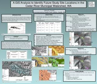
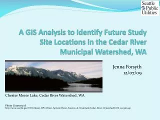
A GIS Analysis to Identify Future Study Site Locations in the Cedar River Municipal Watershed, WA Jenna Forsyth 12/07/09 Chester Morse Lake, Cedar River Watershed, WA Photo Courtesy of http://www.seattle.gov/UTIL/About_SPU/Water_System/Water_Sources_&_Treatment/Cedar_River_Watershed/COS_002326.asp
Outline • Introduction • Objectives • Analysis • Results • Conclusions • Questions?
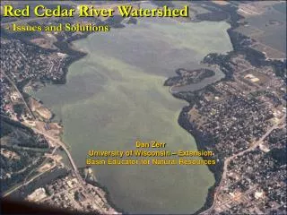
Introduction The Cedar River Watershed • Owned and operated by Seattle Public Utilities • Provides fresh water for the ~ 1.45 million residents of Seattle • Area: 3,946,330,736.44 sq. feet • Located approximately 34 miles east of Seattle, off Interstate-90
Introduction Where is the Cedar River Watershed?
Introduction What is the Scientific study in the Cedar River Watershed? • Scientific question: What is the effect of forest density and structure on snow accumulation in the watershed? • Forest density relates to canopy density • Forest structure relates to forest stand age and type (coniferous vs. deciduous)
Introduction What is the Scientific study in the Cedar River Watershed? Continued… • Scientific question: What is the effect of forest density and structure on snow accumulation in the watershed? • Snow accumulation in forested areas such as the Cedar River Watershed, largely depends on how much snow is intercepted or “stuck” in the trees.
Introduction What is the Scientific study in the Cedar River Watershed? Continued… (a) Turbulence within the forest canopy causes variability in how snow is deposited. (b) Snow intercepted in the canopy sublimates, or falls to the ground. (c) Interception between different species of conifers is not significant, but (d) Interceptionin conifers is significantly greater than interception by deciduous trees. (e) Because of interception, 20-45% more snow accumulates in clear-cut areas or clearings. (Graphics from Mark Williams, CU Boulder)
Introduction What and where are the current study sites? • Three coniferous forest sites of ~ 50x50meter plots
Introduction What are the forest and topographical characteristics of the sites?
Objectives What are the objectives of the current GIS analysis? • Locate 3 potential sites to be pairs for the current sites: • Similar forest and topographical characteristics • Elevation • Slope • Aspect • Canopy Density • Forest Age • Easily accessible (within 100 feet, but no more than 1,000 feet from the nearest road) • Not overlapping with lakes, streams, or pre-existing study sites or meteorological stations
Analysis How was this accomplished? • Elevation • Reclassified to include only elevations of interest, then new layers with only those elevations for each site
Analysis How was this accomplished? • Slope • First calculated slope ranges from elevation • Second, analyzed similar to elevation technique, reclassified and created a new layer: slope range equal for all sites
Analysis How was this accomplished? • Aspect
Analysis How was this accomplished? • Canopy Density
Analysis How was this accomplished? • Forest Age
Analysis How was this accomplished? • Buffer within a buffer • New site>100 feet from road but <1,000feet
Results and Conclusions New potential sites? • Intersected above layers • New Site 1 Potential Area: 5,368,861 sq. feet • New site 1 • At least 28,632.02 sq. feet in area (5x5 cells) • 1,854 feet from previous site (skiing) • 8,158.4 feet from previous site (along the road) • New Site 2 Potential Area: 4,273,018 sq. feet • New site 2 • At least 28,632.02 sq. feet in area (5x5 cells) • 7,532.67 feet from previous site (skiing) • 8,035.22 feet from previous site (along the road) • New Site 3 Potential Area: 1,458,128 sq. feet • New site 3 • Not possible due to overlap with current site area
Results and Conclusions Site 3 Not Possible
Results and Conclusions Site 3: Re-calculating Potential New Site Area • Tried with new parameter ranges for elevation, slope, and aspect:
Results and Conclusions Site 3: Success! • New Site 3 Potential Area: 7,528,051.11 sq. feet • New site 3 • At least 28,632.02 sq. feet in area (5x5 cells) • 6,433.21 feet from previous site (skiing) • 14,415.37 feet from previous site (along the road)
Results and Conclusions Site 3: Success!
Questions? Questions? New Site 2 New Site 1 New Site 3 N