Understanding Earth's Geometric Shape: From Ancient Greeks to Modern Map Projections
Explore the evolution of our understanding of Earth's shape, starting from ancient Greek geometric theories to modern scientific calculations. Discover how figures like Eratosthenes and Posidonius contributed to defining Earth's dimensions and shape. Learn about the distinction between perfect spheres and the Earth's actual shape as an oblate ellipsoid. This guide discusses various map projections, their uses, and the inevitable distortions in representing a three-dimensional globe on a two-dimensional plane, including Mercator and Robinson projections.

Understanding Earth's Geometric Shape: From Ancient Greeks to Modern Map Projections
E N D
Presentation Transcript
The Earth’s Shape • The ancient Greeks liked geometric shapes and the mathematical harmony of nature. This preference probably influenced their speculations about the shape of the earth. • Using a circle's diameter as an axis and rotating the circle 360 degrees creates a perfect sphere. All locations on the sphere's surface are exactly the same distance from its center.
The Size of the Earth • With the circumnavigation of the globe and subsequent scientific calculations, the circumference of the earth would soon return to Eratosthenes' and Posidonius' calculations. After countless millennia, scientists, explorers, clergy, and laymen finally knew the "true shape" and "true size" of the earth. Of course, this geographic euphoria wouldn't last.
An Ellipsoid Earth • The earth is not a perfect sphere but an oblate ellipsoid. If it rotated about its major (longer) axis, it would be described as a prolate ellipsoid.
Measuring Ellipsoids • When you examine the parameters for any ellipsoid used to describe the earth, its semi-major and semi-minor axes are given.
An Spheroid Earth • A spheroid is simply an ellipsoid that approximates a sphere. These examples are two common world spheroids used today with their values rounded to the nearest meter. For each spheroid, the difference between its major axis and its minor axis is less than 0.34 percent.
Differentiating Speroids • Spheroids created using satellite information, such as GRS80, are starting to replace traditional ground-measured spheroids, such as Clarke 1866. In this example, measurements for both spheroids have been rounded to the nearest meter.
When to use a sphere • While difference between the semi-major and semi-minor axes must be considered in regional applications, for most world maps the difference can be ignored and the world can be treated as a sphere. In fact, the difference is so small that for this graphic it would be undetectable.
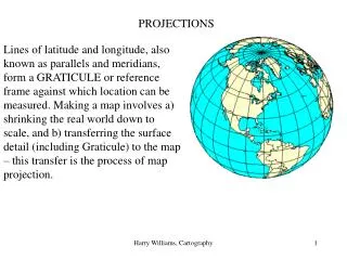
Establishing locations • Latitude and longitude is an angular measurement system. All features on the earth's surface are located using measurements that are relative to the center of the earth. Latitude lines are parallel to each other while longitude lines converge at the poles.
Locating features from North to South • Because latitude lines are parallel, every degree of latitude is theoretically equal. Since the earth is not a prefect sphere, however, the degrees vary slightly (110.572 kilometers or 68.708 miles at the equator and 111.69 kilometers or 69.403 miles at the poles).
Locating features from east to west • The distance for a degree of longitude varies. A degree of longitude at the equator is 111.317 kilometers or 69.171 miles, and gradually decreases toward the poles, which have a value of zero.
Birth of the map projection • From spheroid/sphere to paper • Details • Accuracy • Projection
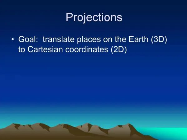
Map projection • Cartographers use the term map projection to describe the process of converting coordinates from a three-dimensional spherical coordinate system to a two-dimensional planar coordinate system.
Early map projections • This is an example of a modern plate carrée map projection that maintains true scale only along the equator. • This is a modern example of an equidistant map projection. The squares of the plate carrée have been replaced by rectangles.
Map projections and distortion • The Mercator projection maintains shape and direction. • The Sinusoidal and Equal-Area Cylindrical projections both maintain area, but look quite different from each other. • The Robinson projection does not enforce any specific properties but is widely used because it makes the earth’s surface and its features "look right."
Distortions • Shape • Area • Distance • Direction
Cylindrical projection • You cut the cylinder along any meridian and unroll it to produce your base map. The meridian opposite the cut is called the central meridian (the red line).
Cylindrical projection • The light source's origin for the map projection is also the origin of the spherical coordinate system, so simply extending the degree lines until they reach the cylinder creates the map projection. • The poles cannot be displayed on the map projection because the projected 90 degree latitude will never contact the cylinder.
Conic projection • The Simple Conic projection is also called the Equidistant Conic projection.
Planar projection • When the plane touches the earth at either the north or south poles latitude lines appear as concentric circles and longitude lines radiate from the pole at their true angle like the spokes on a wheel. • This particular map projection's light source originates at the center of the earth but this is not true for all planar map projections.
Mercator projection • The methodology behind the map was probably in use before Gerardus Mercator's time, but it was so obscure that it is believed to have been independently reinvented by Mercator in 1569. Because the Mercator map projection is cylindrical, and a cylinder is open-ended, the projection in theory goes on forever. This example has been "trimmed" before it reached 90 degrees north and south.
Transverse Mercator • Feature distortion increases proportionally as the distance from the central meridian (the red vertical line) increases. For this reason, the Transverse Mercator map projection is applied to regions with a north-south orientation.
Lambert Conformal Conic • In a Lambert Conformal Conic map projection, latitude lines are unequally spaced arcs that are portions of concentric circles. Longitude lines are actually radii of the same circles that define the latitude lines. Poles are represented as single points. Notice the extreme distortion of the features farthest away from North America.
Lambert Conformal Conic 2 • Distortion increases as you move away from the secant lines and the central meridian.
Albers Equal Area Conic • Poles are represented as arcs rather than as single points. Latitude lines are unequally spaced concentric circles, whose spacing decreases toward the poles.
Lambert Azimuthal Equal Area • Here are three examples of the Lambert Azimuthal Equal Area projection. The upper left is an equatorial, the upper right an oblique, and the bottom a polar, aspect.
Exercises • Ex10 – Examine spheroids • Ex11 – Compare map projections