Download
1 / 39
390 likes | 614 Views
LIGHT WEIGHT ROTARY-WING UAV FOR LARGE SCALE MAPPING APPLICATIONS. Norhadija Darwin, Nurul Farhah Abdul Hamid, Wani Sofia Udin, Noor Aniqah Mohd Azhar & Anuar Ahmad Faculty of Geoinformation & Real Estate Universiti Teknologi Malaysia, 81310 Skudai, Johor, MALAYSIA. PRESENTATION OUTLINE.

E N D
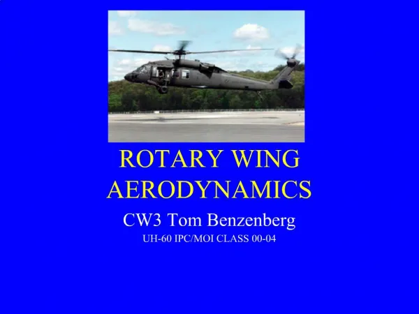
LIGHT WEIGHT ROTARY-WING UAV FOR LARGE SCALE MAPPING APPLICATIONS Norhadija Darwin, Nurul Farhah Abdul Hamid, Wani Sofia Udin, Noor Aniqah Mohd Azhar &Anuar Ahmad Faculty of Geoinformation & Real Estate Universiti Teknologi Malaysia, 81310 Skudai, Johor, MALAYSIA
PRESENTATION OUTLINE • Introduction • Trends UAV in Surveying • Mapping of Environmental Area – Test Field • Methodology • Results and Discussion • Conclusion
INTRODUCTION • The small format aerial photography became popular in 1980’s. However, the cost of map updating remained expansive all the time. • At the same time, unmanned aerial vehicle (UAV) system was introduced due to its low cost and rapid data captured. • UAV system has been reported used for many photogrammetry and non-photogrammetry applications. • Most countries in the world have produced their topographic map using aerial photogrammetry. • Recently, digital photogrammetry has embraced UAV technology known as UAV photogrammetry.
CONTINUED… • UAV system has been used to produce digital map and orthophoto of UTM Johor Bahru (AnuarAhmad, 2011; Anuar Ahmad & Wan Aziz Wan MohdAkib, 2010; Anuar Ahmad, 2009a, 2009b). • In the study carried out, fixed wing UAV was used to acquire digital aerial photograph at low altitude of approximately 300m. The output of the study show that the digital map was produced at large scale and accurate.
CONTINUED… • Therefore, UAV system has expanded data capture opportunities for photogrammetry techniques. Usually, the UAV system uses the concepts of close range photogrammetry (CRP). • In CRP, the photography is acquired where the object-to-camera distance is less than 300m (Cooper and Robson, 1996; Wolf and Dewitt, 2000). • Baoping et al., (2008) stated that numerous UAV have been developed by organization or individual worldwide including a complete set of UAV which uses high quality fibers as material for plane model. The development of this technology is very beneficial for monitoring purpose for limited time and budget.
CONTINUED… Demand of mapping Need for updated map with simpler, faster, less manpower and budget GPS Remote Sensing & Lidar Manned Aircraft Total Station What are the potential use of UAV for environmental area? Suitable or not for mapping purpose using high resolution camera? UAV
CONTINUED… • This paper aims to demonstrate the potential use of unmanned aerial vehicle (UAV) system attached with calibrated high resolution digital camera for environmental survey based on a test field.
TRENDS UAV IN SURVEYING • Unmanned Aerial Vehicle (UAV) system has many advantages in various mapping applications in recent years especially in surveying. • This is apparent in comparison to conventional aerial surveying which offer accurate maps, but very expensive and have limited endurance for only a few hours. The UAV systems could be mounted on either high or low altitude platform (Lin, 2008).
CONTINUED… • Low-altitude systems have advantages in conducting photogrammetric surveys under thecloud, providing different views and tilted images of the surveyed objects, low-cost and easy-to-maintain for engineering applications systems such as topographic either large or small scale mapping. • The development of this technology is very beneficial for monitoring purpose of limited time and budget. It has been reported that UAV has been practiced in many applications such as farming, surveillance, road maintenance, recording and documentation of cultural heritage (Bryson and Sukkarieh, 2009).
CONTINUED… • UAV technology can be utilized in several applications such as modelling of cultural heritage (Pueschel et. al, 2008; Eisenbeiss, 2004; and Eisenbeiss and Zhang, 2006), documentation of archaeological sites (Bendea, 2005), forest-fire monitoring (Zhou, 2005), road navigation (Egbert, 2007), vehicle detection (Kaaniche et. al, 2005), disaster management (Ambrosia, 2003), and mapping urban and suburban areas (Spatalas et. al, 2006). • The UAV systems are also employed in environmental, agricultural, and natural resources monitoring (Zongjian, 2008). • Rango et. al (2006) recommended on using lightweight UAV systems in acquiring high quality geospatial information for resource management agencies, rangeland consultants and private land managers.
CONTINUED… Source: UVS International
TEST FIELD – COASTAL AREA Simulation Model (2.4m x 7.2m) Profile Coastal Zone
Literature Review for preliminary study, Determine Scope, Problem Statement and Objectives PHASE 1 Preliminary Study Perform Aerial Triangulation METHODOLOGY Equipment, Facilities & Simulation Model Flight Planning Acquire Digital Images from Hexacopter UAV PHASE 2 Data Acquisition Uncontrolled mosaic using PTGui software Calibration of compact digital camera Establish of GCPs and CPs using Total Station Interior orientation Exterior orientation PHASE 3 Data Processing
Perform Aerial Triangulation CONTINUED… Orthophoto PHASE 4 Data Analysis Visual Analysis Digital Elevation Model Contour Line Accuracy Assessment Point Analysis PHASE 5 Conclusion Future Work
HIGH RESOLUTION OF CAMERA CALIBRATION • Digital camera calibration is essential to achieve accurate measurement task. • For non-metric digital camera, the internalgeometry camera is not stable, hence, need calibration for the recovery of the parameters of the digital camera. • Camera parameters usually comprised of : • focal length (c), • principal point offset (xp, yp) • radial lens distortion (k1, k2, k3) • tangential lens distortion (p1, p2).
Continued… Laboratory Camera Calibration Eight camera stations Digital images of 3D test plate
Continued… Field Camera Calibration 9 m 9 m
CONTINUED… • This study has been carried out to prove that UAV have the potential for mapping the environmental. • With this technology, many problems could be solved for various applications especially project with limited budget and small area coverage.
CONTINUED… One strips of aerial photograph for simulation of coastal area Direction of flight mission using Hexacopter UAV
CONTINUED… Uncontrolled Mosaic
CONTINUED… • Footprint of Study Area (Simulation Model of Coastal Area)
CONTINUED… • Digital Elevation Model (DEM)
CONTINUED… • Contour Line
CONTINUED… • Orthophoto of Coastal Model
The RMSE of aerial triangulation results is 0.0337m Achievable accuracy is ±0.183m
CONCLUSION • Previously, aerial photogrammetry using manned aircraft has some limitation such as need professional pilot onboard, cannot fly at cloudy day, high cost and large film need to be scanned before it can be processed using photogrammetric software. • This study proves that the light weight rotary-wing UAV was successfully used for capturing the digital aerial images of simulated coastal and archeological models for large scale mapping. • UAV is an autonomous flight without pilot onboard, suitable for cover small area, limited time and budget.
FUTURE WORK • Fixed wing UAV will be used to acquire digital aerial image of real site for coastal area that suffers erosion. It will also be used for real archeological site such as in Lembah Bujang, Kedah or some other archeological sites. • The rotary wing UAV will also be used for the real site wherever possible for acquisition of digital aerial images. HELANG UAV HEXACOPTER UAV
Archaeological Site Coastal Area http://www.bharian.com.my/bharian/articles/Hakis_kikis_lenyap/Article/ http://www.jmm.gov.my/ms/muzium-arkeologi-lembah-bujang#