Download
1 / 27
270 likes | 312 Views
Learn about Indonesia's topographic mapping projects at 1:10,000 and 1:5,000 scales, including specifications, challenges, and accuracy tests using photogrammetry and LIDAR technology.

E N D
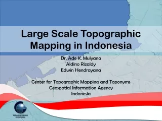
Large Scale Topographic Mapping in Indonesia Dr. Ade K. Mulyana Aldino Rizaldy Edwin Hendrayana Center for Topographic Mapping and Toponyms Geospatial Information Agency Indonesia
Background • Law No.4/2011 on Geospatial Information mandates a.o.: • Transformation from BAKOSURTANAL (National Coordinating Agency for Surveys and Mapping) into BIG (Geospatial Information Agency) • BIG to provide topographic maps as base maps for all thematic maps at small, medium dan large scales • Large scale mapping: 1:10,000 1:5,000 1:2,500 and 1:1,000
Land area of Indonesia: 1.9 million km2 • Prioritization: large scale mapping only for the urban area • At 1:5.000, # sheets for city area (non-district) is more than 15,000. • Capital of provinces • Other cities in need of Detailed Spatial Planning
Large Scale Topographic Mapping Projects • Loan from JICA (Japan) 2011-2014: • 4 cities at 1:10,000 (123 sheets ~2600 km2) • Performed by a Japanese company • Part of NSDI project (1:50K and 1:10K) • National Budget, 2013: • 4 cities at 1:10,000 (131 sheets) • 1 city at 1:5,000 (98 sheets) • Performed by 3 Indonesian companies • National Budget, 2012: • 6 cities at 1:10,000 (131 sheets) • Performed by 2 Indonesian companies
2012 1:10.000
1:10.000 Digital PhotogrammetryProject Specification • Ground Control Point (GCP): • 20 cm planimetric accuracyand 15 cm vertical accuracy • GCP must be signalized • GCP distribution: in the center and in the corner of the block, as well as along the perimeter. • Independent Check Point (ICP) must be distributed for each mapsheet. • Photos: • Ground Sampling Distance (GSD) 20 cm • Overlap/sidelap 60%/30% for flat area, and 70%/40% for mountainous area • Camera must be equipped with GNSS/IMU • Flight plan: Crossflightis mandatory • Aerial Triangulation (AT): • sigma naught of 10 micron and GCP PlanimetricRMSE 1 m; Vertical RMSE 0.5 m • Topographic map compilation: • Stereoplotting is conducted to produce masspoint, spotheght and breakline • DEM building from masspoint, spotheight and breakline • Contour will be generated from DEM • Feature collection threshold is 5 m
1:10.000 LIDARProject Specification • Density of point cloud is ≥ 4 points/m2 • Three return per pulse must be recorded include first return and last return • ≤ 20 cm of vertical RMSE LIDAR • GSD 12 cm for orthoimage • LIDAR system must be included with GNSS/IMU • Filtering or classification must be performed to post-processing LIDAR raw data to create Digital Surface Model (DSM) and Digital Terrain Model (DTM)
2013 1:5.000
1:5.000Project Specification • Ground Control Point (GCP): • 20 cm planimetric accuracyand 15 cm vertical accuracy • GCP must be signalized • GCP distribution: in the center and in the corner of the block, as well as along the perimeter. • Independent Check Point (ICP) must be distributed for each mapsheet. • Photos: • Ground Sampling Distance (GSD) 15 cm • Overlap/sidelap 60%/30% for flat area, and 70%/40% for mountainous area • Camera must be equipped with GNSS/IMU • Flight plan: Crossflight is mandatory • Aerial Triangulation (AT): • sigma naught of 10 micron and GCP PlanimetricRMSE 0.5 m; Vertical RMSE 0.3 m • Topographic map compilation: • Stereoplotting is conducted to produce masspoint, spotheght and breakline • DTM building from masspoint, spotheight and breakline • Contour will be generated from DTM • Feature collection threshold is2.5 m
GCP Measurement Signalized GCP / ICP
Flight Result(Camera Exposure) CROSS LINE CROSS LINE
Accuracy Test (Manado)12 cm GSD LIDAR + Medium Format Camera Leica ALS70 + RCD30 32 ICP’s RMSEx = 0.263 m RMSEy = 0.320 m RMSEz = 0.654 m Horizontal Accuracy 0.717 m Vertical Accuracy 1.283 m
Accuracy Test (Pare Pare)12 cm GSD Medium Format Camera Leica RCD30 15 ICP’s RMSEx = 0.079 m RMSEy = 0.090 m RMSEz = 0.412 m Horizontal Accuracy 0.207 m Vertical Accuracy 0.808 m
Accuracy Test (Medan)25 cm GSD Large Format Camera Vexcel Ultracam-X 18 ICP’s RMSEx = 0.234 m RMSEy = 0.267 m RMSEz = 0.483 m Horizontal Accuracy 0.614 m Vertical Accuracy 0.947 m
Digital Elevation Models of Makassar Source: Digital Aerial Photographs, June 2012 Processing Method: Digital Photogrammetry Purpose: Topographic Mapping at 1:10,000
Challenges • Human resources • Standards and Project Specification • Data Acquisition • Camera and LIDAR equipment availability • Aircraft availability: • Weather (rain and cloud) and terrain condition