Download
1 / 15
150 likes | 268 Views
Learn about the integration of real-time ionospheric data into models for accurate deep space tracking. Explore calibration methods and applications across various technologies.

E N D
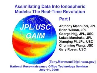
Assimilating Data Into Ionospheric Models: The Real-Time Revolution Part I JPL/USC GAIM Anthony Mannucci, JPL Brian Wilson, JPL George Hajj, JPL, USC Lukas Mandrake, JPL Xiaoqing Pi, JPL, USC Chunming Wang, USC Gary Rosen, USC [Tony.Mannucci@jpl.nasa.gov] National Reconnaissance Office Technology Seminar July 11, 2005
Motivation: Ionospheric Effect on GPS Signals Density Comparison: Troposphere ~1x10⁻³ g/cm3 Ionosphere ~2x10-14 g/cm3 GPS Iono 350 km Tropo 1 km Receiver NRO Technology Seminar July 11, 2005
Ionospheric Delay Versus Frequency Leading term only… 1 TECU = 1016 el/m2 Delay = 40.3 TEC/f2 NRO Technology Seminar July 11, 2005
Raypath Bending • HF communications • Over-the-horizon radar Radio signal path depends on detailed ionospheric vertical and horizontal structure NRO Technology Seminar July 11, 2005
Raypath Bending Versus Frequency Elevation Angle: Approximate Formula Millman and Reinsmith Apparent Elevation Change (Degrees) NRO Technology Seminar July 11, 2005
NASA Application: Deep Space Tracking • Effect of media on tracking observables must be calibrated • How to do it robustly and accurately? S-band 2 GHz X-band 8 GHz NRO Technology Seminar July 11, 2005
Calibrating Media Effects • Remove “average” delay • Climatology (physics or data-based) • Not sufficiently accurate due to “weather” • Self-calibrate • Use dual-frequency tracking observables • Acquire real-time measurements • Most accurate approach • Requires measurements and model that is updated by data NRO Technology Seminar July 11, 2005
Improving Global Delay Estimates Global Ionospheric Map Global GPS Receiver Network Non-data driven (IRI-95) Data driven (GIM) Ionospheric Specification and Determination Workshop, JPL 1998 Iijima et al., Journal of Atmospheric and Solar-Terrestrial Physics, 1999 Low Solar Activity (1998) NRO Technology Seminar July 11, 2005
Low-Earth Orbiter GPS Improving Vertical Profiles Electron Density Profile COSMIC coverage 3000 profiles/day Six-satellite COSMIC constellation Launch late 2005 NRO Technology Seminar July 11, 2005
Latency of Electron Density Profiles COSMIC data latency (courtesy of Chris Rocken, UCAR) NRO Technology Seminar July 11, 2005
USC/JPL Global Assimilative Ionosphere Model (GAIM) NRO Technology Seminar July 11, 2005
Ionospheric and Atmospheric Remote Sensing Group at JPL • Global Ionospheric TEC Mapping (GIM) • First ever global TEC map (1993) • SATLOC wide-area differential GPS (1996) – real-time, regional • FAA wide-area augmentation system 1996-on • Naval Oceanographic Office: ionosphere calibrations for GEOSAT Follow-On mission daily • By-product: provide satellite calibrations (Tgd) to GPS Project • By-product: algorithm adopted by DoD contractors • Ionospheric data systems for R&D • Real-time/near real-time TEC products from GPS global network • GPS TEC sent to Air Force Weather Agency • Model assessment • Ionospheric Network Analysis • Data-Driven Ionospheric Calibration Experiment (DICE) • Model development – Global Assimilative Ionosphere Model • AFOSR/ONR-sponsored MURI 5-year development program • C/NOFS augmentation: C/NOFS data into GAIM NRO Technology Seminar July 11, 2005
C/NOFS Augmentation Effort • AFRL Collaboration (Task manager: Bill Borer) • C/NOFS satellite: Goal is forecast of scintillation • Investigating use of GAIM for background density field • Critical for accurate forecasts • Input C/NOFS Datatypes: • GPS occultation • In situ density • Vector Electric fields, vertical drift velocity • Tri-band beacon (ground-LEO TEC links) • Close collaboration • Source code transfer • Jointly-conducted analysis • Technology transfer (source code, expertise, data sets…) NRO Technology Seminar July 11, 2005
Applications of Data-Based Ionospheric Calibrations • Deep-space tracking • Space environment • Scientific Research • Regional-scale calibration • Global-scale calibration Requirements Driver Products/Obs Applications Accurate deep-space navigation • Line-of-sight slant delay • Regional TEC maps • Error bounds Civil-aircraft navigation/landing Ocean topography Satellite instruments • Global TEC maps • Tracking and sensor corrections • GPS ground and space, in-situ, TEC beacons, sondes, UV GAIM Communications, Navigation, Radar, Surveillance New measurements NRO Technology Seminar July 11, 2005
Navy AFOSR/ONR DoD DoD DoD NOAA JPL Products and Users Products Global Ionosphere Maps (Vertical TEC or Delay) Algorithms FAA Studies Near Real-time Total Electron Content Electron Density Profiles Global Assimilative Ionosphere Model NRO Technology Seminar July 11, 2005