Download
1 / 19
200 likes | 355 Views
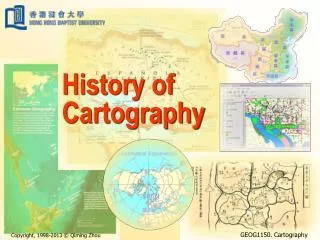
Geography 59 A Brief History of Cartography and Present-Day Identity Problems June 14, 2007. Very Early Maps . 2 nd century AD Early beginnings of understanding the Earth's place in the universe (Western hemisphere understanding). Slightly Later. Common Theme. Common Theme?.

E N D
Geography 59 A Brief History of Cartography and Present-Day Identity Problems June 14, 2007
Very Early Maps 2nd century AD Early beginnings of understanding the Earth's place in the universe (Western hemisphere understanding)
'Colonial' Cartography Many of the 'traditions' followed today in map layout began during the 'colonial' conquest of the world, beginning in the 1500's (Spain), continuing until the 1900's (England, France)
Transition #1: World Wars World Wars..US becomes more involved 1938 – Single Cartography Text by E. Raisz Considered to be a multidisciplinary field However, tended to be limited to drafting and drawing of landforms and features (WM Davis and geomorpohology, land use maps) Why might there have been a transition??
Driving forces for development Radar Aircraft Advances/Aerial imagery Grid systems (gun precision) May others...
Cartography – 1940's to 1950's Universities paved the way for new programs in cartography (alongside geography), journals began to publish cartographic ideas Many qualified GI's entering university Jobs in municipalities, public utilities, planning Advent of thematic mapping Development in other countries/data management (World Bank, 1945)
Cartography – 1960's to 1970's 'Cartographer' is a real job title Remains a technical art form (pens, pencils, advanced knowledge of printing) Major university programs to the doctoral level University of Kansas, Lawrence ** University of Wisconsin, Madison, WI Clark University, Worcester, MA
Cartography – 1970's to present What was the really big development? How might this have affected 'cartographers' ? Are we still seeing the effects today?
Computing and Cartography The improvement of database technology and graphics led the way for UI-based GIS (GIS did go through a command-line phase) More imagery via air and satellite meant more multiple-source imagery How might this have affected cartography?
Big Trends Google Earth – KML standard KML is a file format used to display 'geographic data' in 'Earth Browsers' A profit-driven company Leading the way in their own 'standard' Open Geospatial Consortium (OGC) Standards for geospatial location-based services A consortium of 339 organizations working together to provide specifications for various geospatial products including web applications (map servers)
?? Identity Crisis??What is cartography now ?? Art – neatness, layout, color, aesthetics Science – environment, other phenomena Technology – the Web, laptops, GPS' Dynamic – the Web, databases, mobile devices Interactive – user population highly varied .....Maybe all these things... A new term: 'geovisualization'
Important new aspects Usability A field of specialization on its own Merging of language, communication and cognition Technology Rapidly changing technologies No longer limited to geographic specialists, but includes many experts: technologists, usability experts, programmers, and graphic artists
Back to Earth Exciting new aspects, yes, but you still may need to develop a map in the workplace, perhaps after a long GIS project... Where does it fit?
Group Discussion Handout – scenario in the workplace Where does cartography fit in? Open-ended questions, not meant for right or wrong, but to generate some thought about possible situations Spend 15 minutes discussing, then share ideas
Group Discussion Where does cartography fit