Download
1 / 13
130 likes | 243 Views
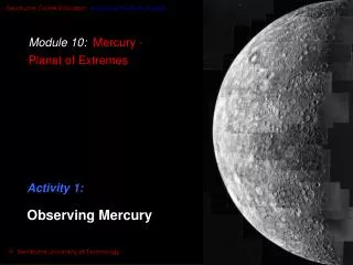
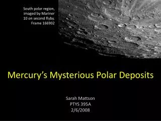
South polar region, imaged by Mariner 10 on second flyby. Frame 166902. Mercury’s Mysterious Polar Deposits. Sarah Mattson PTYS 395A 2/6/2008. Introduction. RADAR-bright deposits were discovered at Mercury’s polar regions in early 1990’s

E N D
South polar region, imaged by Mariner 10 on second flyby. Frame 166902 Mercury’s Mysterious Polar Deposits Sarah Mattson PTYS 395A 2/6/2008
Introduction • RADAR-brightdeposits were discovered at Mercury’s polar regions in early 1990’s • Thought to be volatile ice in permanently shadowed craters – but other explanations possible • Current MESSENGER mission will investigate Mariner 10 mosaic
Why Observe Mercury with RADAR? • Mariner 10 did not image the entire surface • Orbital geometry allows for full disk imaging of Mercury from Earth ground-based Radio telescopes • Arecibo Observatory, Puerto Rico • Goldstone-VLA, Mojave Desert, California • RADAR not affected by Earth’s atmospheric absorption, or by target’s atmosphere • Proximity to Sun makes other types of imaging challenging • Can’t image with cameras where there is no light! Mariner 10 mosaic
Radar Observation from Earth • Soviet scientists first to use RADAR to image Mercury in 1962 (Evans et al. 1965) • Radio telescopes at low latitudes and high altitudes, southern hemisphere (of Earth) best • Advances in radar imaging techniques allow better resolution • RADAR brightness means • Surface or subsurface ice or sulfur • Rough surface • Instrument-facing surface Mercury’s orbital inclination to the solar ecliptic (image from Wikipedia) Color-coded RADAR image of Mercury from the Goldstone-VLA, 1992; North is up
Current questions surrounding Mercury’s Polar Deposits • Are they volatile ices? • What is the nature of regolith cover? • How pure is the ice? • RADAR-bright non-ice material such as sulfur • RADAR reflective surfaces • How do removal processes affect the lifespan of polar crater deposits? • How did they get there? Crater Chao Meng-Fu adjacent to South Pole Imaged by Mariner 10 Diameter 150km
Theoretical basis for existence of icesat Mercury’s Poles • Axis of rotation very small: no seasons • Temperature in polar craters ~100K, while on rest of planet, temperature varies widely • Max. temp. ~700K, day • Min. temp. ~100K, night • Comparison to Moon – possible ices at poles in permanently shadowed craters Modeling of maximum (top) and average (bottom) diurnal temperatures of Crater C at the North Pole. Max. solar angle 2.3 degrees above crater rim. (Vasavada et al. 1999)
Anomalous bright areas at the poles • 15km resolution. • Features are roughly circular, correspond to known craters. RADAR imagery North pole South pole Harmon, et al. 1994
Higher Resolution Imagery • Used RADAR brightness of Galilean icy satellites and Martian polar caps to calibrate Mercury readings and verify signal strength • RADAR images of Mercury north polar region from Arecibo, taken in 1998 and 1999 • Top image resolution is 3 km • Bottom image resolution is 1.5 km • Arrows indicate direction of signal • Brightness indicates stronger signal From Harmon et al. 2001
Volatile Ices • Water ice the most favored • Delivery methods • Comet or meteorite impact • Interaction with exosphere • Outgassing and entrapment • Must be buried by thin layer of regolith (several cm’s deep) to protect against sublimation (Vasavada et al., 19990 • Understand abundance of volatiles during planetary formation, delivery processes
Other possible materials • Sulfur • Accumulated in dark craters after sublimating from surface rocks via random walk • Rate of accumulation up to 35m/Ga (Sprague et al. 1995) • Stable at higher temperatures than water ice, but no similar bright signals seen at other favorable polar craters within this range (Encyclopedia of the Solar System, 2007) • Some highly RADAR reflective material either facing beam direction, or rough textured surface
Possible sources of deposits • Cometary or asteroid impacts • Dust accumulates as volatiles sublimate, eventually covering ice (Vasavada et al. 1999) • Volcanism • Mercury known to have experienced massive volcanism in the past • Degassing from interior • Unlikely due to loss of most volatiles from early megaimpact (Kozlova 2004)
Size and Lifespan of Deposits • Temperature in polar craters steady for the past 3 Ga • Vilas et al. (2005) found d/D ratios for RADAR-bright craters lower than other craters on Mercury • Volume estimated >630 km3 for a 30 km diameter crater (Vilas et al. 2005) • Area covers 30-50 thousand km2, or <0.1% Mercury’s surface (Butler et al. 2001) • Sulfur stable for long lifespan down to 82o lat. (Sprague et al. 1995) • Continuous process – many questions • Adds to other materials (ices)? • Offsets ablation of ices by adding sulfur? • Ice lost faster than sulfur accumulates? Mariner 10 image used to measure crater depth (Vilas et al. 2005); Numbers match Harmon, 2001.
MESSENGER goals • Gamma-Ray and Neutron Spectrometer (GRNS) that will look for Hydrogen signature at poles • Energetic Particle Plasma Spectrometer (EPPS) to look for signs of sulfur at poles • Did not image poles on 1st flyby Planned 2nd flyby and final orbit (at left) will provide opportunities for observations of north polar deposits (images JHU/APL from MESSENGER website)