Download
1 / 88
880 likes | 1.21k Views
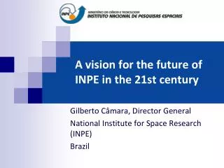
A vision for the future of INPE in the 21st century. Gilberto Câmara, Director General National Institute for Space Research (INPE) Brazil. A vision to follow. Dr. Vikram Sarabhai (father of Indian space program).

E N D
A vision for the future of INPE in the 21st century Gilberto Câmara, Director General NationalInstitute for SpaceResearch (INPE) Brazil
A vision to follow.... Dr. Vikram Sarabhai (father of Indian space program) "There are some who question the relevance of space activities in a developing nation. To us, there is no ambiguity of purpose. We do not have the fantasy of competing with the economically advanced nations in the exploration of the moon or the planets or manned space-flight. But we are convinced that if we are to play a meaningful role nationally, and in the community of nations, we must be second to none in the application of advanced technologies to the real problems of man and society. "
A Vision for INPE in the 21st Century Brazil will be an environmental power and the first developed nation in the tropics INPE will be a world-class centre in Space and Environment R&D for the tropical region
INPE: CONVERTING DATA INTO KNOWLEDGE SATELLITES Earthobservation, scientific, and data collectionsatellites GROUND SYSTEMS Satellitecontrol, Reception, processing anddistributionofsatellite data ANALYSIS AND MODELLING SpaceWeather, WeatherPrediction andEarth System Science SOCIETAL BENEFITS Innovativeproducts to society
INPE’s space technology agenda “Global EO” – Brazil as global player in earth observation Bilateral agreements (China, Germany, UK) Multilateral Agreements (CEOS, GEO)
CEOS Virtual Constellations Commonrequirements, independentsatellites, comparable data (CEOS – CommitteeonEarthObservation Systems)
Land Imaging Constellation TERRA (ASTER & MODIS) IRS LANDSAT RESOURCESAT ALOS SAC-C SPOT CBERS
Global Mean Sea Level from Satellite Altimetry Ocean Surface Topography Constellation Average Rate = 3.5 mm/year (1993-2006) SLR IPCC 2001: 1.8 mm/year
Satellites 2010-2020 2010 2011 2012 2013 2014 2015 2016 2017 2018 2019 2020 CBERS-5 CBERS-3 CBERS-4 CBERS-6 Amazônia-1 Lattes-1 GPM-BR Lattes-2 Amazônia-2 SABIA-2 SABIA MAPSAR CBERS Plataforma Multi-missão Geostac. GEO Met BR
Satellites for Forestry and Agriculture 100 Technology 2000 MUX CBERS-3/4 50 Technology 2008 Mapping Forestry CCD CBERS-2/3/4 MUX CBERS-5/6 CBERS-SAR-2 Technology 2015 Land Use Description 10 Revisit (days) Deforestation Detection CBERS-SAR-1 5 AWFI CBERS-3/4 AWFI Amaz-1/2 AWFI CBERS-5/6 WFI CBERS-2 Agriculture Mapping 1 5 50 500 1 10 100 1000 Resolution (metres)
CBERS: satellites for the public good CBERS-2B Launch (19 September 2007)
CBERS Program Timeline Set/99 Mar/03 Out/03 Mar/09 Set/07 Jun/11 Set/14 Set/17 Set/20
LIT – Integration and Tests Lab Complete infrastructure for assembly, integration and tests of satellites 70,000 man-hours per year for industrial testing
Integration of CBERS-2B in INPE (2006-2007) Assembly, integration and test (AIT) facilities at INPE
CBERS-3 Construction (2008-2010) President Lula's visit to CAST - CBERS-3 engineering model of the (20-05-2009)
CBERS 3 – 4 Cameras Visible – Near IR Thermal IR Short wave IR Reflected IR AWFI 60 m (720 km) IRMSS 40 m (120 km) CCD 20 m (120 km) MUX 5/10 m(60 km) 3.7 3.9 3.5 10 12 1.5 1.7 2.1 2.3 0.4 0.5 0.7 0.9 µm Brasil China
Multimission platform A common support for different Earth observation missions 600 a 1200 km orbit altitude 300 kg payload and 250 kg platform
Amazônia-1 (cooperation with UK) AWFI Global land imaging every 3 days together with CBERS-3 (RAL-UK will alsoinclude a 10-meter camera) 0,45-0,52B 0,52-0,59G SpectralBands(m) 0,63-0,69R 0,77-0,89NIR Spatialresolution(m) 40 Groundswath(km) 780 5 Revisit (days)
Brazilianopticalcameratechnology Amazônia-1 AWFI (R$ 38 M) 40 m resolution 780 km swath 60 m resolution CBERS-AWFI (R$ 60 M) 720 km swath CBERS-CCD (R$ 85 M) 120 km swath 20m res
RAL-CAM 3 (UK contribution to Amazonia-1)
Contrato ACDH - INVAP ARSAT (satelite geoestacionário) Preço e Qualidade Acesso à tecnologia Reuso nos demais satélites da PMM Motivação da equipe do INPE Teste estrutural do SAC-D no LIT (2008)
LATTES (EQUARS and MIRAX) MIRAX: Hard and soft X-rays EQUARS Temperatura na Estratosfera Bolhas ionosféricas Vapor d’água na Troposfera
Global Precipitation Mission (GPM-BR) Passive Microwave Sensor Lighting Detector Brazilian contribution to GPM constellation Near-equatorial orbit
SABIA-MAR 16 bands : 350-2130nm Swath 2800 km Resolution: 1 km Brasil-Argentina cooperation Ocean colour measurement
MAPSAR (Brazilian SAR) Global monitoring of terrestrial ecosystems L-band multi-polarized Agriculture Amazonia
MAPSAR operationmodes • ScanSAR • Swath: 560km • Resolution: 30 m x 30 m • Global revisit: 5 dias • Polarization: HH+HV • StripMAP • Swath: 115km • Resolution: 14 m x 14 m • Global revisit: 25 dias • Polarization: HH+HV
CBSAR Operational Capabilities:Amazonia in 5 days with 30 m resolution
BRMET (Geostationary Meteorological Satellite) Brazil needs images and meteorological data with operational coverage (every 15 minutes) American (GOES) and European (Meteosat) satellites does not meet the needs of Brazil
BRMET (Geostationary Meteorological Satellite) BRMET (50 W) BRMET: satellite dedicated to the observation of South America
BRMET (Geostationary Meteorological Satellite) Precipitação por satélite Temperatura superfície mar BRMET: Better weather forecasts and improved service to society
CBERS 05/06: Preliminary proposal Continuity of CBERS optical data Medium resolution (5-20 m) Frequent Coverage
Câmeras do CBERS 5 – 6 (em discussão) Visible – Near IR Mediumwave IR Thermal IR Short wave IR IRMSS 20 m (120 km) AWFI-2 20 m (720 km) MUX 5/10 m (120 km) 3.7 3.9 3.5 10 12 1.5 1.7 2.1 2.3 0.4 0.5 0.7 0.9 µm Built by Brazil Built by China
INPE: CONVERTING DATA INTO KNOWLEDGE SATELLITES Earthobservation, scientific, and data collectionsatellites GROUND SYSTEMS Satellitecontrol, Reception, processing anddistributionofsatellite data ANALYSIS AND MODELLING SpaceWeather, WeatherPrediction andEarth System Science SOCIETAL BENEFITS Innovativeproducts to society
CBERS-2B HRC (PAN - 2,7 m) + CCD (multispectral, 20 m) Guarulhos Airport, Sao Paulo, March 2008
CBERS-2B HRC (PAN - 2,7 m) + CCD (multispectral, 20 m) São Felix do Xingu, Pará, June 2008
CBERS in PrivateFarm Management “CBERS brought the freedom to have data immediately available when you need it.”
CBERS as a global satellite Miyun Urumchi Aswan Maspalomas Ghuangzhou Chetumal Bangcoc Gabon(?) Nairobi(?) Boa Vista Darwin(?) Cuiabá Alice Springs (?) Jo´burg CBERS ground stations will cover most of the Earth’s land mass between 300N and 300S
“A few satellites can cover the entire globe, but there needs to be a system in place to ensure their images are readily available to everyone who needs them. Brazil has set an important precedent by making its Earth-observation data available, and the rest of the world should follow suit.”
INPE: CONVERTING DATA INTO KNOWLEDGE SATELLITES Earthobservation, scientific, and data collectionsatellites GROUND SYSTEMS Satellitecontrol, Reception, processing anddistributionofsatellite data ANALYSIS AND MODELLING SpaceWeather, WeatherPrediction andEarth System Science SOCIETAL BENEFITS Innovativeproducts to society
B1-low A2-high R&D Programs at INPE (1) SpaceWeather NumericalWeatherPrediction Astrophysics ClimateChangeandEarth System Science
R&D Programs at INPE (2) Mission-critical Technologies Satellite Technology Earth Observation Monitoring Amazonia Computer Science


![21st Century [ Future ] Lab *](https://cdn2.slideserve.com/4525084/slide1-dt.jpg)