Download
1 / 10
110 likes | 495 Views
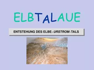
L AUE. ELB T. A. ENTSTEHUNG DES ELBE ~ URSTROM ~TALS. Saale-Eiszeit vor 130.000 Jahren. HAUPTSAMMELRINNE ABFLUSS ZUR NORDSEE. ABSCHMELZENDER GLETSCHER. GLETSCHER. SCHMELZWASSER. GRUNDMORÄNE. GLETSCHERTOR. SCHMELZWASSER. m. 40. +. Elbe-Urstromtal. +. 0. ABFLUSSRINNEN. 2. 0.

E N D
LAUE ELBT A ENTSTEHUNG DES ELBE~URSTROM~TALS
Saale-Eiszeit vor 130.000 Jahren HAUPTSAMMELRINNE ABFLUSS ZUR NORDSEE ABSCHMELZENDER GLETSCHER GLETSCHER SCHMELZWASSER GRUNDMORÄNE GLETSCHERTOR SCHMELZWASSER
m 40 + Elbe-Urstromtal + 0 ABFLUSSRINNEN 2 0 GRUNDMORÄNE DER SAALE - EISZEIT Ende der Weichsel–Eiszeit ca. 12.000 Jahre v. Chr. + 2
Sedimentation durch geringere Schmelzwassermengen ca. 10.000 Jahre v. Chr. TUNDRA ABGELAGERTE FLUSS-SANDE
Entstehung der Elbmarsch bei Hamburg um Christi Geburt Beginn von Ebbe und Flut MISCHWALD ÜBERFLUTUNGSGEBIET SCHLICK DÜNE FLACHMOOR AUWALD BILLE ELBE
Besiedelung von Geest und Marsch bei Hamburg ab 1.200 n. Chr. Siedlung Felder Flachmoor Düne Bruch-wald Wurt Wiese Deich Deich Deich Bille Elbe Elbe Elbe Besiedlung von Geest und Marsch ab 1200 n. Chr.
Geomorphologisches Profil durch den Kreis Lüchow-Dannenberg W Geest Aue Niederterasse, z.T. mit Flugsand oder Niedermoortorf Nt. Aue Nt. Geest-Insel Aue 100 80 Göhrde-Drawehn W 60 60 Seege-Niederung Elbe Jeetzel-Niederung 40 40 20 20 0 0 -20 -20 m NN m NN 50-fach überhöht 0 1 2 5 km 3 4 Quelle: Gillandt, Grimmel & Martens 1983
Geomorphologisches Profil durch das Elbetal am Höhbeck (Landkreis Lüchow-Dannenberg Dammrower Höhbeck Laascher See NE Löcknitz Dünen SW Forst Gorlebener Forst Elbe 60 60 40 40 20 20 0 0 -20 -20 4 0 1 2 3 5 Kilometer 25-fach überhöht Quelle: E. Grimmel 1979
Klima-Optima des Holozän Mittelalterliche Wärmeperiode 17 17 Römisches Klima-Optimum Temperatur (°C) 15 15 Temperatur (°C) Völkerwanderungs-Pessimismus 13 13 2 10 8 6 4 Kleine Eiszeit Jahrtausende vor heute 11 Ende der letzten Kaltzeit Bodennahe Mitteltemperaturen auf der Nordhalbkugel in den letzten 11.000 Jahre Quelle: Dansgaard et al 1969 und Schönwiese 1995, verändert
textLotse - Dr. Michael Struck Übersetzungen Konzept & Text Projektmanagement m.struck@textLotse.de www.textLotse.de © 2004