Download
1 / 42
420 likes | 530 Views
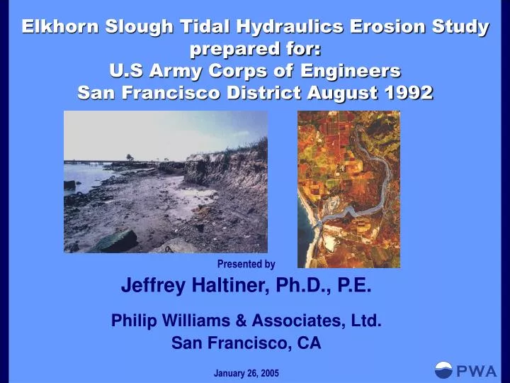
Elkhorn Slough Tidal Hydraulics Erosion Study prepared for: U.S Army Corps of Engineers San Francisco District August 1992. Presented by Jeffrey Haltiner, Ph.D., P.E. Philip Williams & Associates, Ltd. San Francisco, CA January 26, 2005. Project Team/Agency Contacts.

E N D
Elkhorn Slough Tidal Hydraulics Erosion Studyprepared for: U.S Army Corps of Engineers San Francisco District August 1992 • Presented by • Jeffrey Haltiner, Ph.D., P.E. • Philip Williams & Associates, Ltd. • San Francisco, CA • January 26, 2005
Project Team/Agency Contacts This work was performed for the San Francisco District Office of Army Corps of Engineers. Scott Miner was the project manager for the COE, Jeffrey Cole served as the contract manager, Elizabeth Aguila was the Contracting Officer and Thomas Kendall, P.E. was the Acting Chief, Water Resources Branch. The geomorphic and hydrodynamic analysis as well as overall report production was conducted by Philip Williams and Associates, Ltd. in San Francisco, CA. The project team included: Jeffrey Haltiner, Ph.D., P.E.: Project Manager/Principal in Charge Johnny Lin: Hydrodynamics Modeling Peter Goodwin, Ph.D., P.E.: Hydrodynamic Modeling, Supervision Michael Wick: Hydraulic Geometry and Map Analysis The conceptual sill design was developed by Robert Battalio, P.E. of Moffatt and Nichol Engineers (now with PWA).
Project Team/Agency Contacts In reviewing the existing conditions and historic changes to the system, we received valuable help from the following: Mark Silberstein, Ph.D.: Executive Director; Elkhorn Slough Foundation Andrew De Vogelaere, Ph.D.: Research Coordinator; Elkhorn Slough Foundation Steven Kimple: Reserve Manager; California Department of Fish and Game John Oliver, Ph.D.: Marine Ecologist; Moss Landing Marine Laboratories David Vierra: Local landowner; longtime family ownership of land adjacent to the slough
INTRODUCTION A. Overview B. Study Purpose C. Study Methodology HISTORICAL CHANGES AND PRESENT CONDITIONS A. Historical Changes in the Slough and Surrounding Areas B. Field Observations of Present Conditions C. Hydrographic Changes MODELING STUDY A. Introduction B. Modeling Description and Input Data C. Modeling Results OBSERVATIONS AND CONCLUSIONS EROSION CONTROL ALTERNATIVES A. No Project B. Shoreline Protection C. Tidal Barrier Near the Highway 1 Bridge D. Tidal Barrier Near South Marsh/Parson’s Slough
Study Purpose In response, to a letter from the Moss Landing Harbor District, the San Francisco District of the Corps of Engineers requests a Tidal Hydraulic Erosion study of Elkhorn Slough, in December, 1991. The purpose of this present study is: “…to determine if the Corps’ Moss Landing Harbor Navigation Project has caused, or is causing any erosion of the vegetated marshlands in Elkhorn Slough. Lastly, the study will evaluate and recommend solutions to the current erosion problems that exist at Elkhorn Slough.”
Study Methodology The COE designated approach to the above requested study was to gather available data on historical and existing conditions in the slough and to develop a hydrodynamics model to simulate tidal circulation in the slough for the following conditions: 1. Existing (1991) Conditions (with the Federal Navigation Project, and with upstream levee breaches along Elkhorn Slough); 2. Without-Navigation-Project or Levee Breach Conditions (with pre-1946 conditions at mouth of the slough); 3 Navigation Project Conditions only (without upstream levee breaches); and 4. 1985 Highway 1 Bridge and Levee Breach Conditions only (with pre-1946 conditions at mouth of Slough).
Eroding North Bank of Elkhorn Slough Just Upstream of the Highway 1 Bridge
Elkhorn Slough: 1909 USC & GS Map Historic Inlet Current inlet
Old Salinas River Mouth (1940) and 1947 Harbor Entrance Channel
1940 and 1988 cross-sections just upstream of the Highway 1 Bridge
Comparison of the 1940 and 1988 cross-sections at 1.5 and 1.9 miles respectively upstream of Highway 1
Longitudinal Profile of Elkhorn Slough at the Highway 1 Bridge
Modeling Study • Goals: • Quantify the effect of the 1946 Harbor opening • Quantify the effect the 1983-1984 marsh levee breaches (which opened the South Marsh/Parson’s Slough to the tidal circulation) • Identify potential erosion management approaches.
Modeling Study • Modeling Scenarios • 1940 conditions (pre-harbor): No upstream levee breaches; • 1940 conditions with upstream levee breaches (to determine the effect of the 1983-1984 levee breaches would have been without the 1946 harbor opening); • 3. 1947 conditions without levee breaches (to determine the effect of the new entrance harbor); • 4. Present conditions (without levee breaches); • 5. Present conditions (without levee breach); • 6. Present conditions with the proposed rock sill (elev: -5.0 ft NGVD); • 7. Present conditions with the proposed rock sill (elev: -3.0 ft NGVD).
Modeling Results As described previously, the model was run in different configurations to evaluate the historical changes and evaluate a preliminary solution. The modeled runs were: Run #1 1940 conditions (pre-harbor): No upstream levee breaches Run #2 1940 conditions with upstream levee breaches (to determine what the effect of the 1983-1984 levee breaches would have been without the 1946 harbor opening) Run #3 1947 conditions without levee breaches (to determine the effect of the new entrance harbor) Run #4 Present conditions (with the levee breaches) Run #5 Present conditions (without the levee breach) Run #6-9 Present condition with a level rock sill (elevs: -5.0, -3.0, -2.0 feet NGVD at Highway 1) Runs #10-11 Present conditions with a notched rock sill (elevs: -5.0, and –3.3 feet NGVD at Highway 1) Run #12 Present conditions with a rock sill (elev –2.0 feet NGVD at Highway 1) and a rock sill at the SPRR tracks in Parson’s Slough (-3.0 feet NGVD)
Shear stress distribution at the Highway 1 Bridge for 1940 and 1947 conditions
EROSION CONTROL ALTERNATIVES A. No Project B. Shoreline Protection C. Tidal Barrier Near the Highway 1 Bridge D. Tidal Barrier Near South Marsh/Parson’s Slough
(Left) Natural marsh-hillside transition in marsh north of Elkhorn Slough Channel(Right) Marsh strip stabilizing hillside adjacent to a slough channel in the marsh north of Elkhorn Slough Channel
(Left) Potential sill location upstream of the Highway 1 Bridge(Right) Potential sill location downstream of the Highway 1 Bridge
Shear stress distributions at CS-2 for “With Project” Conditions (e.g sill at Hwy. 1) and 1940 conditions with levee breaches
Concept-level Construction Cost Estimate Elkhorn Slough SillRubble Alternative1992
Observations and Conclusions • Based on the results of the field observations, the hydraulic geometry analyses and the hydrodynamic modeling, some reconnaissance-level observations and conclusions can be made: • The pre-1946 slough system had undergone significant alterations from a pristine condition • 1910 diversion of the Salinas River *loss of Salinas River inflow *elimination of sediment supply to entire system • *diking and draining of various wetland areas in the Slough
Observations and Conclusions 2. The 1946 harbor opening and maintenance of the dredged entrance channel allowed full tidal exchange and a lowered “baselevel”. This has resulted in: *rapid erosion in downstream reaches of Elkhorn Slough *maximum degradation of about 15 vertical feet *the amount of channel degradation which has occurred since 1946 decreases further upstream *however, it appears that the channel and bank erosion is proceeding upstream *rate of channel deepening in the most downstream reaches has likely decreased *channel is actively widening in response to increased channel depth *1.2 million cy of material have been eroded from the system *erosion is causing significant loss of salt marsh and intertidal wetland habitat throughout the lower reaches of the system
Observations and Conclusions 3. The levee breaches of 1983-1984 significantly increased the tidal prism (estimate to be about 37 percent) to downstream reaches. *increased erosion in downstream reaches *increase in shear stress in same downstream reaches *bank erosion and channel widening have been the dominant erosion process *additional tidal prism from the levee breaches is responsible for a depth increase of about 3 feet and an increase in channel cross-section of about 33% in reaches below the Parson’s Slough- Elkhorn Slough junction
Observations and Conclusions 4. Based on limited topographic data, it appears that prior subsidence had lowered South Marsh and Parson’s Slough area by 2-3ft *when opened to tidal action in 1983-84 these areas contributed an increase (37%) to total tidal prism causing erosion downstream *because the main slough was subject to full tidal exchange, the 1983-84 opening allowed full tidal circulation into these areas
Observations and Conclusions • 5. Possible management approaches: • A sill across the channel at the Highway 1 bridge can be designed to reduce tidal circulation and associated erosion • A sill could be constructed across Parsons Slough to reduce erosion in the South Marsh. This would also reduce the size of the structure required at Highway 1 • Either of these approaches have large environmental issues
Observations and Conclusions • 6. The geomorphic response of the system to these structures would be gradual. • *erosion will continue to occur until the slough invert is raised by subsequent deposition *South Marsh would benefit by the placement of sediment o recreate the historic marshplain *this would improve habitat, reduce internal erosion and reduce downstream erosion by reducing tidal prism • In the interim, a series of monitoring studies and pilot projects were suggested.