Download
1 / 27
280 likes | 461 Views
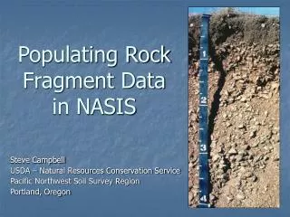
Populating Rock Fragment Data in NASIS. Steve Campbell USDA – Natural Resources Conservation Service Pacific Northwest Soil Survey Region Portland, Oregon. When we describe a soil profile, we record the following rock fragment data by horizon:. Content in percent by volume

E N D
Populating Rock Fragment Data in NASIS Steve Campbell USDA – Natural Resources Conservation Service Pacific Northwest Soil Survey Region Portland, Oregon
When we describe a soil profile, we record the following rock fragment data by horizon: • Content in percent by volume • Roundness (rounded, subangular, etc.) • Size classes – • Nonflat: gravel, cobbles, stones, boulders • Flat: channers, flagstones, stones, boulders • Lithology (rock type) • Hardness (especially for pararock fragments)
Point Data to Aggregated Data • Rock fragment data from pedon descriptions and notes are evaluated by taxonomic unit . • A range in characteristics (RIC) for rock fragments is developed by horizon. • Ideally, the RIC should include the range in percent by volume for each rock fragment size class and the total rock fragment volume range.
Rock Fragment Range in Characteristics Examples • Example 1 • C HorizonRock Fragments - 50 to 75 percent gravel, 0 to 10 percent cobbles, 0 to 10 percent stones, 50 to 75 percent total • Example 2 • Bw horizon – rock fragments average 35 to 70 percent
NASIS Rock Fragment Data Elements • Volume Basis: • Horizon Fragments table • Horizon table – Total Fragment Volume • Weight Basis • > 10 inch (stones and boulders) • > 3-10 inch (cobbles) • % passing sieves (#4 – 4.76 mm, #10 – 2 mm)
Example Horizon Description and Range in Characteristics C--102 to 122 cm; extremely gravelly loamy sand; 60 percent gravel, 5 percent cobbles. C HorizonRock Fragments - 50 to 75 percent gravel, 0 to 10 percent cobbles, 0 to 10 percent stones, 50 to 75 percent total
C--102 to 122 cm; extremely gravelly loamy sand; 60 percent gravel, 5 percent cobbles. C HorizonRock Fragments - 50 to 75 percent gravel, 0 to 10 percent cobbles, 0 to 10 percent stones, 50 to 75 percent total
RV values are based on the typical pedon Ranges are from range in characteristics RV values are based on the typical pedon
The next step is to convert rock fragments from % of the whole soil by volume to % by weight. • Factors that affect the conversion: • Specific gravity (density) of the rock fragments • Bulk density of the fine earth fraction
For most rock types, you can safely select a specific gravity (density) of 2.6 to 2.7 g/cm3.
MO-1 NASIS Guide 2 – Assumes 2.7 g/cm3 rock specific gravity Coarse Fragment Conversion from Percentage by Volume to Percentage by Weight
Rock Fragment Data on a Weight Basis in Older Soil Surveys • The rock fragment data for many older soil surveys used guides that assumed a soil bulk density of 1.5 g/cm3. • If the actual bulk density of the soils was significantly lower, such as for Andisols or Andic subgroups, the values for rock fragments on a weight basis will be too low.
Methods for Converting Rock Fragments from Volume to Weight Basis • Make the conversions manually, using the guides in MO-1 Technical Note 40 • Use the NASIS Excel spreadsheet, available on the MO-1 website • Use lab data when available
NASIS Excel Spreadsheet – User enters bulk density, rock density, and volumetric rock fragment content for gravel, cobbles, stones, and total fragment volume
The spreadsheet converts the volumetric rock fragment content to a weight basis for the >10 inch (stones and boulders) and the 3-10 inch (cobbles). The percent passing the #4 and #10 sieves are also calculated. Some adjustment may be needed for the percent passing #4 sieve (4.76 mm) if the gravels are dominantly a single size fraction.
Another complicating factor in the volume to weight conversion • The percent passing the #4, 10, 40, and 200 sieves is based on the material less than 3 inches (75 mm) in size. • For soils with both gravel and rock fragments greater than 3 inches, the percent passing the sieves needs to calculated using a new 100 percent base that excludes the >3 inch fragments.
Example – Very cobbly sand with 15% gravel, 20% cobbles, and 5% stones by volume. • Convert gravel to a new 100% base excluding >3 inch fragments • 15% gravel / [(100 – (20% cobbles + 5% stones)] = 15/75 = 0.20 or 20% gravel by volume • Assuming a bulk density of 1.5 g/cm3 • 20% gravel by volume = 31% by weight • % passing #10 = 100 – 31 = 69% (round to 70%)
15% gravel 25% cobbles and stones 60% fines (less than 2 mm) Example – Very cobbly sand with 15% gravel, 20% cobbles, and 5% stones by volume. + + = 100%
20% gravel 80% fines (less than 2 mm) Example – Very cobbly sand with 15% gravel, 20% cobbles, and 5% stones by volume. Take out the cobbles and stones and recalculate based on new 100% base. = 100% +
Summary - Horizon Rock Fragments • All soil scientists should understand the procedure for converting rock fragments from volume to weight and populating the applicable NASIS data elements. • Everyone should go through the process manually to understand the principles. • Once the principles and procedures are understood, the MO-1 NASIS Excel spreadsheet greatly simplifies the process, and automatically takes into account the soil bulk density, rock density, and rock fragments greater than 3 inches.
Surface Fragments • Rock fragments that are exposed on the soil surface should be populated in the NASIS Component Surface Fragments table. • Any size fraction can be populated. Emphasis should be placed on populating stones and boulders.
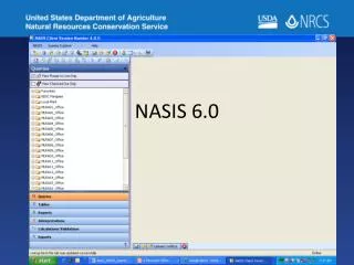
NASIS ExampleAlpha gravelly loam, 5 to 20 percent slopes, very stony