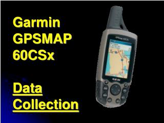
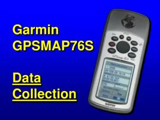
Garmin GPSMAP76S Data Collection
Garmin GPSMAP76S Data Collection. Objective. Collect: - Waypoints Average Location (Averaged Waypoint) - Track. In the field!. X. X. Summary of Topics. Mark Waypoint Average Location Collect Track View Track Area (without Saving) Multiple Track Segments.

Garmin GPSMAP76S Data Collection
E N D
Presentation Transcript
Objective • Collect: • - Waypoints • Average Location (Averaged Waypoint) • - Track In the field!
X X Summary of Topics • Mark Waypoint • Average Location • Collect Track • View Track Area (without Saving) • Multiple Track Segments
Reminder – Check Satellite Page Check Accuracy Check number of satellites – minimum 4 satellites required
X Goal: Mark Waypoint Press and hold Enter -All values frozen -No values stored yet
X Modify Mark Waypoint Page Waypoint Symbol Waypoint Name, max 10 characters Current Position DO NOT EDIT – needed for ArcView/ArcGIS Current Elevation Input from NMEA device Show Waypoint on Map Page
X Save Waypoint Press Enter
X Average Location – Begin with Mark Waypoint To see Location differences in meters, change Coordinate System to UTM (see next slide for reminder).
X Reminder – How to Change Location Format (Coordinate System)
X Open Mark Waypoint Options Menu Press Menu
X OpenAverage Location Page When acceptable “Save” Note 1 second collection interval
X Compare Waypoints Averaged Initial 1 position 60 positions
X Save Mark Waypoint No indication this is an Average Location
Open Main Menu Press Menu Twice
Open Tracks Page Press Enter
Open Track Page Options Press Menu
Open Track Log Setup Press Enter
Open Recording Options Overwrites oldest track points when memory is full Press Enter
Tip: Collecting a Track Log Incorrect Correct Start Stop Stop Start Track Track Stop collection just shy of starting point Overshoot may: - create extra polygon in GIS - calculate incorrect area in GPS
View Area (without Saving) Press Quit Change units ac = acres
Goal: Multiple Track Segments in One Active Track Log Map Page Tracks Page 1st Track 2nd Track No Saved Tracks 3rd Track
Start Collecting 1st Track - Set Recording to Stop When Full Press Enter
Stop Collecting 1st Track - Set Recording to Off This option saves only most significant points.
Collecting 2nd Track Check Memory Begin End
Collecting 3rd Track Check Memory Begin End
X X Review of Topics • Mark Waypoint • Average Location • Collect Track • Calculate Track Area • Multiple Track Segments