Download
1 / 21
250 likes | 428 Views
Multispectral Remote Sensing of Benthic Environments. Christopher Moses, Ph.D. Jacobs Technology - USGS NPS-USGS Servicewide Benthic Habitat Mapping Workshop June 3-5, 2008 Lakewood, CO. Outline. Matters of scale Advantages and disadvantages Common principles Satellites

E N D
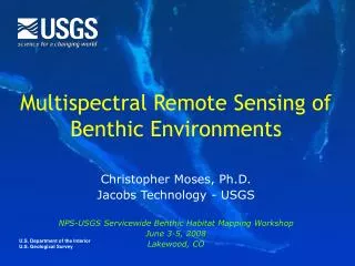
Multispectral Remote Sensing of Benthic Environments Christopher Moses, Ph.D. Jacobs Technology - USGS NPS-USGS Servicewide Benthic Habitat Mapping Workshop June 3-5, 2008 Lakewood, CO
Outline • Matters of scale • Advantages and disadvantages • Common principles • Satellites • Coral reefs applications
Scales of benthic mapping Global ecosystem distribution Island and coastal geomorphology Community Organism
Synoptic Repeated acquisition Possible time series and change detection Multi-spectral to hyperspectral Calibration and validation Expensive Clouds High-tech issues Rapid change, hard to follow literature Interpretation Products based on many assumptions Programming errors Unknown calibration problems Unknown orbit or sensor errors Advantages and disadvantages
WAVELENGTHS (IN METERS) shorter 10-11 10-10 10-9 10-8 10-7 10-6 10-5 10-4 10-3 10-2 10-1 101 102 longer ULTRA VIOLET GAMMA RAYS X RAYS INFRARED RADIO WAVES MICROWAVE VISIBLE 400 500 600 700 nanometers Electromagnetic Spectrum A sensor measures the amount of light being reflected or emitted by the earth’s surface at specific wavelengths in the electromagnetic spectrum
Path radiance Scattering at edges of atmosphere Attenuation due to absorption and scattering in atmosphere Attenuation due to absorption and scattering in water Irradiance Radiance Radiative Transfer Theory Cloud Atmosphere Sea Surface Ocean
Satellite Airport Temporal resolution Satellite Airport
AISA Ikonos ASTER Landsat Spatial resolution
Satellites by name • Landsat 7 ETM+ • 30 m spatial resolution • 16 day revisit time, identical scene locations, LTAP • NIR, R, G, B bands • ASTER • Advanced Spaceborne Thermal Emission and Reflection Radiometer • 15 m spatial resolution • 16 day revisit time • NIR, R, G (no blue!) • IKONOS • 4 m spatial resolution • Image acquisition by request • NIR, R, G, B • $$
Landsat 7 ETM+ full scene ~180 km Path 18, Row 48 8 Nov. 2000
Landsat 7 ETM+ 5 Feb 2000 North Florida Reef Tract
Supervised habitat classification Brock et al. (2006)
Satellite accuracy (supervised) • L7 = 86.2 (±2.3%) • 5 classes • Need class separability • Sand is most easily misclassified
Not just for corals! http://gis.esri.com/library/userconf/proc01/professional/papers/pap900/p90011.jpg http://www.nasa.gov/centers/goddard/earthandsun/nps_data.html
Summary I • Advantages of satellites: • Synoptic; repeated acquisition; multi- or hyperspectral bands • Disadvantages: • Expensive; rapidly evolving technologies; complications of interpretation • Resolution depends on mapping needs • Temporal and spatial resolution • Useful satellites for benthic mapping • Landsat 7 ETM+ (30 m spatial resolution) • ASTER (15 m spatial resolution) • No blue band! • IKONOS (4 m spatial resolution)
Summary II • Landsat 7 and IKONOS can reach accuracies of >80% in reef areas • Supervised classification of 5-6 classes • Satellites and aerial photos reliable to max depth of ≤20 m • Particularly useful in reef areas, but also good for kelp and other near surface habitats