Download
1 / 20
200 likes | 324 Views
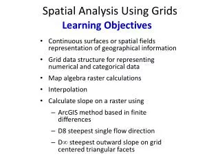
Current use of spatial reference grids in European Environment Agency. Andrus Meiner, EEA. Direct and indirect spatial reference (position) Source: http://crs.ifag.de/crs_content.php (Bundesamt für Kartographie und Geodäsie). Environmental issues and use of reference grids (1).

E N D
Current use of spatial reference grids in European Environment Agency Andrus Meiner, EEA
Direct and indirect spatial reference (position)Source: http://crs.ifag.de/crs_content.php (Bundesamt für Kartographie und Geodäsie)
Environmental issues and use of reference grids (1) • Air pollution, ozone and UV • emissions • deposition • concentrations • exposure • calculated critical loads, exceedances • Biodiversity assessment • species distribution (atlases)
Environmental issues and use of reference grids (2) • Climate change and hydrology • temperature change • average annual runoff • Land cover • land cover distribution • fragmentation • Soil • erosion risk
Current use of reference gridsNumber of maps in 3 latest EEA main assessment reports • EMEP grids: 50 km and 150 km, /17 maps • air pollution modelling, deposition • UTM 50 km, 5 maps • species distribution mapping (atlases) • Equal area 10 km grids, /10 maps • supports geographical comparisons based on area • land cover, river basin management • Lat / Long cells: 30’ x 30’, also others /8 maps • various uses: deposition of hazardous substances, erosion risk, mean temperature, seismicity • regular sampling grids (ICP Forest 16 km grid) /2 maps
EMEP grid • Monitoring for CLRTAP • Projection: Polar Stereographic • Resolution • Original 50 x 50 km (on project plane) • Derived 150 x 150 km and 1˚x 1˚ • Cell area on earth vary 1750 – 2850 km2 • Conversion to geographical (lat/long) coordinates supported
Example of EMEP 50 km grid: ecosystems protected against acidification
UTM grid by CGRS/AFEChorological Grid Reference System/Atlas Florae Europaeae • Widely used in species distribution mapping • Spatial reference system: • UTM (and UPS) • WGS84 datum • grid is based on Military Grid Reference System • Resolution • standard 50 x 50 km • irregular cell size on the UTM zone boundaries
New AFE Grid cell locationsSource: http://www.fmnh.helsinki.fi/map/afe/E_newgrid.htm
Other grids • 10 km equal area grid • Lambert Azimuthal Equal Area projection and WGS84 • Centerpoint 52˚N 20˚E • Used in land cover mapping and analysis • Lat/long grids • Different resolution (30’ x 30’ etc) • Variety of applications
Example of lat/long grid (water erosion vulnerability 1990, IMAGE 2 by RIVM)
Conclusions • EEA is not a grid developer, but is interested in European common grid • EEA priorities : • Compatibility through clear relation to ETRS89 • use WGS84 datum • agreed projections LAEA, TMzn and LCC • Convertability to geographical lat/long coordinates • Efficiency for data storage and access, like quadtree hierarchical data structure