Download
1 / 36
360 likes | 521 Views
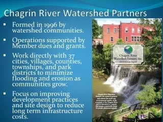
Chagrin River Watershed Partners. Formed in 1996 by watershed communities. Operations supported by Member dues and grants. Work directly with 37 cities, villages, counties, townships, and park districts to minimize flooding and erosion as communities grow.

E N D
Chagrin River Watershed Partners • Formed in 1996 by watershed communities. • Operations supported by Member dues and grants. • Work directly with 37 cities, villages, counties, townships, and park districts to minimize flooding and erosion as communities grow. • Focus on improving development practices and site design to reduce long term infrastructure costs.
CRWP Sponsoring Members Ohio Land Stewardship
What Does CRWP Do? • Member Services: • Grants for open space and stormwater management. • Development plan review and technical testimony. • Model regulation adoption and implementation. • Landowner assistance. • Watershed Initiatives: Activities to support the public health and safety basis for member planning and zoning. • Watershed planning • Stormwater retrofit and demonstration projects • Dam removal and stream restoration projects • Research and monitoring of stormwater practices
National Estuarine Research Reserve (NERR) System Science Collaborative: Evaluating Stormwater Solutions in Ohio’s Lake Erie Basin • NOAA Funds administered by the University of New Hampshire • Research addressing local coastal management problems • Researchers and intended users work together
Model Code Updates • Riparian/wetland setbacks • No updates • Ordinance and resolution versions available from CRWP • Off Street parking: Revised February 2014 • Conservation development • Partner with Lake County Planning and Community Development and Cleveland State University • Revised code available in June 2014 • Tree codes: Kirby Date at CSU working on updates
Riparian & Wetland Setbacks • Zoning tool to limit development within specific distances of streams and wetlands to protect property and limit infrastructure costs. • Controls location of soil disturbing activities. • Does not apply to existing structures and uses. • Variancesavailable, as with all zoning codes.
14 (45%) of CRWP Member communities have adopted riparian and wetland setback codes.
Model Parking Code • Space maximums & minimums by land use • Bicycle parking standards • Shared parking & land banking • Allow bioretention & permeable pavement • CRWP discussing with Bainbridge, Willoughby, Chardon City, Geauga County. • Adopted by Mentor and Mayfield
Conservation Development • Preservation of rural character, natural resources, historical structures • 50% recommended protected open space (40% minimum) • Less infrastructure to maintain • Density-neutral development or modest density bonuses
Conservation Development • Flexible, easy for communities to tailor • Dark skies lighting, bike and pedestrian access, groundwater • User-friendly density calculation instead of yield plan • Less onerous for community review & developers • Useable for communities within existing zoning framework Model code available by June 2014
Tree Codes • Multiple versions: • Protect large trees • Forestry/Timber Harvest • Kirby Date, Cleveland State University working on revisions to recommendations for Ohio Balanced Growth Program • Work group convened in early April • Work group members more concerned about compaction of soils than preservation of existing trees • Ability and survivability for replanting efforts.
Phase II: Draft MS4 Permit • Draft permit issued November 27, 2013. • Renewal notification package to communities • 90 days NOI submittal • $200 application fee • Possible New Requirements: • 2 years for update to current CGP standards • 2 years to update Storm Water Management Program. • Use of TMDL water quality recommendations in BMP selection
CRWP Plan for Updating the Model Stormwater Management Plan and Codes • Inventory the number and types of TMDLs. • Identify BMPs to address TMDL in revised stormwater management program. • Summarize BMPs by type of TMDL; the summary will recognize if the BMPs are currently included in the SWMP or codes or if they would be additional recommendations. • Convene a technical review committee to review/discuss identified BMPs and any suggested changes to the SWMP/codes. • Revise the model codes and SWMP and submit to Ohio EPA, interested communities, and Northeast Ohio Storm Water Training Council for review and comment.
Codes Checklist • Supplement to the Ohio Balanced Growth Program’s Best Local Land Use Practices • Development Regulations • Parking Lot Design • Flood Damage Reduction • Stream and Wetland Setbacks • Flexible Subdivision Design • Compact Development • Tree and Woodland Protection • Natural Areas
Parking Lot Design • Evaluate: • Number of required parking spaces • Use of parking maximums • Width of parking stalls and aisles • Allow: • Pervious paving materials • Shared parking and land banking • Landscaping to be used as stormwater management.
Interested in more in depth training on the NERR System Science Collaborative Project? • Sign clipboard at the front of the room after the presentation and you will receive a short e-mail about topics of interest.
Amy H. BrennanChagrin River Watershed Partners, Inc.abrennan@crwp.org(440) 975-3870www.crwp.org
Ohio Balanced Growth Program New Tools for Plans and Codes Review Kirby Date, AICP, Cleveland State University
Best Local Land Use Practices: Encourage voluntary implementation of recommended practices for improved watershed quality and economic benefit. • Start and participate in watershed planning partnerships • Align comprehensive plans with BG watershed plans • Update plans and codes with best practices • Incentivize developers and property owners to use best practices
Recommended Best Local Land Use Practices • Comprehensive Planning • Compact Development • Conservation Development • Storm Water Management • Stream, Wetland and Floodplain Protection • Natural Areas Establishment • Source Water Protection • Woodland Protection • Steep Slope Protection • Transfer of Development Rights • Agricultural Land Protection • Brownfields Redevelopment • Historic Protection • Scenic Protection • Access Management
Checklist for Code Review • Development Regulations • Parking Lot Design • Minor Subdivisions • Flood Damage Reduction Regulations • Stream and Wetland Protection • Flexible Subdivision Design • Compact Development • Tree and Woodland Protection • Steep Slope Protection • Natural Areas Establishment and Management • Land Conservation Incentives
Applicability Density and Lot Sizes Open Space Requirements Resource Protection Administration and Review Checklist: flexible subdivision design (AKA Conservation Development)
Conventional Conservation Development • 40-50% Permanent Open Space • Quality Open Space • Resource Protection • Appropriate Development Intensity
Flexible Subdivision Design • Allow flexible layouts and lot sizes to accommodate resource protection and restoration • Provide for neutral density with underlying zoning, using proven density calculation method • Require 40% permanently protected open space at a minimum • Define quality open space with clear criteria • Set limits on development of open space • Make the code by-right
Applicability Pre-Design/Pre-Application Design Construction Administration Checklist: tree and woodland protection
Benefits of Tree Cover • Filter and manage storm water, reduce erosion, protect steep slopes, wetlands and riparian areas • Enhance property values across community and onsite
Tree and Woodland Protection: NEW APPROACH COMING • Protect or restore % of site soils • Plan for %tree cover on site in 30 years (new or existing) • Identify and specifically protect Landmark Trees only (Heritage/Champion)
RESOURCES http://balancedgrowth.ohio.gov
BLLUP Technical Assistance • 24 hours free technical assistance available to individual communities • South Euclid: review of PUD code and available sites • Medina Township: Comprehensive Plan Review and RFP • 17 assistance areas to date
Resources: BLLUP Guidance Document • Economic and environmental benefit explained • Terminology and concepts • Key decision-points for leaders • Recommendations for implementation • Ohio examples and case studies
Resources: Example Codes and Matrices Also see http://www.crwp.org
Additional BLLUP Resources • Checklists for review of codes and plans • Video and update • Bibliography of research demonstrating economic benefit of the practices
Gail Hesse Executive Director Sandra Kosek-Sills Environmental Specialist 419-621-2040 (office) 419-357-2775 (cell) sandra.kosek-sills@lakeerie.ohio.gov Brian Hall Administrator www.ohiodnr.com/owrc Kirby Date, AICP Best Local Land Use Practices Program Manager 216.687.5477 k.date@csuohio.edu