Download
1 / 52
530 likes | 730 Views
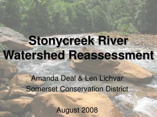
Stonycreek River Watershed Reassessment. Amanda Deal & Len Lichvar Somerset Conservation District August 2008. Watershed Characteristics. 298,920 acres 538 perennial stream miles 519 mi natural stream/river 19 mi artificial path Elevation ranges 3132 ft to 896 ft.

E N D
Stonycreek River Watershed Reassessment Amanda Deal & Len Lichvar Somerset Conservation District August 2008
Watershed Characteristics • 298,920 acres • 538 perennial stream miles • 519 mi natural stream/river • 19 mi artificial path • Elevation ranges 3132 ft to 896 ft
Stonycreek River Watershed • Major Sub-watersheds • Quemahoning Creek • Shade Creek • Bens Creek • Paint Creek • Rhoads Creek • Beaverdam Creek • Wells Creek • Solomon Run • Oven Run
urban forest agriculture barren water Land Cover • ~66% forested • ~24% ag • ~9% urban
REassessment? • USGS 1997 • Effects of coal-mine discharges on the quality of the Stonycreek River and its tributaries, Somerset and Cambria counties, Pennsylvania • Located & sampled 270 mine discharges • Stream water chemistry at 37 sites • Stream sampled above and below 5 discharges different discharges and entrance of Pokeytown Run and Oven Run
REassessment? • Led to nearly $10 million of project investment dollars • Reversed Stonycreek River from net acidic to net alkaline • Over 15 miles of recovered fisheries • Proliferation of watershed groups & grassroots interest • Wells Creek, Shade Creek, Paint Creek
Purpose of Reassessment • Develop baseline data set • Fill in data gaps • Funding for watershed groups • AML funding • Quantify water quality changes • Identify new projects • Complete restoration efforts that began >15yrs ago
Objectives • Survey water quality throughout watershed • Especially upstream and downstream of treatment systems (main stem and tributaries) • Assess macroinvertebrate assemblages • Identify fish assemblages • GIS mapping • Master database • Full report
Interagency Cooperation • PA DEP • Bureau of Abandoned Mine Reclamation • PA Fish & Boat Commission • Habitat Management Unit • Provided: • Personnel • Expertise • Equipment • Analysis assistance
Interagency Cooperation (cont.) • PA Fish & Boat Commission (cont.) • Filled a major gap in biological data that would have been lacking without collaboration. • Data collected will serve both agencies • SCD • Reassessment and support for remediation projects • PFBC • Fisheries management decisions
Sampling Points • 35 sites • 17 main stem • 18 tributaries
Physical habitat • EPA habitat assessment and physiochemical characterization from Rapid Bioassessment Protocols for Use in Streams and Wadeable Rivers (2nd ed.) • epifaunal substrate, embeddedness, velocity/depth regime, sediment deposition, channel flow status, channel alteration, frequency of riffles, bank stability, vegetative protection, riparian vegetative zone width
Weather conditions Habitat types cobble, snags, vegetated banks, sand, submerged macrophytes, other Surrounding landuse NPS pollution Erosion Canopy cover Morphology types LWD Aquatic vegetation Turbidity Stream width Average thalweg depth Velocity Physical Characterization Adapted from Rapid Bioassessment Protocols for Use in Streams and Wadeable Rivers (2nd ed.)
Water Chemistry • Temperature • Conductivity • pH • TDS • DO • Iron • Sulfate • Nitrate • Phosphate Multi-Meter--HI 991300 Ion Specific Meter--HI 93732 Hach hot kit Hanna Sulfate Test Kit (modified Barium Sulfate Turbidimetric method) LaMotte hot kits
Macroinvertebrate Sampling • D-frame Kick Net Multihabitat Approach • EPA Rapid Bioassessment Protocols • Modification 5 kicks/jabs instead of 20 • Kicks/jabs taken in proportion to the percentages of each habitat type • Sample mixed into one homogeneous sample • Stored in 70% isopropyl alcohol • Entire sample sorted in lab • Organisms identified to genus (when possible)
Macroinvertebrate Data Analysis • PA DEP IBI • Modified Beck’s • EPT • Species Richness • Shannon Weiner Diversity Index • Hilsenhoff Biotic Index • % intolerant taxa
Fish Sampling • PA FBC Protocols • 200 m reach • Single pass electrofishing • Collect all fishes • Field id for most fishes; questionable specimens preserved and identified in lab
Fish Sampling Sites • 18 sites • 12 main stem • 6 major tribs
Electrofishing Crew Left to right: Eric Null (SCD), Amanda Deal (SCD), Gary Smith (Management Area 4 Habitat Biologist, FBC), Bob Ventorini (Fisheries Biologist, FBC), John Trilli (FBC)
Physical Habitat Scores • Ranged 194 -- 36 (200 max) • Avg 134 • Highest scores in middle reaches • Lowest scores in headwaters and near mouth
Temperature Ranged 23-13oC (55-73oF) Conductivity Ranged 2200-43mS DO Ranged >10-5mg/L pH Ranged 9-3 TDS Ranged 1100-21ppm Fe Ranged 0-6mg/L Nitrate Ranged 0-13ppm Phosphate Ranged 0-2ppm Sulfate Ranged >100-0mg/L Field Water Chemistry
Water Chemistry Highlights • Low phosphtes and nitrates throughout • Nitrate spikes in headwaters • South Fork Bens Creek • Conductivity43mS 1.5mi 1322mS
Macroinvertebrate Summary • 2,034 organisms picked and identified • 15 orders • 57 families • 91 genera
Paint Creek Below Paint Creek no macros were found.
Beaverdam Creek High IBI Score (76.2)
Fish Highlights • 6,184 fish captured and identified • 30 total species
Fish Highlights • Greatest richness at Turkeyfoot Bridge in Kantner (19 species) • Most fish collected at Bens Creek (929) • Fewest fish (41) & lowest richness (6 spp) at Quemahoning Creek below Hoffman Run
Fish Highlights • Caught more fish at 7 of 8 sites previously sampled • Greater richness at 8 of 8 sites previously sampled
15 Sept 1998 4 Creek Chub 1 Yellow Perch 2 spp; 5 total 12 July 2007 1 Banded Darter 143 Blacknose Dace 1 Blackside Darter 12 Bluntnose Minnow 15 Central Stoneroller 13 Creek Chub 2 Johnny Darter 14 Longnose Dace 1 Mimic Shiner 2 Mottled Sculpin 1 Northern Hogsucker 4 Rock Bass 124 White Sucker 1 Yellow Perch 14 spp; 334 total Site #4 – Krings Bridge
Site #6 Carpenters Park • 12 July 2007 • 1 Blacknose Dace • 2 Blackside Darter • 1 Bluntnose Minnow • 12 Creek Chub • 13 Mimic shiner • 1 Pumpkinseed • 8 Rock Bass • 3 Smallmouth Bass • 34 White Sucker • 1 Yellow Perch • 10 spp; 76 total • 15 Sept 1998 • 2 Brown Trout • 3 Central Stoneroller • 7 Creek Chub • 1 Northern Hog Sucker • 1 Pumpkinseed • 13 White Sucker • 6 spp; 27 total
Blacknose Dace Over 1,100 Blacknose Dace were collected in the survey, representing the most abundant fish species in the watershed.
Mottled SculpinSecond most abundant species collected in the survey (>900 collected)
Common small fishes.Left to right: Bluntnose Minnow, Johnny Darter, Fantail Darter.
Largemouth Bass Smallmouth Bass
Smallmouth Bass Rock Bass
Girl Brown Trout
Trout Over 1,000 trout were collected in the survey.
Fallfish Previously, Fallfish were not thought to occur in the Stonycreek River watershed, but in the current study 47 were collected.
Next steps… • Data processing, compilation, evaluation • Full report • Executive summary • Identify specific locations where further remediation projects are needed • Provide results to partners for support of additional projects