Download
1 / 24
240 likes | 428 Views
Data Management of Large 3D Urban Scenes. Xavier Lopez Oracle, Inc. USA. 3D Data Management. <Insert Picture Here>. Technology Drivers Use Cases for 3D Data Management Overview of Spatial Databases Wrap-up. Technology & Business Drivers. Massive new sensor hardware capabilities

E N D
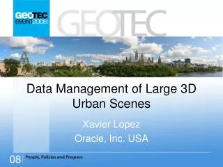
Data Management of Large 3D Urban Scenes Xavier Lopez Oracle, Inc. USA
3D Data Management <Insert Picture Here> • Technology Drivers • Use Cases for 3D Data Management • Overview of Spatial Databases • Wrap-up
Technology & Business Drivers • Massive new sensor hardware capabilities • Automated Data Capture / Model Creation (sensors) • Lidar (point clouds), automated photogrammetry • 3D data coming into mainstream • Mass Market: Consumer-focused systems • Benefit from IT scalability, security, and reliability • Managing a 3D data enterprise workflow • Improve performance and scalability of existing workflows • Bridging gap between point cloud surveys, GIS, CAD, BIM • Files to Databases
Challenges: Managing Point Clouds • Robust Data Management Challenges: • High Density LIDAR: Sub-meter point spacing (billions of points) • Combine with multi-spectral gridded data (terabytes of data) • Versioning, Archiving (terabytes, petabytes) • Back-up/recovery • Data Transformation • LIDAR point filtering, visualization, analysis • Surfaces and 3D vector models • Attribute Data Integration • Leverage Grid computing, clustered servers • Visualization & Analytics • Integrate 3D models into business workflows • Associate 3D objects/features to attributes • Spatial query across point cloud features
What do Spatial Databases Bring? • Scalability: Large seamless 3D scenes: Terabytes • Fast Retrieval: Geospatial Indexes on 3D point clouds • Partitioning: Manage large seamless scenes • Grid computing: Massive Data processing • Interoperability: Fuse aerial imagery, close-range airborne, ground video/LIDAR, 2D vector models • Spatial analysis: traditional GIS queries on 3D scenes • Transactional Updates • Enterprise Integration: Integrate 3D models with business information • Versioning and Long Transaction Support: • Data security, access control, encryption, authent. • Open: Support by third party 3D viz and analysis tools
Creating Value Added Data Products CAD/BIM server TIN server Point Cloud Repository 3D Model server Image server
Spatial DBMS in a Workflow Dissemination & Exploitation Data Collection Production LIDAR Surveys Photogrammetry Aerial Photos Satellite Imagery COTS Scenes CAD Designs Model/Scene Generation Image Texture Wrapping Versioning Editing/Updates Quality Control Volumetric Analysis 3D Mapping Fly Through 3D analysis Engineering Design Predictive Analysis Navigation Systems CAD Ortho-Photos LIDAR Spatial RDBMS
GIS Analytical Modeling & Simulation Flood Plain Analysis Petroleum Exploration
CAD Infrastructure Design(Super Models) • Courtesy Parsons Brinckerhoff
<Insert Picture Here> Overview: Spatial Databases
Customer Requirements • Enterprise RDBMS to manage ALL geospatial types • 2D, 3D, Rasters, Networks, Topology, Attributes • Native type support, indexing, and analysis • Support 2D & 3D coordinate systems support • Standards based: SQL, Java, .NET • Addresses large volumes of 3D point data • Building City models (Collada, CityGML) • Laser scanning (LIDAR, sonar) • Geo-engineering (CAD) • Surfaces (TINS, DEMS) • Addresses range of 3D application domains • City Modeling, environmental analysis • Real Estate, asset management • Personal navigation • VR, gaming, simulation
Spatial Database Capabilities Spatial Analysis • Spatial Indexing Spatial Data Types Spatial DBMS Fast Access to Spatial Data All Location/Spatial Data Stored in the Database Spatial Access Through SQL
Spatial Databases: Managing all Geodata Types Networks (Highway network) Parcels (polygons) 3D Models (Buildings) Spatial DBMS Data Lidar (Point Clouds) Imagery (Satellite) Structured Networks/Boundaries (persistent topology)
<Insert Picture Here> Oracle 11g Spatial 3D Capabilities
3D Functionality in RDBMS • SDO_GEOMETRY (3D) • SDO_TIN • SDO_POINT_CLOUD Types Building Models,.. Efficient Storage Query Analysis Surface Modeling 3D COORDINATE SYSTEMS Scene, Object Modeling
3D Spatial Data Types • Simple and composite Solids • Solids are composed of closed surfaces • It has to have one outer surface and one or more interior surfaces • Cube is an example of a simple solid • A pyramid is another example of a simple solid • Composite solids: formed by multiple solids • Always define a single contiguous volume
Point Clouds: LIDAR • Large volumes of point data acquired by sensors • LIDAR (Light Detection and Ranging) • Seismic sensors • Millions of points used to model a scene • New data type introduced to efficiently manage this type of point data • TIN to create triangulation of such points
TINs: Triangulated Irregular Networks • Vector-based topological data model represents terrain/surface • Contain a network of irregularly spaced triangles • 3D surface derived from irregularly spaced points • Each sample point has an x, y, z or surface value
Query, Analysis of 3D Data • Given a 3D Geometry as Query, Identify data geometries that • Intersect the Query (SDO_ANYINTERACT) • Within specified distance from Query (SDO_WITHIN_DISTANCE) • Nearest to Query (SDO_NN) • Analysis Functions • Relationship: Geometry-Geometry Intersection • Length, Area, Volume Analysis • Validation of 3D Geometry: Is Solid ‘closed’ ? • Extrusion of 2-D Footprint to a 3-D Solid by specifying heights • Association of Textures with LabelStrings of Geometry Elements • Extraction of Elements using LabelString of Geometry • Conversion Functions to/from GML, to KML/Collada, from CityGML
3D Coordinate Systems • Oracle Spatial 11g supports the following EPSG types • Vertical Coordinate Systems: Essentially 1-d coordinate system (w.r.t sea-level etc.) • Geocentric: 3-d Cartesian • Geographic-2d, Projected-2d: 2-d Ellipsoidal • Geographic-3d: 3-d Ellipsoidal • Compound Coordinate System • Combines • A Vertical Coordinate System with • Either Geographic-2D or Projected-2D Coordinate System • Support transform between different 3D Coordinate Systems
Summary • Support large seamless 3D scenes: Terabytes • Provide bridge to fuse 3D, 2D, CAD, raster data • Fusion of aerial imagery, close-range airborne and ground video/LIDAR, with 2D vector models • Integrated support for Web delivery • Spatial analysis: GIS queries on 3D scenes • Transactional Updates • Enterprise Integration: Integrate 3D models with business information. • Data security, access control, encryption, authent. • Open: Support by 3D viz and analysis tools