Virtual Design & Construction: 3D Information Modeling
Virtual Design & Construction: 3D Information Modeling. Ron Gant, P.E., Bentley Systems, Inc. The Challenge. B uilding I nformation M odeling Civil I nformation M odeling But really……. Information Modeling. Information Modeling. Everything is an extract of…. Physical 3D design model

Virtual Design & Construction: 3D Information Modeling
E N D
Presentation Transcript
Virtual Design & Construction: 3D Information Modeling Ron Gant, P.E., Bentley Systems, Inc.
The Challenge • Building Information Modeling • CivilInformation Modeling • But really……. Information Modeling
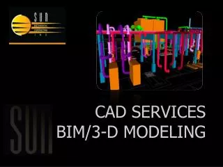
Information Modeling • Everything is an extract of…. • Physical 3D design model • Digital Terrain Model • Plan Set (construction or fabrication) • Quantities • Machine Guidance • Clash detection . . .
Information Modeling • Business drivers for Civil-Transportation • PPP (Public-Private Partnerships) • Design Build • Machine Guidance • Clash Detection • Improved profitability • Life Cycle Management • Construction simulation • Paradigm shift for Civil Engineers • Not just about construction • Life Cycle data management
The Challenge • Vertical modeling in a horizontal world • Technical challenges • Horizontal scale of projects • Grid to ground • Convergence of meridians • Linear stationing vs. grid • State Plan or geodetic vs. local coordinate system • U.S. Survey Foot • One International Foot equals 0.999998 U.S. Survey feet • Professional challenges • No state registration board accepts the model, yet • Paper rules • Model stamping, security Ronald E. Gant 55849
Comparisons Building Advantages Civil Challenges Lots of standards – 50 DOTs Geo-coordination Linear or State Plane Traditional workflows • AIA approved, National CAD Standards • Physical scale • Coordinate systems • Willingness to change
What Makes Civil Information Special • Some cases, Nothing • Drainage • Survey • Site
What Makes Civil Information Special • But working with the DOT • Pay Item Databases
What Makes Civil Information Special • But working with the DOT • Pay Item Databases
Information Modeling Public Involvement InRoads GEOPAK MX Field Reporting Quantities Collaboration Shop Drawings Project Survey / Layout Civil Information modeling Scheduling 3D Visualization Machine Controls External Vendors and Suppliers Constructability Collaboration Field Working Drawings Owner Project Deliverables As-Built Drawings
Things to look for in your Information Modeling Solution • Geo-Coordination • Geometric Precision • Project Collaboration • Project History
Mission of TIG – AMG • Dedicated to sharing high-payoff, market-ready technologies among transportation agencies across the U.S. • Promote technological advancements • Sponsor technology transfer efforts • Encourages implementation of those advancements
AASHTO –TIG Team • Partnering with the Contracting Community • Contractors on team • Working with AGC and ARTBA
AASHTO –TIG Partners • Working with Governmental Groups • FWHA on TIG team • TRB • AASHTO committees • Partnering with private sector • Software developers • Hardware vendors
Thank you Ron Gant, P.E., Bentley Systems, Inc.