Download
1 / 60
600 likes | 621 Views
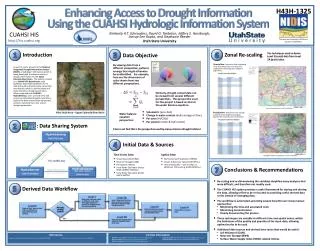
The project focuses on data services, observatories, science advancement, and education in hydrology. It aims to streamline data access, support digital watersheds, and improve hydrologic analysis.

E N D
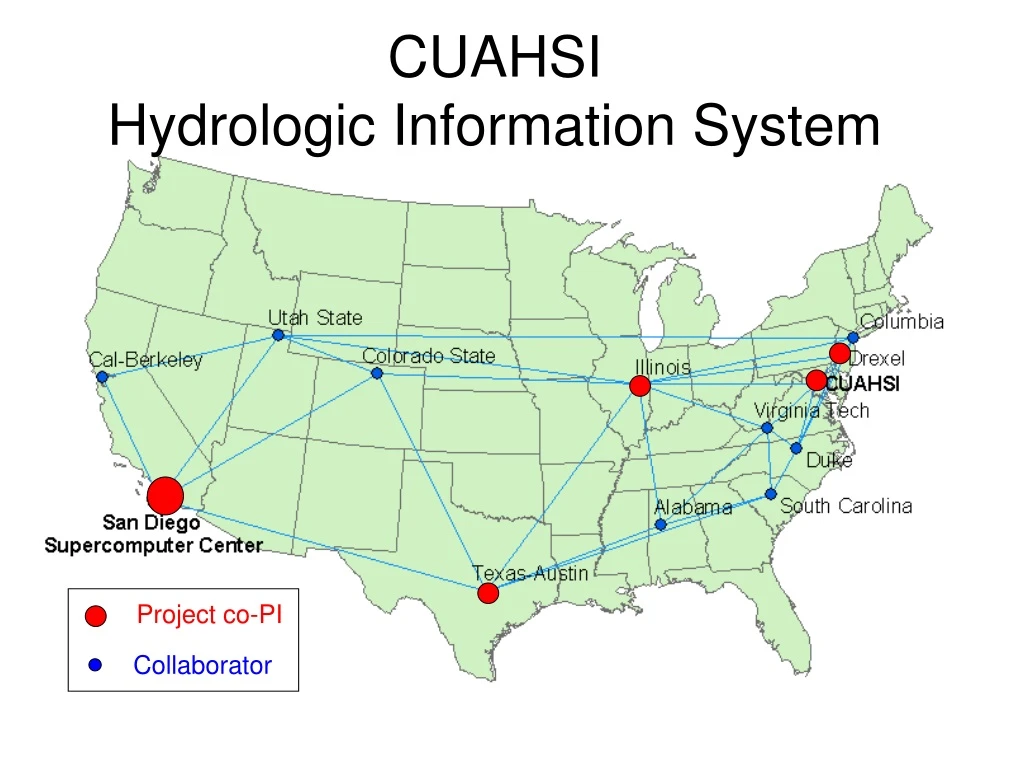
Project co-PI Collaborator CUAHSI Hydrologic Information System
Environmental Cyberinfrastructure • Part of NSF Cyberinfrastructure program • CUAHSI Hydrologic Information Systems is one of several pilot projects – CUAHSI, CLEANER, ORION, NEON, GEON, …..
HIS Goals • Data Services for Hydrologists – get me the data I want quickly and painlessly • Support for Observatories – data structure for Digital Watersheds • Advancement of Hydrologic Science – flux coupler, HydroObjects • Hydrologic Education – how to get data into the classroom
Digital Watershed Hydrologic Observation Data Geospatial Data (GIS) (Relational database or delimited ascii) Digital Watershed Remote Sensing Data Weather and Climate Data (EOS-HDF) (NetCDF)
CUAHSI HIS Overview • HIS User Assessment • Hydrology Data Portal • Digital Watershed • Hydrologic Analysis
CUAHSI HIS Overview • HIS User Assessment • Hydrology Data Portal • Digital Watershed • Hydrologic Analysis
HIS User Assessment • First survey done for HIS White Paper (2003) • HIS Symposium in March – 4 institutional surveys and a survey of participants • CUAHSI Web Surveyor – developed by David Tarboton and Christina Bandaragoda (75 responses from 38 institutions) • Summary paper circulated by email yesterday
Please rank these four HIS service categories for helping you. Value Score (counting 4 for first, 4 for second, 2 for third and 1 for fourth). Conclusion: Data services are the highest priority
Which operating systems do you use for your research? If you use more than one operating system, select all that apply.
Please indicate one dataset that you believe would most benefit from increased ease of access through a Hydrologic Information System (HIS). Conclusion: EPA STORET Water Quality, Streamflow and Remote Sensing Data are perceived to be able to benefit from improved access. I am surprised USGS streamflow is up there. Is this an indication of importance over difficulty?
Which of the following data analysis difficulties are most important for HIS to address? Conclusion: High priorities are: - Data formats - Metadata - Irregular time steps Value Score (counting 3 for first, 2 for second and 1 for third).
How we use software (Web Surveyor) • Programming (85% of respondents): Fortran, C/C++, Visual Basic • Data Management (93%): Excel, MS Access • GIS (93%): ArcGIS • Mathematics/Statistics (98%): Excel, Matlab, SAS, variety of other systems • Hydrologic models (80%): Modflow, HEC models • A general, simple, standard, and open interface that could connect with many systems is the only way to accommodate all these
CUAHSI HIS Overview • HIS User Assessment • Hydrology Data Portal • Digital Watershed • Hydrologic Analysis
Hydrologic Observations Data Model Relationships Review conducted by David Tarboton with 22 responses – redesign of this model is now being done
Plot from the Hydrology Data Portal Produced using a CUAHSI Hydrology Web Service: getDailyStreamflowChart
CUAHSI Hydrology Web Services for NWIShttp://water.sdsc.edu/HydrologicTimeSeries/NWIS.asmx
Documentation: getDailyStreamflowChart https://webspace.utexas.edu/jgoodall/HydrologicTimeSeriesWebServices.htm
Applications and Services Web application: Data Portal • Your application • Excel, ArcGIS, Matlab • Fortran, C/C++, Visual Basic • Hydrologic model • ……………. • Your operating system • Windows, Unix, Linux, Mac Internet Web Services Library
CUAHSI HIS Overview • HIS User Assessment • Hydrology Data Portal • Digital Watershed • Hydrologic Analysis
Issues • Variety of data sources, formats, and data models used in hydrologic sciences • Size and scale of data sources – observation databases, terrain models, NEXRAD, river networks, etc. • Disconnection between geospatial and temporal information systems
Digital Watershed How can hydrologists integrate observed and modeled data from various sources into a single description of the environment?
Digital Watershed Hydrologic Observation Data Geospatial Data (GIS) (Relational database or delimited ascii) Digital Watershed Remote Sensing Data Weather and Climate Data (EOS-HDF) (NetCDF) A digital watershed is a synthesis of hydrologic observation data, geospatial data, remote sensing data and weather and climate data into a connected database for a hydrologic region
Digital Watershed:An implementation of the CUAHSI Hydrologic Data Model for a particular region Created first for the Neuse basin
Neuse Atmospheric Water • Daily precipitation data from NCDC gages • Nexrad daily rainfall rasters • Land surface – atmosphere fluxes from North American Regional Reanalysis of climate
Streamflow, water quality hydrologic observational data GIS: River network, water bodies, watersheds, monitoring points Land cover, soils, MODIS remote sensing (Praveen Kumar) Neuse Surface Water MODIS Terrain and Land Cover
http://neuse.crwr.utexas.edu/ ArcIMS Web Server displaying data compiled in Neuse HO Planning Study
Neuse Basin: Coastal aquifer system Section line Beaufort Aquifer * From USGS, Water Resources Data Report of North Carolina for WY 2002
Neuse Groundwater Geovolumes of hydrogeologic units from US Geological survey (GMS)
Create a 3 dimensional representation Geovolume Each cell in the 2D representation is transformed into a 3D object Geovolume with model cells
Numerical Models Prediction HSPF Sensor Arrays NGDC NWS NCDC USGS NWIS NCEP Air-Q MM5 Individual Samples Data Centers Page 3 The Demands METADATA Drexel University, College of Engineering
Upper Hydrologic Ontology Hydrologic ProcessesSedimentation Many More Many More Many More Many More ARCHydro ISO 19115 Geospatial ISO 19108 Temporal Objects ISO 19103 Units/Conversion USGS Hydrologic Unit Code Page 21 Hydrologic Metadata We currently have What we need is Michael Piasecki is our expert in this subject! Ontology Examples Drexel University, College of Engineering
CUAHSI HIS Overview • HIS User Assessment • Hydrology Data Portal • Digital Watershed • Hydrologic analysis
Hydrologic Analysis Statistics and Hypothesis Testing Hydrologic Process Modeling Digital Watershed Visualization Data Mining and Knowledge Discovery
Data Driven Discovery Tools Praveen Kumar is our expert on this subject!
Time, T D Space, L Time Series Analysis Variables, V D Geostatistics Multivariate analysis Data to Knowledge D2K Jan Feb 4-D Data Model Image to Knowledge i2K Data Files
Hydrologic Flux Coupler Hydrologic Fluxes and Flows Digital Watershed(Atmospheric, surface and subsurface water) We want to do water, mass, energy and water balances
HydroVolumes Take a watershed and extrude it vertically into the atmosphere and subsurface A hydrovolume is “a volume in space through which water, energy and mass flow, are stored internally, and transformed”
Watershed Hydrovolumes Hydrovolume Geovolume is the portion of a hydrovolume that contains solid earth materials USGS Gaging stations
Atmospheric science – hydrology • Weather and climate fields are the drivers – continuous in space and time across the nation • Local watersheds are the reactors – each behaving according to its location and characteristics
GeoTemporal Reference Frame • A defined geospatial coordinate system for (x,y,z) • A defined time coordinate system (UTC, Eastern Standard Time, ….) • A set of variables, V • Data values v(x,y,z,t) Time, t v – data values Space (x,y,z) Data Cube Variables, V