Download
1 / 12
120 likes | 140 Views
Explore rural settlement patterns, historical settlement types, town functions, and town development over time using Ordnance Survey maps. Sample questions provided for analysis and sketching maps. Learn about settlement aspects, rural patterns, town functions, and town development reasons.

E N D
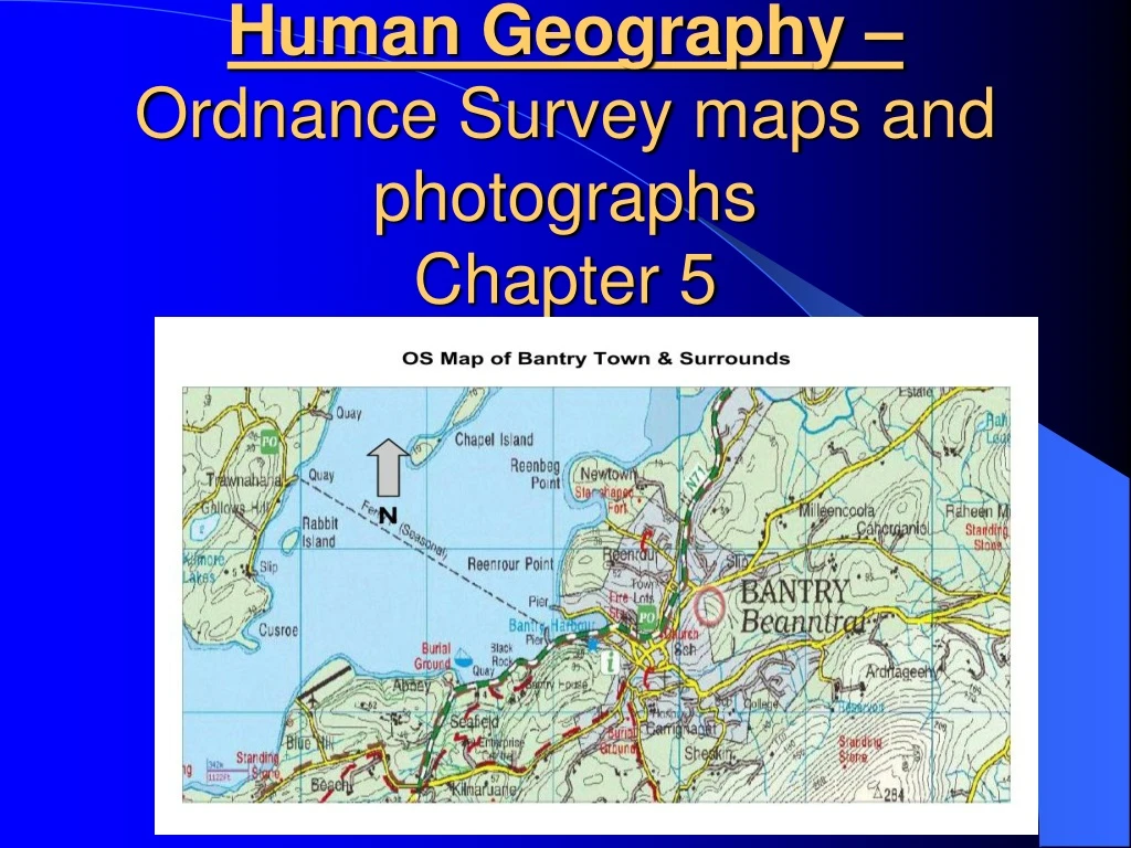
Human Geography –Ordnance Survey maps and photographs Chapter 5
Chapter 5 - Students can be asked about the following: • The patterns of rural settlement • The different types of historical settlement in an area • The functions of a town or city • The development of a town or city over time
Possible Questions - • Examine the OS map. Using evidence from the OS map, describe and explain three different aspects of historic settlement. • Describe and explain three patterns of rural settlement evident in the map. • Examine the development of any 3 functions of the town of ____, both past and present using evidence from the map to support your answer.
Possible Questions - 4. Draw a sketch map of the OS map of ______ and include the following; 5. Study the OS map and explain 3 reasons why the town of _____ developed at this location. 6. Study the OS map & aerial photo, examine any 3 functions of the town of _______. 7. Using the OS map & aerial photo, explain 3 reasons for the development of the town at this site.
1. Examine the OS map. Using evidence from the OS map, describe and explain 3 different aspects of historic settlement. How to answer question: • Pick 3 different eras of settlement from the map, eg. Stone Age, Bronze Age, Iron Age, Pre-Christian period, Early Christian Norman settlement etc. • Give examples from each of these periods and give the location by giving a 6 figure grid reference, example a castle from the Norman period. • Finally explain each type of settlement.
2. Describe and explain three patterns of rural settlement evident in the map. How to answer question: • Pick 3 different patterns of rural settlement from the map. • Explain each type and give location and grid reference.
Study the OS map and explain 3 reasons why the town of _____ developed at this location. How to answer question: • Talk about three reasons the town developed. Use the following 3 headings: • Tourist attractions • Transport • Other services • You could also discuss about its location if the area had a port/harbour or flat land, river etc.
Study the OS map & aerial photo, examine any 3 functions of the town of _______. How to answer question: • Discuss 3 functions using RICEPOTS; • Residential, recreational, religious, industrial, commercial, educational, port, open space, transport, services • Other (past) functions that can be discussed are bridging point and defensive.
Draw a sketch map of the OS map of ______ and include the following; • Draw frame half the scale of original map • Divide into 3 evenly-spaced rows and columns • Title and sub-zone letter • Symbol for North • State scale – 1: 50,000 map, half scale is 1:100,000 • Mark coastline and major lakes and town. • Mark and label only what you have been asked for • Use a key to explain your colour code and symbols & give map a title
October Mid Term Exam Human geography topics covered to date. • Topics/possible questions will include; • Population; • Population density & distribution • Causes and effects of overpopulation • Migration; • Migration – donor & receiver countries • Migration - Ethnic & religious issues • Changing patterns of Irish migration • Rural to urban migration – impact on developed countries (Ireland) and impact on developing countries (Brazil).
October Mid Term Exam Settlement – Map Questions; Describe and explain three different aspects of historic settlement. Describe and explain three patterns of ruralsettlement Examine the development of any 3 functions of the town of ____. Draw a sketch map of the OS map of ______ and include the following; Explain 3 reasons why the town of _____ developed at this location.
October Mid Term Exam You will be given 1 structured question with an A,B and C part. The A part will be short and the B and C is long. Ordinary level is worth 100 marks and Higher 80 marks You will be 40 minutes to answer the question. Answer your question in your geography copy. This will be taken up and should include all your sample answer questions.


