
Geography: Spatial Thinking and Skills
E N D
Presentation Transcript
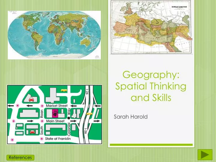
Geography: Spatial Thinking and Skills Sarah Harold References
Geography: Spatial Thinking and SkillsSocial Studies Grade 3 Standards: Physical and political maps have distinctive characteristics and purposes. Places can be located on a map by using the title, key, alphanumeric grid and cardinal directions. Students will help locate features on a map and label the specific parts.
MENU • Title and Author • Standards • Website/Video/Audio • Overview of Maps • Vocab • Types of Maps • Compass Rose • Map Legend • Scale • Review • Project • Citations
Website/Video Video: http://www.youtube.com/watch?v=gbFIhmTd3iY Website: http://www.kidsgeo.com/geography-for-kids/0025-usefullness-of-maps.php
Maps • Maps tell you the location of places or objects. They can tell you where a building is, where a road is, or even a weather pattern. • Maps include a COMPASS ROSE, a MAP LEGEND, and a SCALE.
History of the Map • The oldest map known of is about 5,000 years old. • Maps were made by hand until recently. • In the beginning, maps had a lot of mistakes. • Cartography is the art of making maps.
Vocab • MAP- A model of land such as towns, countries, or the world. • COMPASS ROSE-A diagram that shows direction. • MAP LEGEND-A table of symbols that show what things stand for on a map. • SCALE- A line that allows you to measure distances on a map.
Political Map Shows only boundaries and territories like countries, cities, or states.
Physical Map Shows the same thing as a political map, but focuses on landforms like deserts, lakes, forests, mountains, or monuments.
Weather Map Shows the weather over a large area.
Compass Rose NEVER EAT SOGGY WHEAT! NORTH WEST EAST Also called Cardinal Directions SOUTH
Is the School NORTH or SOUTH of the Hospital? Is the Post Office EAST or WEST of the Fire Station? What direction is the Police Station if the starting point is the Hospital? Is the Library NORTH or SOUTH on the map? Is the Library EAST or WEST on the map?
Map Legend If you see a camp fire on the map, there’s a campground in that location. Wherever a tree is on the map, there’s a forest.
Where is the FOREST? Where is the FERRY? What is the red line circling the island?
Scale The distance from 0 to 1 is 1 mile. The distance from 0 to 4 is 4 miles. You can measure the distance on a map from one point to another using a SCALE.
How far is the Post Office to the Fire Station? How far is the Police Station to the Hospital? How far is the Hospital to the School?
Review • Maps are used to find location of certain things whether it be a building, park, lake, road, anything. • They help you when your lost. • Maps include a COMPASS ROSE (N,S,E,W), a MAP LEGEND, and a SCALE. • Maps have been around for thousands of years.
Project • Partners will be assigned. • A plain map will be given to each group. • Draw places on it (rivers, buildings, forests). • Create a Map Legend and a compass for your map. • Be creative! • Follow the rubric to make sure you get all the credit!
Picture Citations • Atmospheric Pressure: Definition, Effects & Quiz. (n.d.). Educaton Portal. Retrieved November 4, 2013, from http://education-portal.com/academy/lesson/atmospheric-pressure-definition-effects-quiz.html#lesson • Compass Rose clip art. (n.d.). - vector clip art online, royalty free & public domain. Retrieved November 4, 2013, from http://www.clker.com/clipart-13694.html • File:1730 Stoopendaal Map of the World in two Hemispheres - Geographicus - WereltCaert-stoopendaal-1730.jpg. (n.d.). Wikimedia Commons. Retrieved November 4, 2013, from http://commons.wikimedia.org/wiki/File:1730_Stoopendaal_Map_of_the_World_in_two_Hemispheres_-_Geographicus_-_WereltCaert-stoopendaal-1730.jpg • File:Baylonianmaps.JPG. (n.d.). Wikipedia. Retrieved November 4, 2013, from http://en.wikipedia.org/wiki/File:Baylonianmaps.JPG • File:Dissolution of Austria-Hungary.png. (n.d.). Wikimedia Commons. Retrieved November 4, 2013, from http://commons.wikimedia.org/wiki/File:Dissolution_of_Austria-Hungary.png • File:Map of USA with state names.svg. (n.d.). - Wikimedia Commons. Retrieved November 4, 2013, from http://commons.wikimedia.org/wiki/File:Map_of_USA_with_state_names.svg • File:Maps-roman-empire-peak-150AD.jpg. (n.d.). Wikimedia Commons. Retrieved November 4, 2013, from http://commons.wikimedia.org/wiki/File:Maps-roman-empire-peak-150AD.jpg • File:Simple compass rose.svg. (n.d.). - Wikimedia Commons. Retrieved November 4, 2013, from http://commons.wikimedia.org/wiki/File:Simple_compass_rose.svg • Grade 3 Geography Preview. (n.d.). Grade 3 Geography Preview. Retrieved November 4, 2013, from http://www.linkstolearning.com/grade_3_geography_preview.htm • History of maps and cartography. (n.d.). History of maps and cartography. Retrieved November 4, 2013, from http://academic.emporia.edu/aberjame/map/h_map/h_map.htm • Illustration of Simple Elegant Compass Rose. (n.d.). Illustration Of Simple Elegant Compass Rose. Vector Clip Art To Download at FeaturePics.com. Retrieved November 4, 2013, from http://www.featurepics.com/online/Simple-Elegant-Compass-Rose-878281.aspx • Index of Ohio-related articles. (2013, April 11). Wikipedia. Retrieved November 4, 2013, from http://en.wikipedia.org/wiki/Index_of_Ohio-related_articles • Map Keys And Map Scale - Geography For Kids - By KidsGeo.com. (n.d.). Map Keys And Map Scale - Geography For Kids - By KidsGeo.com. Retrieved November 4, 2013, from http://www.kidsgeo.com/geography-for-kids/0027-map-key-and-scale.php • Map Scale. (n.d.). Map Scale. Retrieved November 4, 2013, from http://www.personal.psu.edu/zwr5027/art003/project4/page3.html • Maps. (n.d.). Computer Kiddos Wiki /. Retrieved November 4, 2013, from http://computerkiddoswiki.pbworks.com/w/page/16304767/Maps • Portal:Atlas. (2013, January 11). Wikipedia. Retrieved November 4, 2013, from http://en.wikipedia.org/wiki/Portal:Atlas • Tag Archives: Neighborhoods. (n.d.). Slow Family. Retrieved November 4, 2013, from http://www.slowfamilyonline.com/tag/neighborhoods/ • United States Intermediate Political Classroom Map from Academia Maps. (n.d.). United States Intermediate Political Classroom Map from Academia Maps. Retrieved November 4, 2013, from http://www.worldmapsonline.com/academia/academia_us_intermediate_political_map.htm • political and physical maps and definitions. (n.d.). political and physical maps and definitions. Retrieved November 4, 2013, from http://www.worldatlas.com/aatlas/infopage/politphys.htm
Website/Video Citations • Teacher and the Rockbots - How To Read A Map. (2008, January 18). YouTube. Retrieved November 5, 2013, from http://www.youtube.com/watch?v=gbFIhmTd3iY • Usefulness of Maps - Geography For Kids - By KidsGeo.com. (n.d.). Usefulness of Maps - Geography For Kids - By KidsGeo.com. Retrieved November 5, 2013, from http://www.kidsgeo.com/geography-for-kids/0025-usefullness-of-maps.php