Download
1 / 18
180 likes | 353 Views
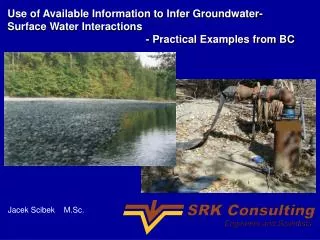
Use of Available Information to Infer Groundwater-Surface Water Interactions - Practical Examples from BC. Jacek Scibek M.Sc. OUTLINE:. BC observation well network – examples of water levels and interactions with surface water

E N D
Use of Available Information to Infer Groundwater-Surface Water Interactions - Practical Examples from BC Jacek Scibek M.Sc.
OUTLINE: • BC observation well network • – examples of water levels and interactions with surface water • Delineating areas of aquifers where GUDI wells are likely to occur • Aquifer heterogeneity
Cassidy Aquifer (Nanaimo) Example 1: Nanaimo River gauge Obs 330 Nanaimo River Obs 312 CASSIDY Obs 228 N
Obs 330 Nanaimo River Obs 312 Obs 228
Obs 330 Obs 312 Recovery event Wellfield drawdown
Nanaimo River Obs 312
Wells near rivers are potentially GUDI Obs 330 Obs 312 Nanaimo River Obs 228
318 River Gauge 211 204 205 Cowichan River Valley (Duncan) Example 2:
Rough sketch of area of interaction of groundwater with surface water
Grand Forks Valley Example 3: Obs well Kettle River
Effect of aquifer heterogeneity on connection with surface water: head difference map = Aquifer Scenario 1 – Aquifer Scenario 2 (homogeneous K) (heterogeneous K) 0 m River recharging aquifer + 0.5 m - 0.5 m Aquifer discharging to river
Fraser Valley (Abbotsford) Example 4: No GUDI wells up-gradient from rivers? How far? Stream leakage?
CONCLUSIONS: • Available information: • often not used • significance missed • objective is to avoid expensive tests done that confirm what is already known • BC observation well network • free source of data • most wells too close to rivers to help characterize aquifer behaviour