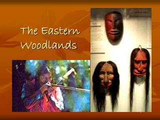
Region 1: Pineywoods
140 likes | 444 Views
Rolling terrain covered with pines and oaks, and rich bottomlands with tall hardwoods, characterize the forests of the east Texas Pineywoods. This region is part of a much larger area of pine-hardwood forest that extends into Louisiana, Arkansas, and Oklahoma.

Region 1: Pineywoods
E N D
Presentation Transcript
Rolling terrain covered with pines and oaks, and rich bottomlands with tall hardwoods, characterize the forests of the east Texas Pineywoods. This region is part of a much larger area of pine-hardwood forest that extends into Louisiana, Arkansas, and Oklahoma. The average annual rainfall of 36 to 50 inches is fairly uniformly distributed throughout the year, and humidity and temperatures are typically high. The soils of the region are generally acidic and mostly pale to dark gray sands or sandy loams. Elevations range from 200 to 500 feet above sea level. The Pineywoods region can be described as pine and pine-hardwood forests with scattered areas of cropland, planted pastures, and native pastures. Timber and cattle production are important industries in the region. Farms and ranches are relatively small in size compared to the state average. Longleaf pine forests once dominated the southeastern part of the Pineywoods. A few pockets of longleaf pine may still be seen today. Mixed pine-oak forests occur to the west and north of the longleaf pine area. Dominant trees include loblolly pine, blackjack oak, and post oak. Hardwood forests of sweetgum, magnolia, tupelo, elm, and ash occur in the lowlands. Swamps are common and are most outstanding in the southern part of the pine-oak forest. Region 1: Pineywoods
Region 2: Oak Woods and Prairies The Oak Woods and Prairies region is a transitional area for many plants and animals whose ranges extend northward into the Great Plains or eastward into the forests. This region, sometimes called the Cross-Timbers, was named by early settlers, who found belts of oak forest crossing strips of prairie grassland. Average annual rainfall averages 28 to 40 inches per year. May or June usually brings a peak in monthly rainfall. Upland soils are light colored, acidic sandy loam or sands. Bottomland soils may be light brown to dark gray and acidic with textures ranging from sandy loams to clays. The landscape of the region is gently rolling to hilly and elevations range from 300 to 800 feet above sea level. The region can be described as oak savannah, where patches of oak woodland are interspersed with grassland. Cattle ranching is the major agricultural industry in the Oak Woods and Prairies. Introduced grasses such as bermuda grass are grazed along with forage crops and native grasslands.
Region 3: Blackland Prairies The Blackland Prairies region is named for the deep, fertile black soils that characterize the area. Blackland Prairie soils once supported a tallgrass prairie dominated by tall-growing grasses such as big bluestem, little bluestem, indiangrass, and switchgrass. Because of the fertile soils, much of the original prairie has been plowed to produce food and forage crops. The average annual rainfall ranges from 28 to 40 inches. May is the peak rainfall month for the northern end of the region; however, the south-central part has a fairly uniform rainfall distribution throughout the year. Typically, soils are uniformly dark-colored alkaline clays, often referred to as "black gumbo," interspersed with some gray acidic sandy loams. The landscape is gently rolling to nearly level, and elevations range from 300 to 800 feet above sea level. Crop production and cattle ranching are the primary agricultural industries.
Region 4: Gulf Coast Prairies and Marshes The Gulf Coast Prairies and Marshes region is a nearly level, slowly drained plain less than 150 feet in elevation, dissected by streams and rivers flowing into the Gulf of Mexico. The region includes barrier islands along the coast, salt grass marshes surrounding bays and estuaries, remnant tallgrass prairies, oak parklands and oak mottes scattered along the coast, and tall woodlands in the river bottomlands. Average annual rainfall varies from 30 to 50 inches per year distributed fairly uniformly throughout the year. The growing season is usually more than 300 days, with high humidity and warm temperatures. Soils are acidic sands and sandy loams, with clays occurring primarily in the river bottoms. Native vegetation consists of tallgrass prairies and live oak woodlands. Brush species such as mesquite and acacias are more common now than in the past. Although much of the native habitat has been lost to agriculture and urbanization, the region still provides important habitat for migratory birds and spawning areas for fish and shrimp.
Region 5: Coastal Sand Plains The Coastal Sand Plains is fairly level with elevations less than 150 feet above sea level. Average annual rainfall is 24 to 28 inches per year and the soils are primarily windblown sands. The vegetation can be described as tallgrass prairie with live oak woodlands, mesquite savannah, and salt marshes. Woody vegetation is more extensive now than in pre-settlement times. Most of this region is grazed by cattle. In the past, the Coastal Sand Plains were called the "Wild Horse Prairie" because of the large herds of feral horses roaming here in the 19th century.
Region 6: South Texas Brush Country The South Texas Brush Country is characterized by plains of thorny shrubs and trees and scattered patches of palms and subtropical woodlands in the Rio Grande Valley. The plains were once covered with open grasslands and a scattering of trees, and the valley woodlands were once more extensive. Today, the primary vegetation consists of thorny brush such as mesquite, acacia, and prickly pear mixed with areas of grassland. The average annual rainfall of 20 to 32 inches increases from west to east. Average monthly rainfall is lowest during winter, and highest during spring (May or June) and fall (September). Summer temperatures are high, with very high evaporation rates. Soils of the region are alkaline to slightly acidic clays and clay loams. The deeper soils support taller brush, such as mesquite and spiny hackberry, whereas short, dense brush characterizes the shallow caliche soils. Although many land changes have occurred in this region, the Brush Country remains rich in wildlife and a haven for many rare species of plants and animals. It is home for semi-tropical species that occur in Mexico, grassland species that range northward, and desert species commonly found in the Trans-Pecos. Livestock grazing and crop production are the principal agricultural land uses.
Region 7: Edwards Plateau The Edwards Plateau region comprises an area of central Texas commonly known as the Texas Hill Country. It is a land of many springs, stony hills, and steep canyons. The region is home to a whole host of rare plants and animals found nowhere else on earth. Average annual rainfall ranges from 15 to 34 inches. Rainfall is highest in May or June and September. Soils of the Edwards Plateau are usually shallow with a variety of surface textures. They are underlain by limestone. Elevations range from slightly less than 100 feet to over 3,000 feet above sea level. Several river systems dissect the surface, creating a rough and well-drained landscape. The limestone of the Edward's Plateau is honeycombed with thousands of caves. Beneath the eastern edge of the Plateau lies a hidden world of underground lakes known as the Edwards Aquifer. This precious water resource also is home to a number of curious creatures, such as the blind salamander. Today, the Edwards Plateau is characterized by grasslands, juniper/oak woodlands, and plateau live oak or mesquite savannah. Open grasslands and savannahs were more common in presettlement times than they are today. Ranching is the primary agricultural industry in the region.
Region 8: Llano Uplift The Llano Uplift is also known as the central mineral region. Although surrounded by the Edwards Plateau region, the Llano Uplift is distinguished by its unique geology. Home to some of the oldest rocks in Texas, the central mineral region contains unique minerals and rock formations. The region is characterized by large granite domes, such as Enchanted Rock near Fredericksburg. Rainfall averages about 24 to 32 inches per year, peaking in May or June and September. The landscape is rolling to hilly and elevation range from 825 to 2,250 feet above sea level. Soils are predominantly coarse textured sands, produced from weathered granite over thousands of years. Native vegetation consists of oak-hickory or oak-juniper woodlands, mesquite-mixed brush savannah, and grasslands. Open grassland and savannah were once more common than they are today. Ranching is the predominant agricultural industry.
Region 9: Rolling Plains Several Texas rivers begin in the gently rolling hills and broad flats of the Rolling Plains. These rivers and their numerous tributaries are responsible for the rolling character of the land. The rivers have cut canyons that shelter some plants and animals typical of the Rocky Mountains. Average annual rainfall is 20 to 28 inches, with peaks in May and September. A summer dry period with high temperatures and high evaporation rates is typical. Soils vary from coarse sands along outwash terraces adjacent to streams, to tight clays and shales. Soil reaction is neutral to slightly alkaline. Elevations vary from 800 to 3,000 feet above sea level. The original prairie grasslands included tall and mid-grasses such as bluestems and gramas. Buffalo grass and other shortgrasses have increased under heavy, uncontrolled grazing. Mesquite is a common invader on all soils. Much of the Rolling Plains today can be described as a mesquite-shortgrass savannah. Stream floodplains are dominated by various hardwood species, and juniper is common on steep slopes along rivers. Steep slopes, cliffs, and canyons occurring just below the edge of the High Plains Caprock comprise the Escarpment Breaks area of the Rolling Plains. The Breaks are an ecotone or transition zone between the High Plains grasslands and the mesquite savannah of the Rolling Plains. Crop and livestock production are the major agricultural industries in this region.
Region 10: High Plains The High Plains region, together with the Rolling Plains, comprise the southern end of the Great Plains of the central United States. The High Plains is a relatively level high plateau, separated from the Rolling Plains by the Caprock Escarpment. Elevations range from 3,000 to 4,500 feet above sea level. Average annual rainfall is 15 to 22 inches. Rainfall is lowest in winter and mid-summer and highest in April or May and September or October. Extended droughts have occurred here several times this century. Surface texture of soils ranges from clays on hardland sites in the north to sands in the southern portion of the region. Caliche generally underlies these surface soils at depths of two to five feet. Native vegetation of the High Plains is shortgrass prairie dominated by buffalo grass. Although historically a grassland, mesquite and yucca have invaded parts of the region. Shinnery oak and sand sage are common invaders on sandy lands, and juniper has spread from the breaks onto the plains in some areas. Immense herds of buffalo and pronghorn antelope once thundered across vast prairies of blue grama and buffalo grass. Today, the plains are mostly irrigated cropland and the native vegetation includes more mesquite and juniper. Although much of the shortgrass prairie and the vast prairie dog towns are gone, large flocks of wintering waterfowl still come to the playa lakes (shallow, round depressions which spot the surface, sometimes covering more than 40 acres).
Region 11: Trans Pecos The Trans Pecos is perhaps the most complex of all the regions. It occupies the extreme western part of the state eastward generally to the Pecos River. This is a region of diverse habitats and vegetation, varying from the desert valleys and plateaus to wooded mountain slopes. Elevations range from 2,500 feet to more than 8,749 feet at Guadalupe Peak. Even the mountain ranges vary greatly in the environments they offer for plant and animal life. Some are characterized by volcanic rocks, others by limestone. Over most of the area average annual rainfall is less than 12 inches, but varies greatly from year to year and from lower to higher elevations. July and August are usually the higher rainfall months. Mountain outwash materials have formed the soils of the Trans Pecos. Surface textures and profile characteristics are varied. Soil reaction is generally alkaline. Due to the diversity of soils and elevations, many vegetation types exist in the region. The principal plant communities are creosote-tarbush desert scrub, desert grassland, yucca and juniper savannahs, and montane forests of pinon pine and oak. The various subregions reflect the diversity of the Trans Pecos. The Sand Hills area consists of shin oak and mesquite on wind-blown dunes. Flat-topped mesas and plateaus are intersected by steep-walled canyons and dry washes that comprise the Stockton Plateau. Soils with high salt content and gypsum dunes are typical of the Salt Basin area. The Desert Scrub subregion is an area of low rainfall and rapid drainage. Creosotebush flats with yucca, lechuguilla, and various small-leafed plants are common. The Desert Grassland area occurs in the central part of the region and is characterized by deeper soils with high clay content. Finally, the Mountain Ranges have higher rainfall and woody vegetation such as junipers, oaks, pinon pine, ponderosa pine, and Douglas fir. Ranching is the primary industry in the Trans Pecos region.
1. Pineywoods 2. Oak Woods and Prairies 3. Blackland Prairies 4. Gulf Coast Prairies and Marshes 5. Coastal Sand Plains 6. South Texas Brush Country 7. Edwards Plateau 8. Llano Uplift 9. Rolling Plains 10. High Plains 11. Trans Pecos
To calculate the square footage of the ecoregion, use the transparency grid. Place the grid over the ecoregion. Calculate the area of the map represented by each square in the grid. Devise a method for estimating the total land area shown. hint: if a grid square is half or more than half filled, count the square as land.