Download
1 / 22
220 likes | 455 Views
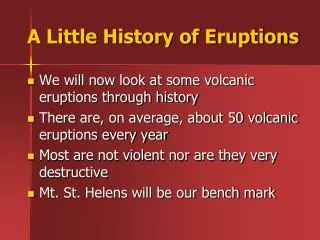
A Little History of Eruptions. We will now look at some volcanic eruptions through history There are, on average, about 50 volcanic eruptions every year Most are not violent nor are they very destructive Mt. St. Helens will be our bench mark. Historical Benchmark.

E N D
A Little History of Eruptions • We will now look at some volcanic eruptions through history • There are, on average, about 50 volcanic eruptions every year • Most are not violent nor are they very destructive • Mt. St. Helens will be our bench mark
Historical Benchmark • Mt. St. Helens is a good starting point so we can have a frame of reference for other significant eruptions • Year: May 18th, 1980 • Location: Washington St, USA • Size: 1 km3 of erupted material • Significance: Widely studied & publicized; eruption was expected because of several preceding geological changes Top: St. Helens before the 1980 eruption Bottom: St. Helens after the 1980 eruption
Eruptions through History • Name: Mt. Vesuvius • Year: Aug 24th-25th, 79 AD • Location: Naples, Italy • Size: 4 km3 of material • Historical significance: Buried ancient Roman city of Pompeii, which has been remarkably well preserved for archeological study Pompeii should serve as a loud warning as to what can happen to cities that are near volcanoes (but people aren’t listening)
Eruptions through History • Name: Mt. Pelee • Year: May 8th, 1902 • Location: Island of Martinique, in Caribbean • Size: 0.5 km3 of material • Historical significance: The first photographs and first modern proof of a pyro-clastic flow in action All 29,000 inhabitants in city of St. Pierre were killed except 2—a shoemaker who lived on the outskirts of town and a prisoner who was in an underground dungeon
Eruptions through History • Name: Mt. Katmai • Year: June 6th-8th, 1912 • Location: Aleutian Island Chain, Alaska • Size: 12 km3 of material • Historical significance: Largest eruption in 20th century Produced huge pyroclastic flows that filled the adjacent valley These deposits remained at high temperatures for 15 years after the eruption and the valley floor frequently billowed smoke as it slowly released its ambient heat Top: Katmai’s caldera is seen from the air Bottom: The leading edge of the pyroclastic flows in the Valley of 10,000 Smokes is found some 30 km away from the peak
Eruptions through History • Name: Mt. Paricutin • Year: 1943-1952 • Location: Mexico • Size: 1.5 km3 of erupted material • Historical significance: Prior to 1943, Paricutin did not exist, then one day, fissures opened up in a Mexican corn field and a volcano began forming After the first day of eruptions the volcano was over 40 feet high, and after one week, the cone was over 500 feet high The volcano went silent in 1952, but only after it had buried nearby towns and villages
Eruptions through History • Name: Mt. Pinatubo • Year: June 15th, 1991 • Location: Philippine Islands, Asia • Size: 6 km3 of erupted material • Historical significance: Largest eruption of our generation 20 Mtons of SO2 erupted into atmosphere, which blocked out sunlight, and earth’s temperature cooled by 1°C in 1992-1993 Eruption was successfully predicted & a very large nearby US military base was evacuated in only 72 hours An aerial photo shows Pinatubo during the 1991 eruption Billions of dollars worth of damage was incurred over the following three weeks due to the fallen ash clouds The remnant caldera three years after the eruption
Eruptions through History • Name: Krakatau • Year: Aug 26th, 1883 • Location: Indonesia Island Chain, SE Asia • Size: 18 km3 of material • Historical significance: The explosion, with a force equivalent to 200 Megatons of TNT, was heard over 2500 mi away in Australia 36,000 people were killed by resulting giant tsunamis Explosion completely annihilated the island of Rakata on which Krakatau once stood Recent eruptions have built a new “Anak” (son of) Krakatau Anak Krakatau is seen quietly smoking This small slumbering remnant is a reminder of its destructive parent, and its potential to erupt again in the future The island in the distance is remains of the original island of Rakata that was destroyed in 1883
Eruptions through History • Name: Tambora • Year: April 12th, 1815 • Location: Indonesia Island Chain • Size: ~60 km3 of material • Historical significance: Largest eruption of historical times, killing 115,000 people Explosions were heard 1700 mi away and the ash plume surged 40 mi into the atmosphere Tambora has the deepest volcanic crater on Earth; it spans 5mi wide and sinks ¾ mi deep Atmosphere was affected so severely by ash and dust, that 1816 has been historically labeled, The Year Without a Summer Top: Tambora’s caldera as seen from above Bottom: A NASA photograph of Tambora from space shows its immense size
Eruptions through History • Name: Long Valley Caldera • Year: ~700,000 yra • Location: California, USA • Size: ~500 km3 of material • Historical significance: Truly a “Super Volcano” with its caldera crater measuring 17 X 32 km wide Identifying ash deposits found in Nebraska Mammoth Mt. Resort built directly on top due to vents & hot springs
Eruptions through History • Name: Yellowstone Caldera • Year: ~0.6 Mya, ~1.3 Mya, & ~2 Mya • Location: Yellowstone Nat’l Park, Wyoming, USA • Size: ~1000 km3 each! • Historical significance: Yellowstone Caldera spans 80 X 50 km in size, and identifiable ash deposits can be found in Iowa, Texas, Mississippi, and even Mexico
Eruptions through History • Name: • Year: ~0.6 Mya, ~1.3 Mya, & ~2 Mya • Location: Yellowstone Nat’l Park, Wyoming, USA • Size: ~1000 km3 each! • Historical significance: Yellowstone Caldera spans 80 X 50 km in size, and identifiable ash deposits can be found in Iowa, Texas, Mississippi, and even Mexico
Eruptions through History • Name:Eyjafjallajökull • http://upload.wikimedia.org/wikipedia/commons/f/fb/Eyjafjallaj%C3%B6kull-bjarmason.ogg • Year: 8800 years • Location: Situated to the north of Skógar and to the west of Mýrdalsjökull • Size: 10 km high blast • Historical significance: In 2010 erupted and caused all of Europe planes to be cancelled. *
Igneous intrusions are cooled magma bodies that never quite made it to the surface to become lava They then become exposed rock formations Examples are dikes, sills, laccoliths, & batholiths These intrusions are all characterized by their size, shape, and orientation Studying historical eruptions is crucial for understanding volcanoes Eruptions are inevitable, so we must be wise with our coexistence with them If we want to avoid future volcanic disasters we should take careful notes of all volcanic activity Know all eruptions listed To Review:
VOLCANOES When magma reaches the surface we are witness to the awesome forces of lava Most Magma actually never reaches the surface…
IGNEOUS INTRUSIONS • Intrusions are underground magma deposits that cooled and crystallized as they were rising to the surface • They did not have enough energy to make it all the way up and become lava • These intrusions are sometimes called “plutons” for the Roman god of the underworld, Pluto • They then become visible on the surface after erosion has exposed them
IGNEOUS INTRUSIONS • Intrusions can be classified into four major categories: • Dikes • Sills • Laccoliths • Batholiths • These categories are based upon the size and shape of the intrusion formation • See pg 229 for further information
Intrusions—Fire Down Below • Dike • Remember, that rock layers usually form horizontally • When igneous rocks cut across these layers vertically, it is labeled a dike Shiprock in NM is an ancient volcanic plug The ridge rising in the foreground is a volcanic dike
More Intrusions • Sill – When igneous intrusions form along horizontal rock layers • These original host rocks can be igneous, sedimentary, or metamorphic This canyon found in Colorado shows a series of sills that have intruded the original rocks layers
More Intrusions • Laccolith – an igneous intrusion that forms a flat bottom and a bulging domed top Enchanted Rock State Park is a group of three granite laccoliths found in central Texas The largest one rises 425 feet above the surroundings
More Intrusions • Batholith – largest of the igneous intrusions covering 100s – 1000s km2 on the surface Stone Mountain in GA is the world’s largest single mass of exposed granite It rises 825 ft above its surroundings and covers 25 million square feet