Download
1 / 50
530 likes | 890 Views
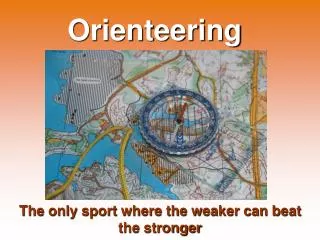
MAPPING STANDARD S OF DIFFERENT ORIENTEERING DISCIPLINES AND FORMATS. Specification of disciplines Foot-o Ski-o MTBO Trail-o Specification of formats Sprint The future of the specifications. Overview. FOOT- ORIENTEERING. ISOM International Specification for Orienteering Maps.

E N D
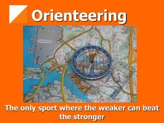
MAPPING STANDARDSOFDIFFERENT ORIENTEERING DISCIPLINES AND FORMATS
Specification of disciplines Foot-o Ski-o MTBO Trail-o Specification of formats Sprint The future of the specifications Overview
FOOT-ORIENTEERING ISOMInternational Specification for Orienteering Maps
1961: the foundation of the International Orienteering Federation (IOF) • Bulgaria • Czechoslovakia • Denmark • Finland • Germany (FRG and GDR) • Hungary • Norway • Sweden • Switzerland
The pre-ISOMfor the first European Championships (1962, Norway)
The first „official” ISOM – 1969 • black, brown and blue for topography, • yellow for open ground, • grey or green / black for restricted runnability (vegetation).
Standardization in ISOM – 1969 • There were no accepted international standards (the description of the vegetation was a key issue). • „Fight” between the Scandinavian and Central European style. • The number of signs was the half of the actual issue (smaller scale, less details).
ISOM – 1975 • Scale: 1:20,000 or 1:15,000, • green in three shades for the representation of restricted runnability due to vegetation, • yellow screen or diagonal stripes for semi-open terrain, • grey for bare rock.
Standardization in ISOM – 1975 • The standardization of the runnability was the most important decision: three shades of green. • Three categories of symbols: • „A symbols", which were compulsory, • „B symbols", which could be used according to the special needs of the different types of terrain, and • not clearly defined „C symbols”, which supplement classes A and B according to the particular conditions of individual types of terrain and were only to be used for national competitions. • Symbols for course setting were added
ISOM – 1982 • Scale: 1:15,000 or 1:10,000, • introduction of yellow screens to extend the possibilities for combining colours and thus better representing vegetation and runnability, • green stripes to represent restricted runnability with good visibility, • changed print colours (brown, yellow and green).
Standardization in ISOM – 1982 • Finetuning the vegetation symbols (green and yellow combinations). • Systematic further development of ISOM 1975 with the aim of consolidating the established and eliminating weaknesses.
ISOM – 1990 • From a "guideline" to a "rule set" by continuous improvement of colours and symbols on the basis of extensive tests and studies; • increased scale from 1:40,000 >1:25,000 >1: 20,000 >1:15,000 > 1:10,000; • extension of the time between revisions from 6 years via 7 and 8 to 10 years.
Standardization in ISOM – 1990 • Discontinue the distinction between A and B symbols and to abandon the C symbols. The established B symbols were incorporated into the list of definitive symbols. • Maps in 1:10000 scale are simple enlargements of 1:15000 scale maps (larger symbol sizes, no more details). • Special terrain rule as the exception (on extreme terrains some rules can be violated).
ISOM – 2000 • No big changes, • existing standards are adjusted for computer mapping, • consideration of new printing methods, • inclusion of other disciplines of orienteering, • English was the only „official” edition.
Standardization in ISOM – 2000 • No need of serious changes. Investments in existing maps should be protected. • Total international acceptance. • Open for new mapping technologies: the standardization is for the final printing maps, not for the map producing process. • Think globally, not nationally!
SKI-ORIENTEERING ISSkiOMInternational Specification for Ski-Orienteering Maps
The first Ski-orienteeringWorld Championships:Finland 1975 No mappingstandard for the Ski-WOC.
2nd Ski-O WOC, Bulgaria 1977:supplementary green tracks3rd Ski-O WOC, Sweden 1980:black tracks only 80’es:Continuous discussion about green(only green or overprint on black).
ISSkiOM 1984Published by the IOF Map CommissionPrinted by the Finnish Federation
ISSkiOM 1984 • Scale: 1:20000, 1:25000, 1:30000. • Equidistance: 5 or 10 m. • 3 kinds of green tracks (under the black path/track): fast, good, slow. • A, B, C symbols as in ISOM. • Symbols for normal orienteering maps could be used on ski-orienteering maps, if it is essential to show a particular detail.
ISSkiOM 1994 Made by the IOF Ski-O Commission (the Map Commission was partly included in the process)
ISSkiOM 2002 revision Created together by the IOF Ski-O Commission and the Map Commission • Scale • Classic 1:15000 • Middle and relay 1:15000 or 1:10000 • Sprint 1:5000 or 1:10000 • 4 kinds of ski tracks: very wide, wide, track, track slow (no black) • Size of symbols in different scales • New symbols: prepared area, unploughed path/road • Overprint symbols were enhanced • The order of printed colour is defined
MTBO-ORIENTEERING MTBOMap Specification
Small changes before the first MTB WOC • Graphical adjustment of track symbols (6 categories as in ISOM). • Adopt experiences of the first MTBO World Cup events. • Includes small changes discussed and accepted by both commissions.
A separate specification was requested by the MTBO Commission in 2004 (just an extract from the ISOM2000 with small adjustments) • To know which symbols are unnecessary to map. • Add a special text part refers to MTBO. • Special overprint symbols: • Dangerous object across tracks or paths • Forbidden route
The first Trail-OWorld Championships:Sweden2004 Mapping for Elite Trail-O Written by Brian Parker 1999
No separate trail-o map specification required:the sprint map specification is suitable for trail-orienteering events. • The trail-o map is an oblique view presented in plan form, it needs to appear correct from a very limited number of oblique viewing points (no need for own specification, but special survey). • The mapper has to remove detail that is not visible from the viewing positions – team work of the map maker and the course planner is essential.
SPRINT – A NEW FORMAT • First time in the official WOC (foot-o) programme: Finland, 2001 – without valid map specification • Ski-WOC, for the first time Bulgaria, 2002 (three individual events) • MTB-WOC – sprint for the first time will be organized in 2006 • Trail-o: sprint is not planed (no sense)
What is sprint orienteering? Sprint orienteering is a fast, visible, easy-to-understand format, allowing orienteering to be stagedwithin areas of significant population. The sprint profile is high speed. Sprint is built on very high speedrunning in very runnable parks, streets or forests. The winning time, for both women and men, shall be 12-15 minutes.
The origin of sprint orienteering Park and city events have always been popular. For example, the public orienteering events in Venice (Italy) has a long tradition and has attracted more and more participants. In many countries the orienteers have organized such kinds of visible events for a number of years. On the international arena, a series of park events, called the Park World Tour (PWT) have been staged annually since 1996. The PWT has attracted the elite, and has had a high media profile.
International Specification forSprintOrienteering maps (ISSOM) August 2001: sprint event is a new form of foot orienteering World Championships (WOC). In the WOC2001 the sprint event was organized with the ISOM. February 2002: the IOF Map Commission started to work on the specification of sprint format.
The development of ISSOM July 2002: the first map with the preliminary version of ISSOM (Lausanne, Switzerland)
The development of ISSOM March 2003: the release of the first official version (final draft 2003): • to let the countries test the specification • to present what can be expected on the WOC2003 (Switzerland) April 2004: the release of the final draft 2004 April 2005: the final version – the official standard.
Difficulties of ISSOM • One of the main difficulties of ISSOM is that sprint events can be organized on different terrains: • urban areas, • park areas, • forest areas, • any combination of the above areas. • Many more restrictions affecting route choice have to be considered in parks and urban terrains, e.g. barriers, areas with forbidden access and multi-level structures. • The amount of details on urban terrain, particularly in the centre of old towns is often higher than on a forested terrain.
The main principles ISSOM • ISSOM is based on the ISOM2000, but competitors and map makers must understand that sprint maps are special maps. • The most important difference is that thick black lines indicate barriers/uncrossable features. To ensure fairness it has been decided that features which are mapped uncrossable (e.g. walls, fences, cliffs) are also forbidden to cross.
The main principles ISSOM • The correct mapping of reduced running speed, both to degree and extent, is extremely important for sprint because of the short winning times. • In urban areas it is not unusual to find multilevel areas. ISSOM allows for the representation of simple underpasses and overpasses. More complex multilevel areas which cannot be mapped clearly are not suitable for international events.
Difficulties of sprint orienteering mapping The number of symbols in the ISOM2000 is 104. At first look one can think that there is a need for more symbols to represent urban areas because of the special features of parks and urban areas. But some symbols can be left out. For instance, due to the large scale some of the ISOM point and linear features can be mapped as area features in true shape on sprint maps.
Sprint mapping conclusions • The good generalization is essential. Don’t map small features, map only the prominent ones! Always remember the very high speed of the competitors! • We have to be flexible, but the main advantage of standards is stability. • Extreme, unmappable areas should be avoided at international level (can be good for local events if the organizers can guarantee fairness).
The future of the specifications • No need for immediate changes. • These standards are accepted by the competitors, these are rules. • The ISSOM may affect the future release of the ISOM (improvements of ISSOM to include in ISOM). • Non-offset printing? • ISOM/ISSOM 2010?
The standardized orienteering maps • Probably the only map types that are using exactly the same symbols in every country (65 member countries): • no deviations, • global (international) thinking is more important than a local (national) one. • The ISOM is a real standard, practically used on the terrain and on drawing. • Further improvement: hints (standardization?) of generalization.
Thank you for your attention László ZENTAI laszlo.zentai@elte.hu IOF Map Commission, http://lazarus.elte.hu/mc